Map of Columbus, Indiana
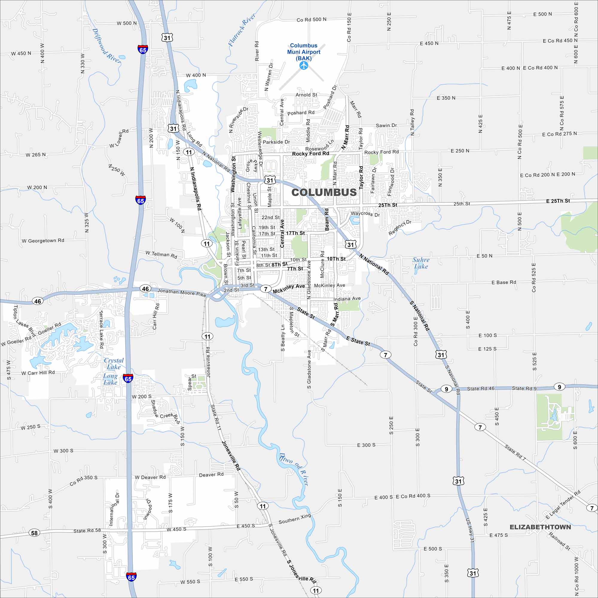
Our map of Columbus outlines the city’s streets, waterways, and nearby parks. Known for its modern architecture, it sits along the Flatrock River. Trails and greenways are common throughout the community.
Indiana State Maps
Study about Indiana with our map collection


Map Information
On the Map
Interstates/Highways: I-65, US Hwy 31, State Rte 46, State Rte 7, State Rte 11, State Rte 58, State Rte 9 Major Roads: National Rd, 25th St, State St, Central Ave, Washington St, 10th St, Marr Rd, Jonathan Moore Pike, 3rd St, 2nd St, Gladstone Ave, Tally Rd, Rocky Ford Rd, Middle Rd, Poshard Rd, Beam Rd, Taylor Rd, Jonesville Rd, Terrace Lake Rd, Carr Hill Rd Airports: Columbus Muni Airport (BAK) Lakes and Reservoirs: Suhre Lake, Crystal Lake, Long Lake Major Rivers: Flatrock River, Driftwood River Nearby Communities: ElizabethtownIndiana City Maps
Here are our maps of Indianapolis and Indiana cities


