Map of Charlotte, North Carolina
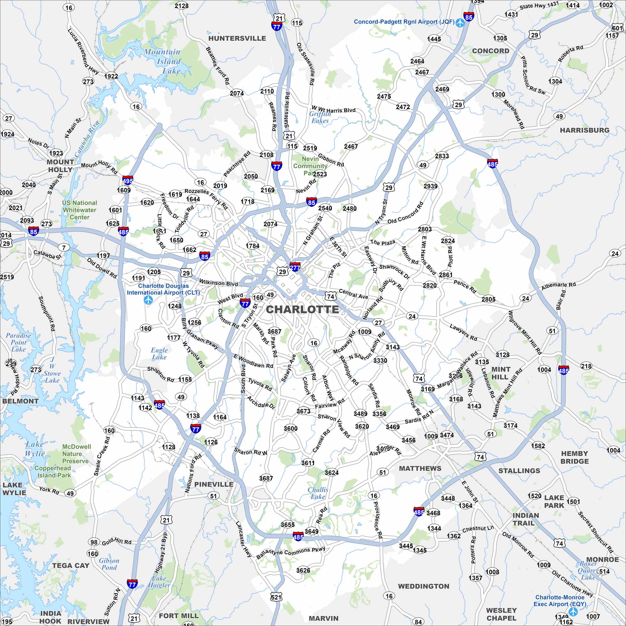
Here’s out map of Charlotte with its Uptown grid, interstates, and green parkways. The city is a major financial hub in the Piedmont region. Its growth extends outward from the central core.
Map Information
On the Map
Interstates/Highways: I-77, I-85, I-485, US Hwy 74, US Hwy 29, US Hwy 21, State Rte 49, State Rte 16, State Rte 27, State Rte 51 Major Roads: Tryon St, Graham St, Independence Blvd, Billy Graham Pkwy, Tyvola Rd, Woodlawn Rd, Fairview Rd, Sharon Rd, Providence Rd, Brookshire Blvd, Harris Blvd, Albemarle Rd, Monroe Rd, Matthews Township Pkwy, Pineville Matthews Rd, Rea Rd, Ballantyne Commons Pkwy, Nations Ford Rd, Wilkinson Blvd, Central Ave Airports: Charlotte Douglas International Airport (CLT), Concord-Padgett Rgnl Airport (JQF), Charlotte-Monroe Exec Airport (EQY) Lakes and Reservoirs: Lake Wylie, Mountain Island Lake, Eagle Lake, Challis Lake, Lake Haigler, Lake Park, Baker Quarry Lake Major Rivers: Catawba River Parks and Preserves: US National Whitewater Center, Nevin Community Park, McDowell Nature Preserve Nearby Communities: Gastonia, Mount Holly, Huntersville, Concord, Harrisburg, Mint Hill, Matthews, Stallings, Indian Trail, Lake Park, Weddington, Marvin, Wesley Chapel, Pineville, Fort Mill, Tega Cay, Belmont Neighborhoods: Downtown CharlotteNorth Carolina State Maps
Get to know the mountains and coastlines of North Carolina.


City Maps of North Carolina
Journey through North Carolina with our city maps


