Pennsylvania Precipitation Map
Our precipitation map of Pennsylvania shows the Appalachian Mountains creating wetter conditions in the central and northern regions.
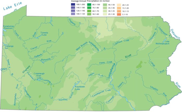
Our precipitation map of Pennsylvania shows the Appalachian Mountains creating wetter conditions in the central and northern regions.
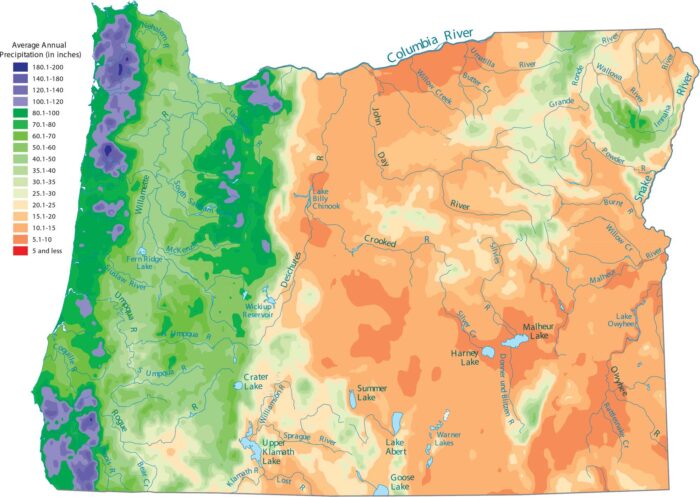
Pacific storms dump everything on the western slopes, while the east stays very dry. See it on our precipitation map of Oregon.
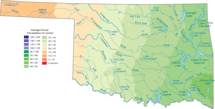
Our precipitation map of Oklahoma shows that the eastern part of the state is much wetter than the “Panhandle” in the west.
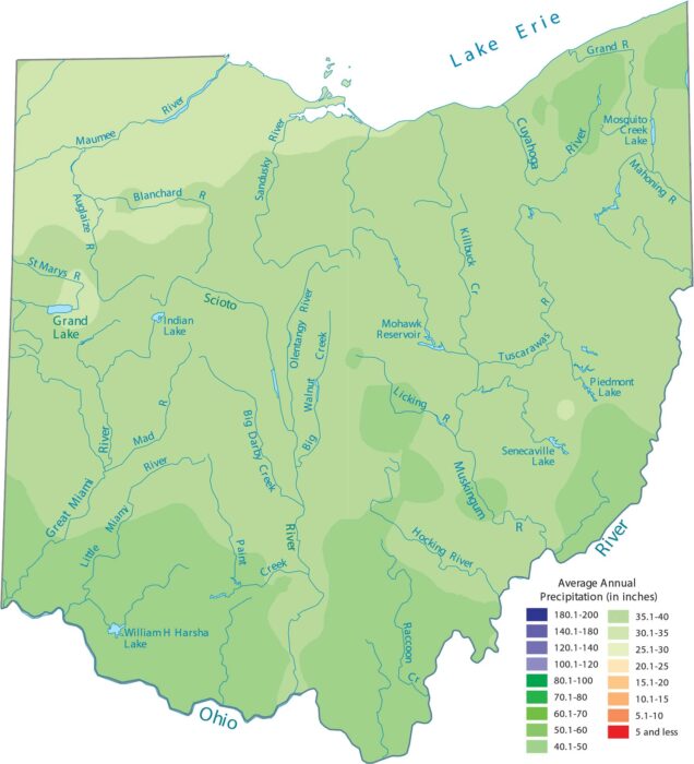
Our precipitation map of Ohio shows lake-effect precipitation. This especially dominates the northern areas near Lake Erie.
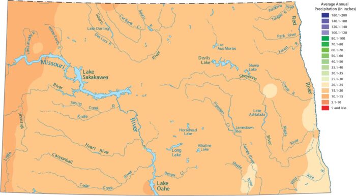
North Dakota sits far from any major moisture sources. As you can see in our precipitation map of North Dakota, this keeps things pretty dry.
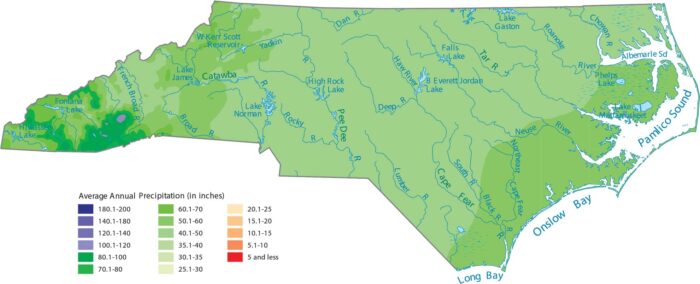
North Carolina gets a lot of rain because of its geography. Our precipitation map of North Carolina shows its mountains are the wettest spot.
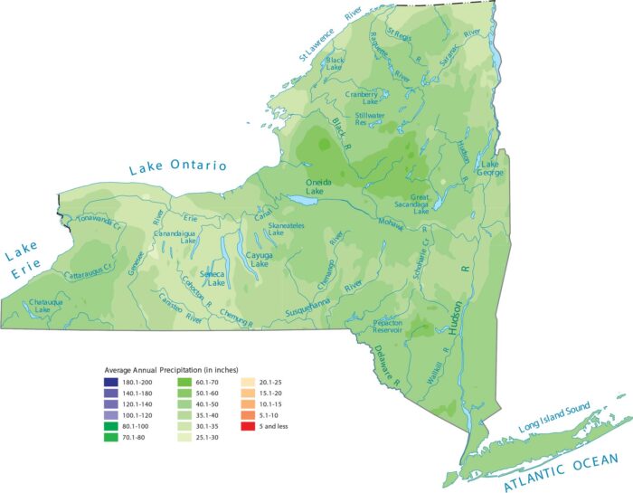
Our precipitation map of New York reveals how the Adirondack and Catskill Mountains create pockets of heavier rainfall.
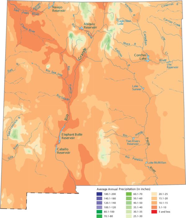
New Mexico gets most of its limited rainfall in the mountains. Our precipitation map of New Mexico shows desert that keeps most areas dry.
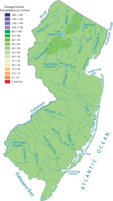
Our precipitation map of New Jersey shows a consistent amount of rain. But the northern highlands get the most moisture.
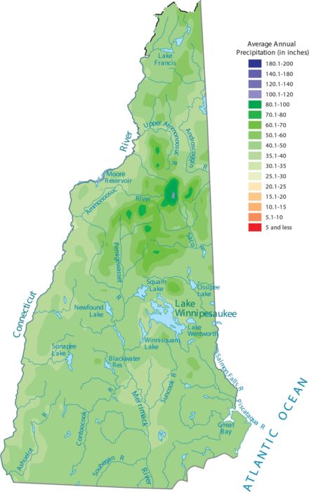
Our precipitation map of New Hampshire shows the White Mountains creating noticeably wetter conditions in the central part of the state.
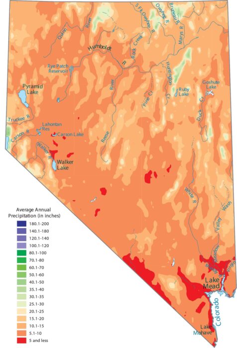
As the driest state in the country, our precipitation map of Nevada shows that the only “wet” spots are the very tops of the high mountains.
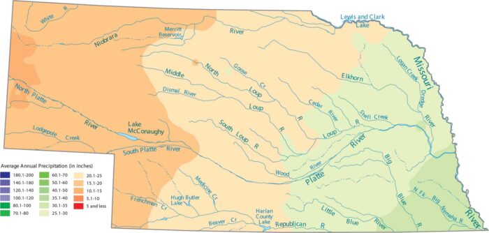
Our precipitation map of Nebraska shows that the eastern border is the wettest area. See As you head west, this creates drier conditions.
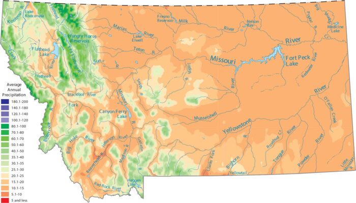
Our precipitation map of Montana shows moisture trapped by terrain. Plains in the eastern region of Montana stay dry behind mountain ranges.
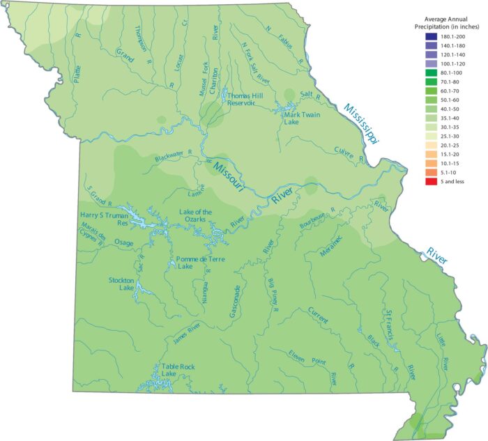
Missouri sees the most rain in the southeastern lowlands region. Our precipitation map of Missouri reflects this contrast.
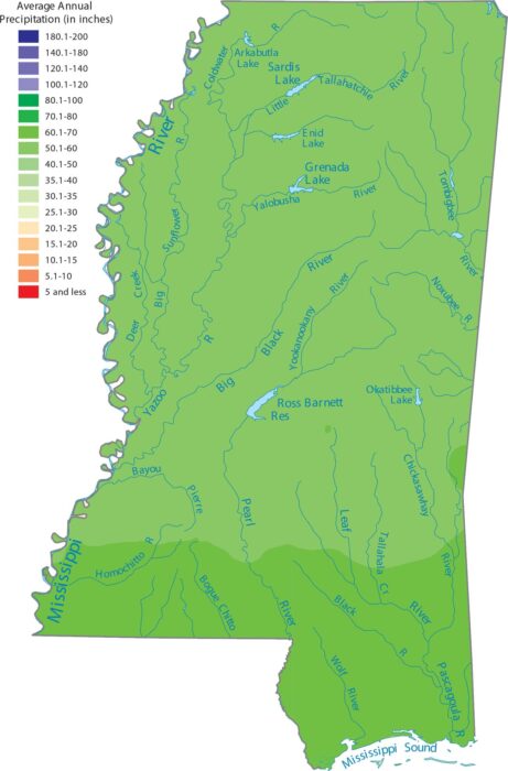
Mississippi is one of the wettest states because of its location along the Gulf Coast. Our precipitation map of Mississippi shows wetness.