Arkansas Counties and Cities Map
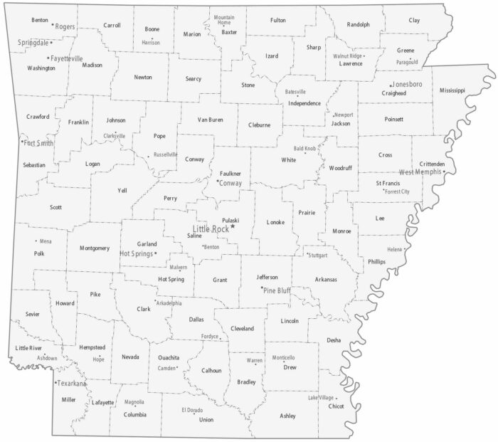
Our map of Arkansas is split into 75 counties. Little Rock is the capital and sits at the state’s geographic center in Pulaski County.
Our map of Arkansas is split into 75 counties. Little Rock is the capital and sits at the state’s geographic center in Pulaski County.
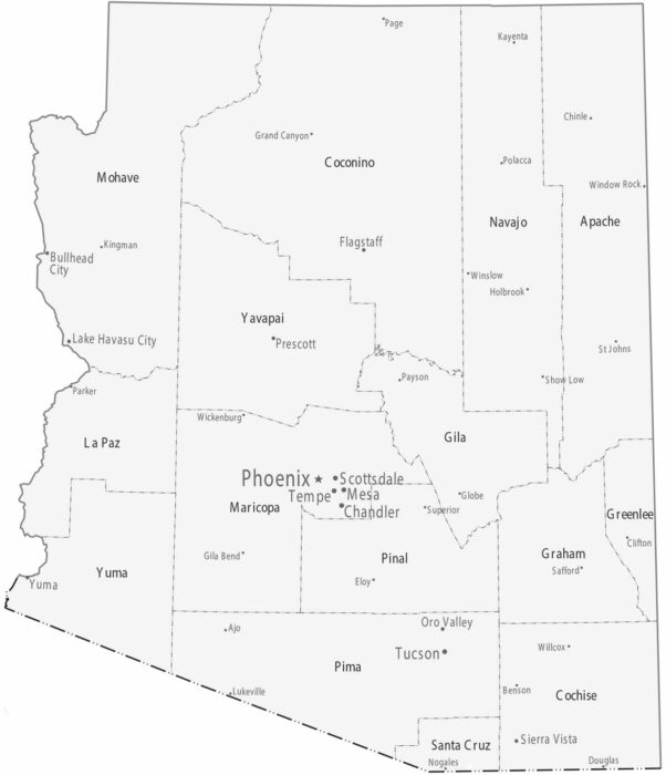
County boundaries are large and expansive, especially in the north of Arizona. Most cities sit in Maricopa and Pima counties.
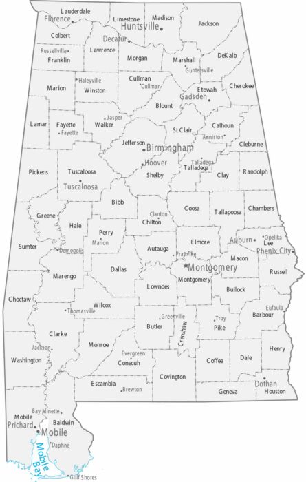
This map shows Alabama’s counties alongside major and minor cities. Population centers cluster along the Tennessee River.
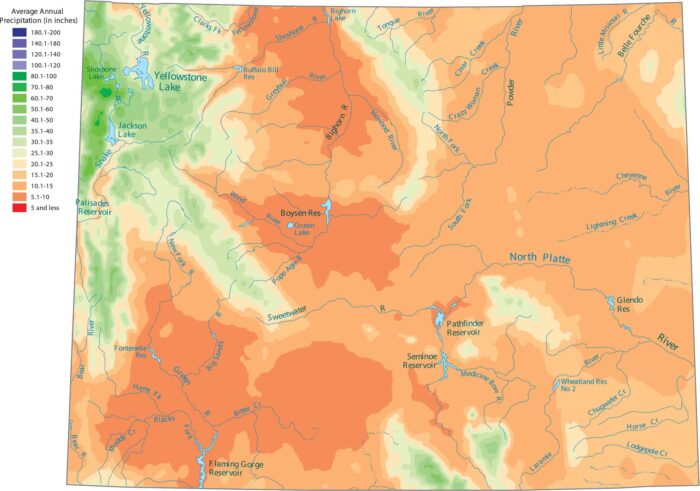
Wyoming is one of the driest states. Our precipitation map of Wyoming shows that the only wet areas are the high mountain ranges.
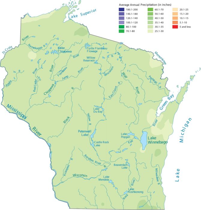
Wisconsin sees above average precipitation because of lake-effect moisture. See the change in precipitation on our map.
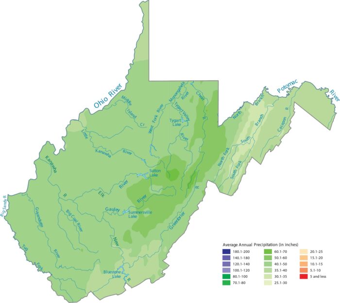
West Virginia has mountainous terrain. Our precipitation map of West Virginia reflects how the ridges appear wetter.
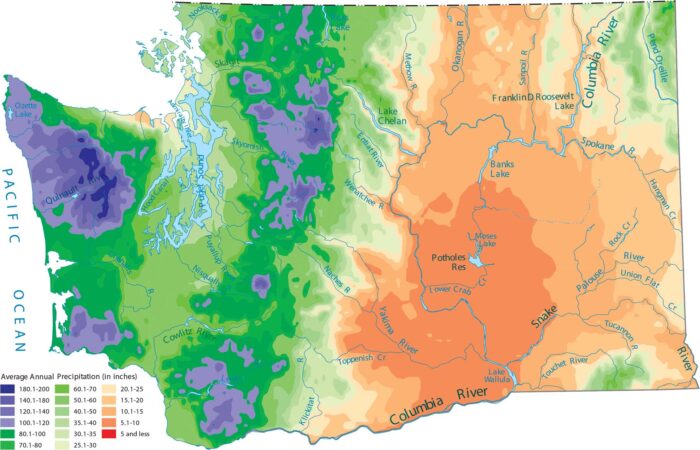
Washington is known for its rain. Our precipitation map of Washington shows that the Olympic Mountains and the Cascades get the most water.
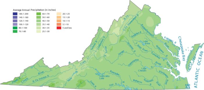
Virginia’s precipitation increases as you move from the coast inland toward the Blue Ridge Mountains. It decreases in the valleys beyond.
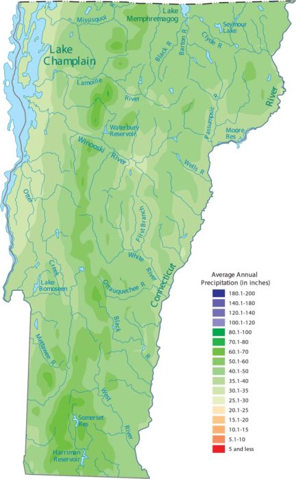
Vermont gets a lot of precipitation. Our precipitation map of Vermont shows higher elevations like the Green Mountains appearing wetter.
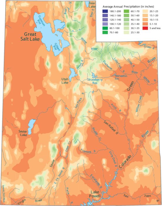
Desert basins dominate much of the state. Our precipitation map of Utah shows that the Wasatch Range in the center gets the most moisture.
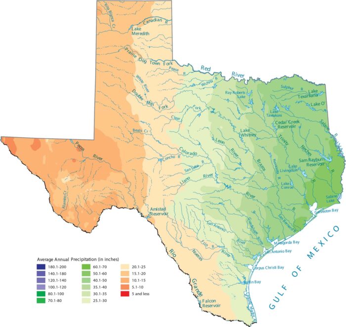
From its wet eastern forests to the bone-dry deserts, Texas shows maybe the most dramatic precipitation gradient in the country.
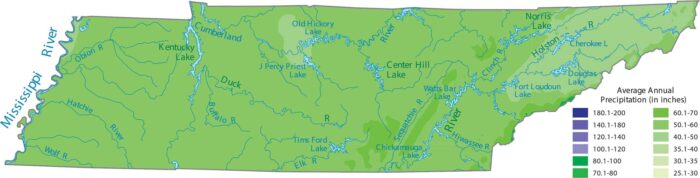
Our precipitation map of Tennessee shows that the Great Smoky Mountains in the east are the wettest areas.
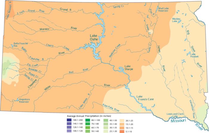
Our precipitation map of South Dakota shows the Black Hills standing out as the wettest spot in an otherwise dry state.
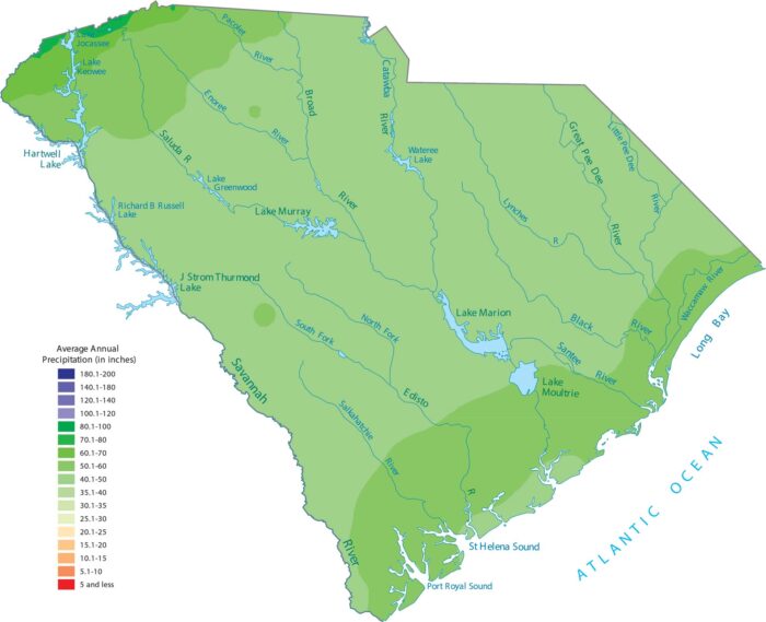
South Carolina is a warm, wet state. Our precipitation map shows that the northwest mountains and the coast get the most rain.
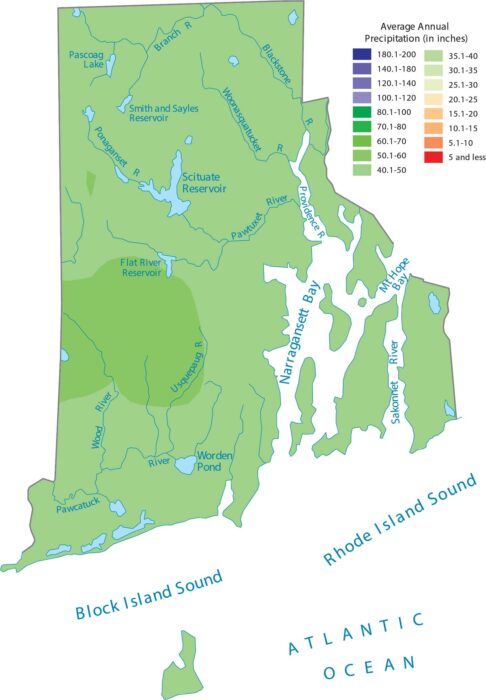
Rhode Island’s size and coastal position means Atlantic storms keep the whole state consistently wet, as shown on our precipitation map.