North Dakota Counties and Cities Map
On our map of North Dakota, you will find its 53 counties mostly in agricultural areas. Fargo sits on the eastern border as the largest city.

On our map of North Dakota, you will find its 53 counties mostly in agricultural areas. Fargo sits on the eastern border as the largest city.
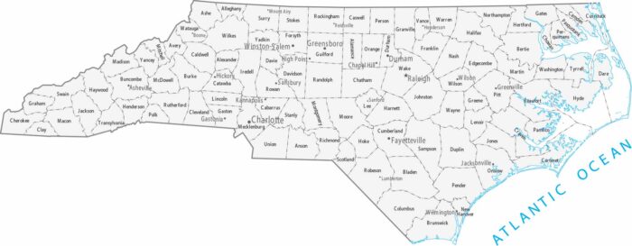
There are 100 counties in North Carolina and they’re fairly uniform in size. Our map shows cities spread from mountains to the coastal plain.
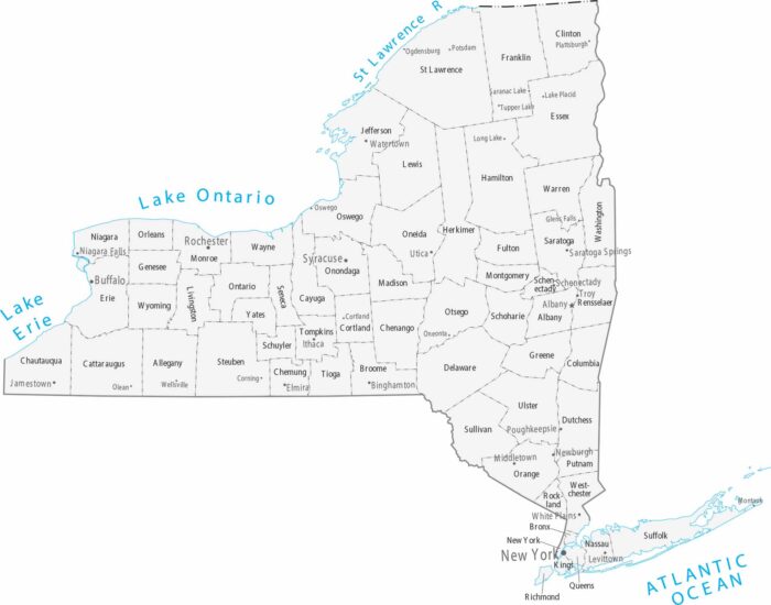
Spanning from the Atlantic to the Great Lakes, our map of New York identifies its 62 counties and major cities like New York City and Albany.
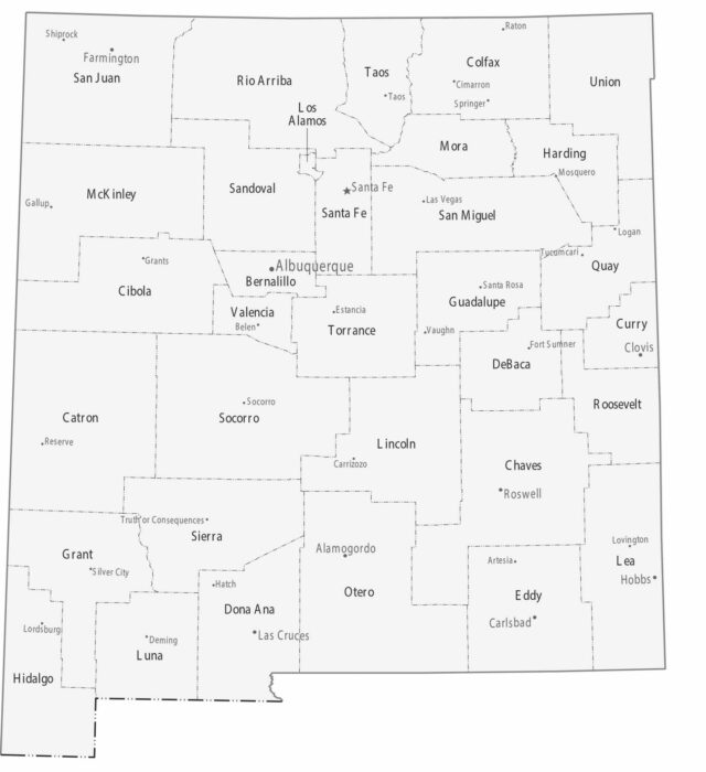
Our map of New Mexico highlights 33 counties filled with high deserts and alpine peaks. Albuquerque serves as the central metropolitan hub.
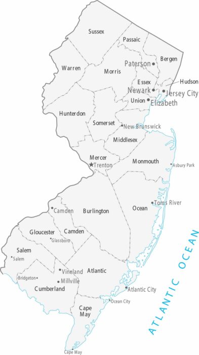
As the most densely populated state, our map of New Jersey organizes 21 counties between the urban centers of New York City and Philadelphia.
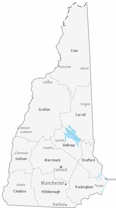
The 10 counties on our map of New Hampshire stretch from the small Atlantic coastline to the White Mountains.
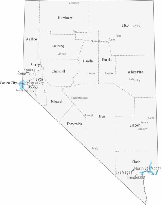
Our map of Nevada features some of the largest counties in the country. Most cities are concentrated in Clark and Washoe counties.
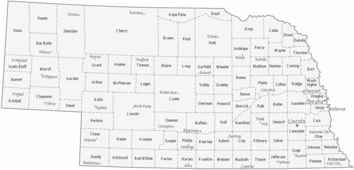
Our map of Nebraska features 93 counties. Omaha is the largest city on the eastern edge. It’s balanced by Lincoln to the southwest.
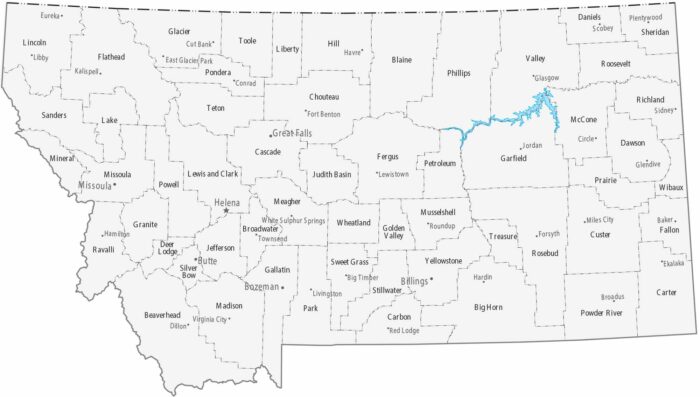
“Big Sky Country” is represented on our map by 56 massive counties. Our map is dominated by very large counties with few cities.
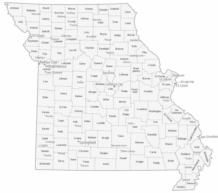
Our map shows two big metro areas. Kansas City is situated in the west and St. Louis is in the east. Lots of small cities are between the two.

Our map shows fairly evenly sized counties covering the state of Mississippi. Cities tend to follow the Mississippi River and corridors.
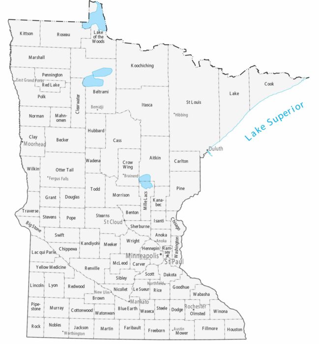
Counties stretch large across northern Minnesota, while southern counties are smaller and more numerous. Our map highlights the Twin Cities.
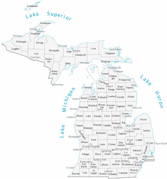
Our map displays counties and cities across both peninsulas. You’ll notice that cities concentrate near the Great Lakes.
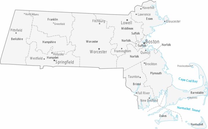
Our map shows Boston and its suburbs taking up most of the eastern part of the state. The counties are small and packed with cities.
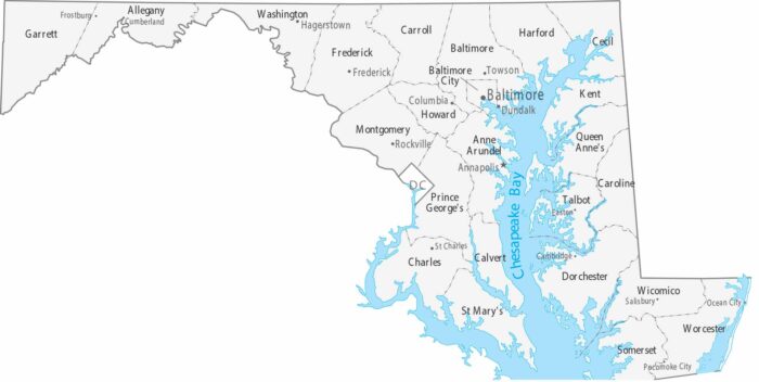
Maryland features 23 counties and the independent city of Baltimore. Our map shows Annapolis as the capital on the Chesapeake Bay.