Map of Maine
Our Maine map brings the coast and countryside together. From Portland’s harbor lights to the deep forests up north, every part stands out.
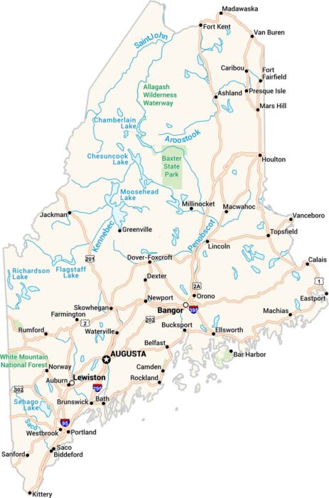
Our Maine map brings the coast and countryside together. From Portland’s harbor lights to the deep forests up north, every part stands out.
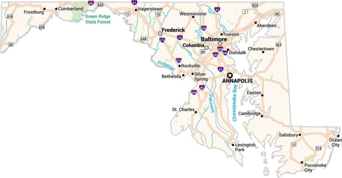
Our Maryland map includes it all. From busy Baltimore to the quiet shores of the Chesapeake Bay, it has cities, rivers, and highways.
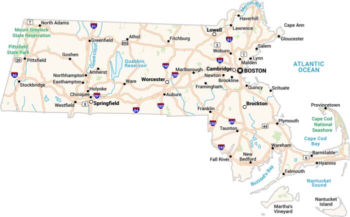
Our Massachusetts map lays it all out. It has cities, highways, rivers, and coastlines. You can trace the curve of Cape Cod or Boston.
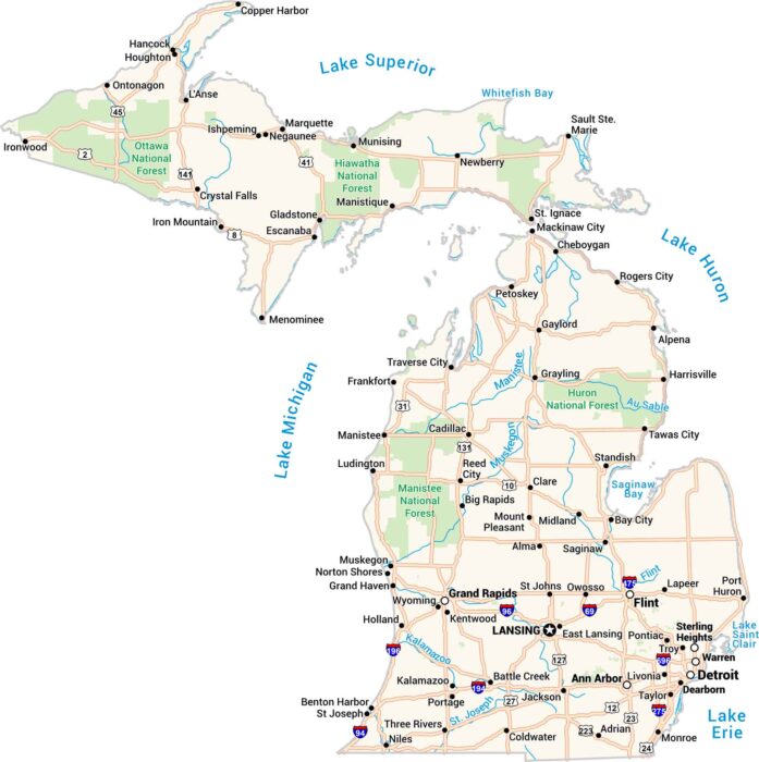
Michigan comes alive on this map. You’ll find cities like Detroit, Grand Rapids, and Marquette. The Great Lakes and rivers are here too.
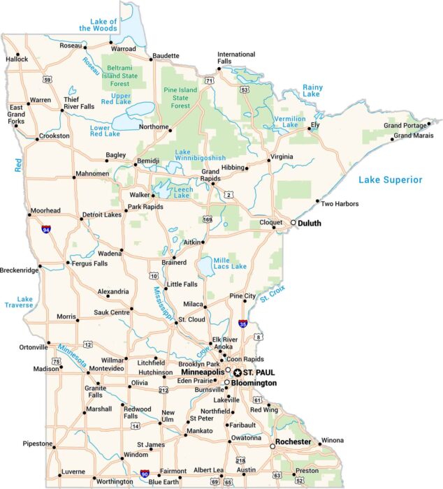
Our map of Minnesota shows the land of 10,000 lakes. From Minneapolis to Duluth, every road connects water, forest, and people.
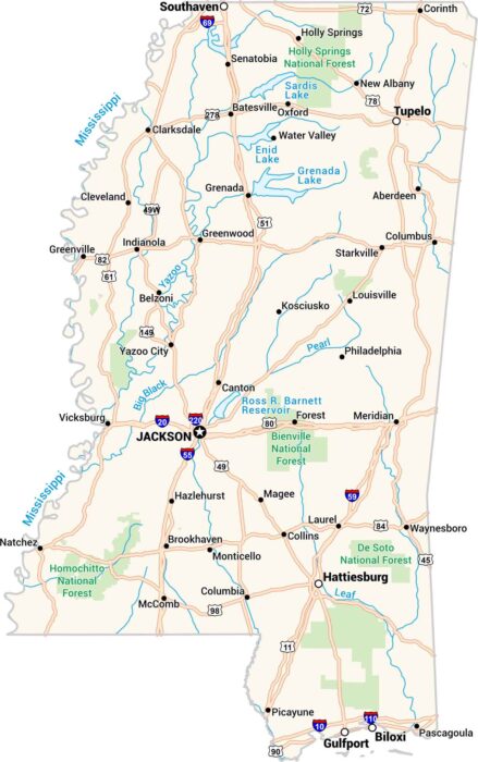
Our map of Mississippi shows every bend of the river and every small town along the way. You’ll see Jackson, Biloxi, and the Delta.
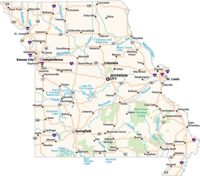
Missouri sits where the Midwest meets the South. Our map shows its rivers, highways, and growing cities like St. Louis and Kansas City.
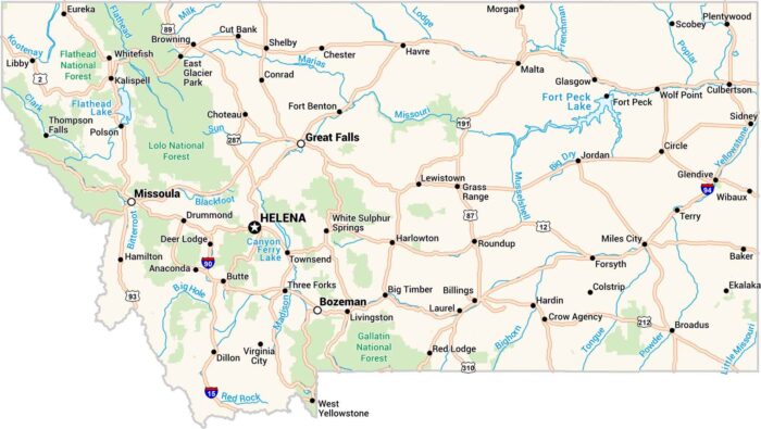
Our map of Montana stretches wide showing cities, lakes and highways. Rivers carve through the land, from the Missouri to the Yellowstone.
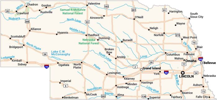
Our map of Nebraska lays out wide plains, winding rivers, and quiet towns. You’ll spot the Platte cutting through the heart of the state.
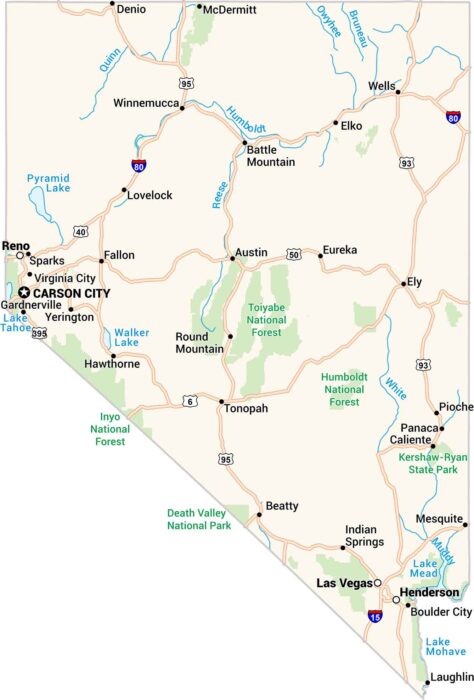
Our map of Nevada shows a land of sharp contrasts. Deserts stretch endlessly. Then, sudden bursts of green appear around Reno and Las Vegas.
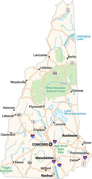
Our map of New Hampshire takes you from rugged mountains to quiet lakes. Small towns cluster along winding roads here in wild country.
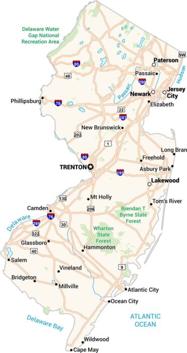
New Jersey might be small in size, but our map shows how packed it really is. Highways twist past cities like Newark and Jersey City.
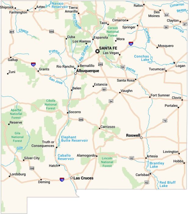
Our map of New Mexico feels wide open, like the land itself. Santa Fe sits high and calm, while Roswell keeps its mystery.
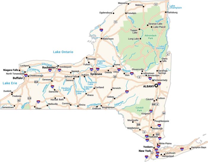
Our map of New York state shows it all… From Niagara Falls to the Finger Lakes, highways connect large cities and smaller towns.
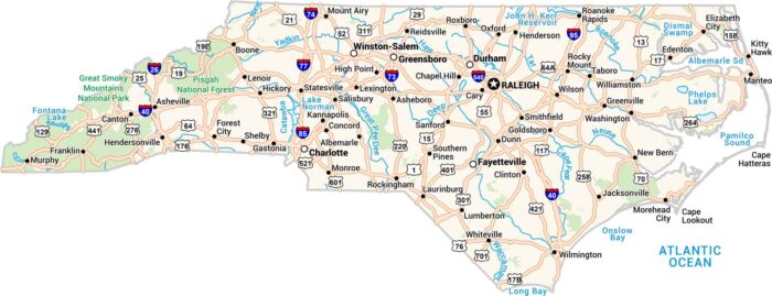
Our North Carolina map captures everything from parks to highways and populated places. You’ll also find rivers, forests, and sandy coast.