Map of Arkansas
Here’s our map of Arkansas with cities, towns, rivers, and lakes. The Ozarks rise in the north and the Mississippi River flows in the east.
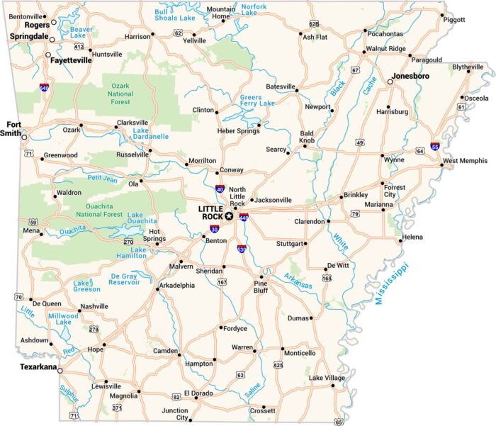
Here’s our map of Arkansas with cities, towns, rivers, and lakes. The Ozarks rise in the north and the Mississippi River flows in the east.
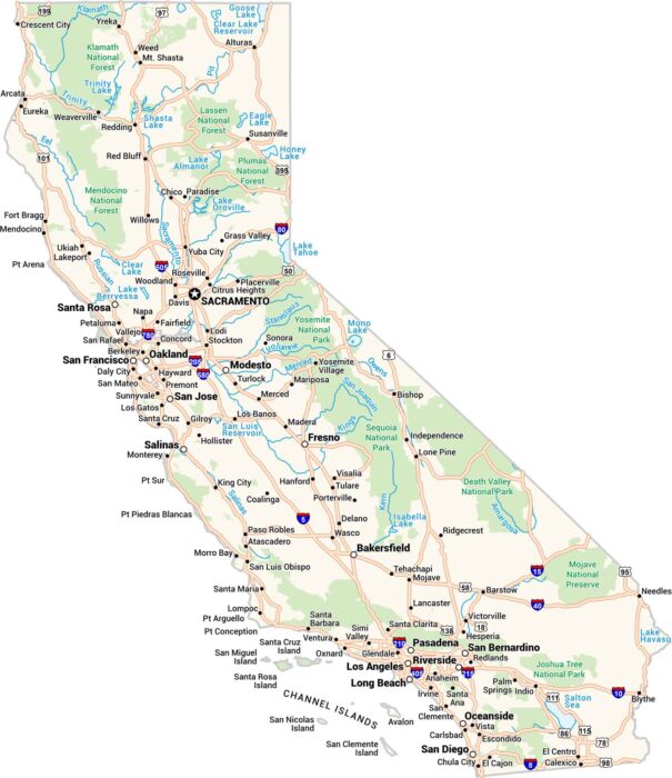
California is massive. It has cities, deserts, redwoods, and surf all in one place. Our map of California lays it out clean.
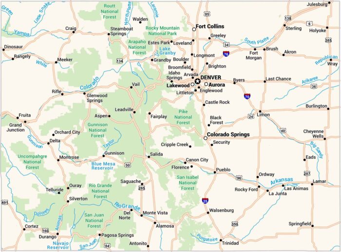
Colorado isn’t just mountains. It’s winding highways, green forests and towns. Our map shows it all, from Denver’s grid to scenic Aspen.
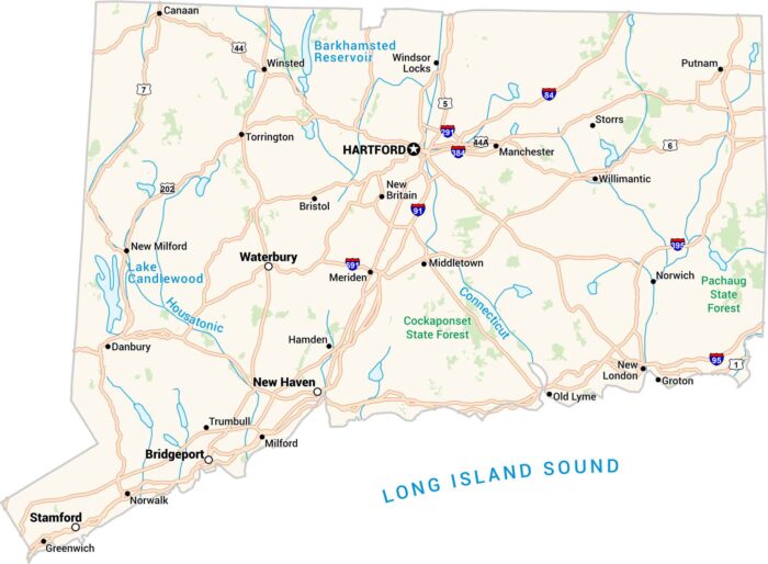
Connecticut’s got a little of everything. It has coasts, forests, and cities packed in one state. Our map of Connecticut shows it all.
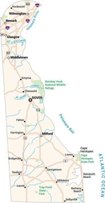
Our Delaware map shows a small state with a lot packed in. Highways link quiet towns to the busy corridor near Wilmington.
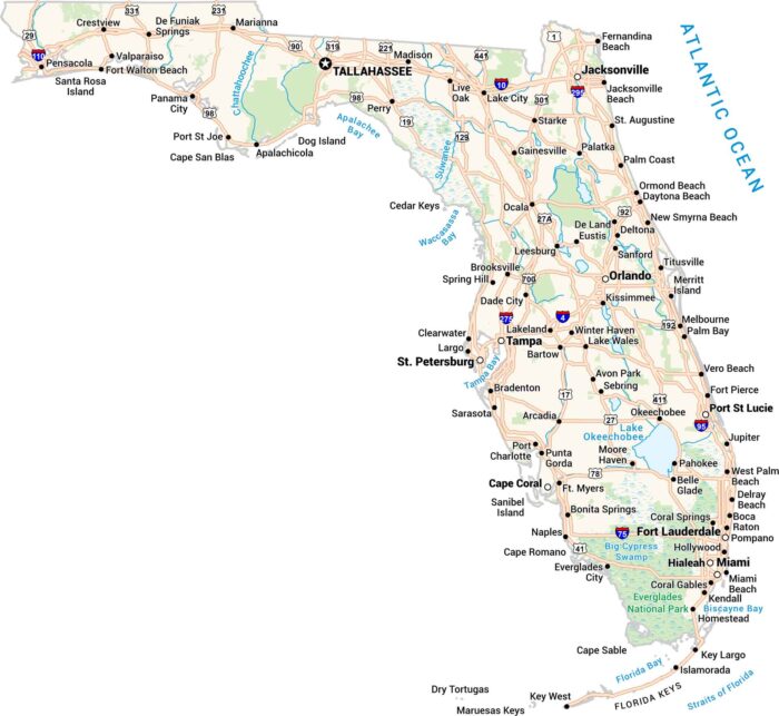
Our Florida map shows the Sunshine State. Cities line up along the coasts, and highways travel along the edge of the Everglades.
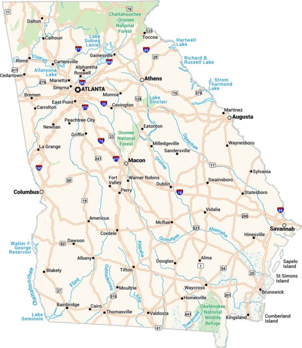
Here’s our map of Georgia. It shows the cities, small towns, rivers, and wide lakes. From Atlanta to Savannah, the whole state is here.
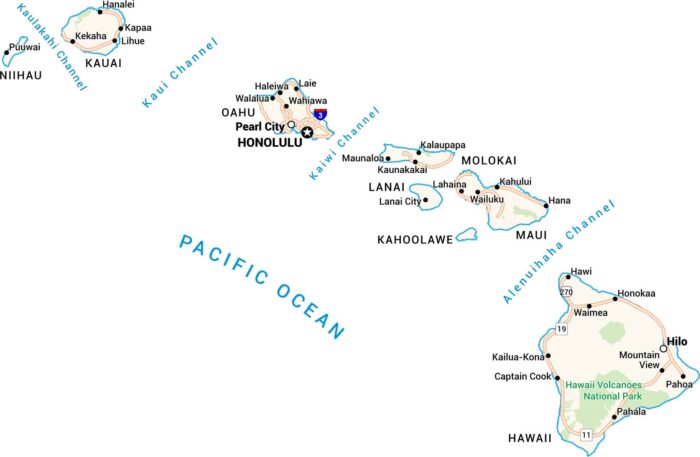
Here’s a map of Hawaii worth keeping. Every island, from Kauai to the Big Island, comes to life. You can see its channels, towns, and roads.
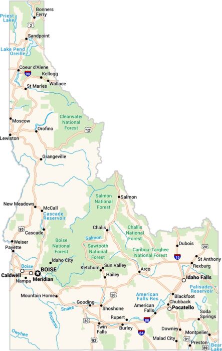
Here’s our map of Idaho made for exploring. Forests, rivers, towns, and lakes fill the landscape. You’ll spot Boise, Coeur d’Alene and more.
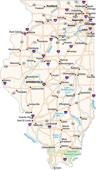
This map of Illinois keeps things clear. Cities, towns, rivers, and lakes are easy to see. Our map makes sense of the Land of Lincoln.
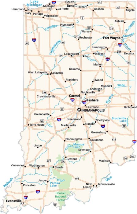
Our map of Indiana shows cities, towns, rivers, and lakes in detail. You can see where the Wabash and Ohio Rivers form its borders.
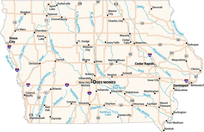
Our Iowa map shows its lakes, rivers, highways, cities and quiet towns. You’ll see Des Moines at the center of it all.
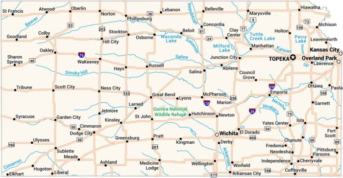
Our Kansas map lays out the wide open plains. Highways cut clean across small towns. You’ll spot Wichita, Topeka, and Kansas City.
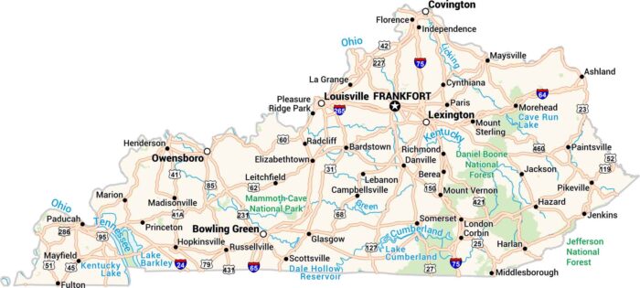
Our Kentucky map shows its rivers, forests, and highways. From Louisville to Lexington, you can find the Ohio River along the western border.
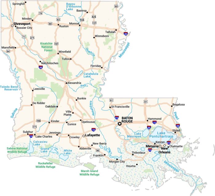
Our Louisiana map captures its bayous and big cities. You’ll spot Baton Rouge, Shreveport, and of course, New Orleans along the Mississippi.