Colorado Population Map
Most residents in Colorado live along the eastern edge of the Rockies. The Front Range forms a clear north–south corridor.
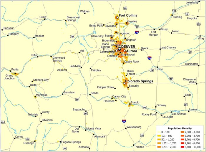
Most residents in Colorado live along the eastern edge of the Rockies. The Front Range forms a clear north–south corridor.
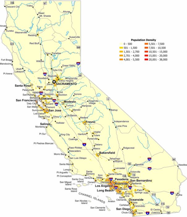
Coastal metro areas and the Central Valley have high population density. Whereas deserts and mountains create wide low-density gaps.
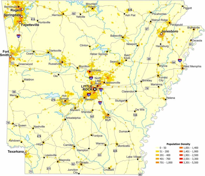
Population density in Arkansas increases near major cities like Little Rock. Our map also shows large rural regions with far fewer residents.
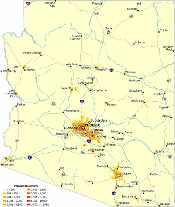
Much of Arizona’s population is concentrated in the south and central parts of the state. Check out our map to see its population density.
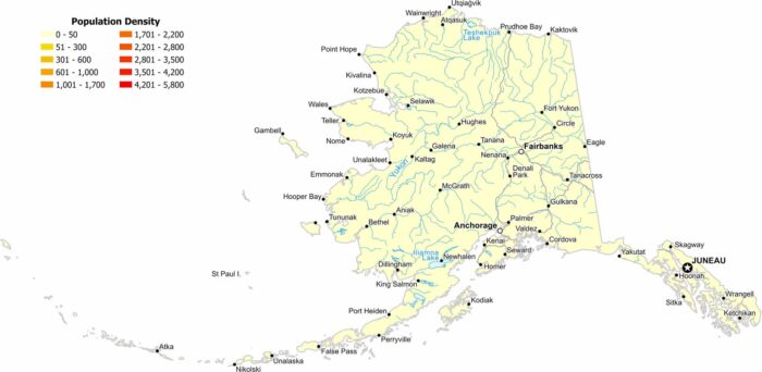
Our population density map of Alaska shows extremely low population density, except for Anchorage, Juneau and Fairbanks.
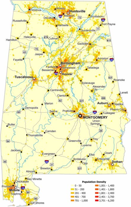
Population across Alabama is uneven, with clear clusters around major cities. Our map highlights higher density areas like Birmingham.
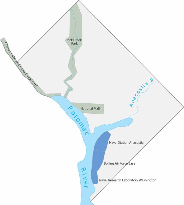
DC spans just 68 square miles between Maryland and Virginia. Our map shows the Potomac River, National Mall and Rock Creek Park.
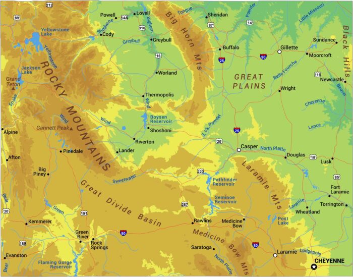
Stand anywhere in Wyoming and you’re probably above 6,000 feet. The Rockies dominate with ranges like the Tetons, Wind River, and Bighorns.
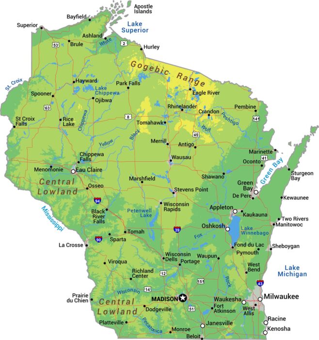
Explore Wisconsin’s physical geography with our detailed map showing forested highlands, river valleys, and Great Lakes coastline.
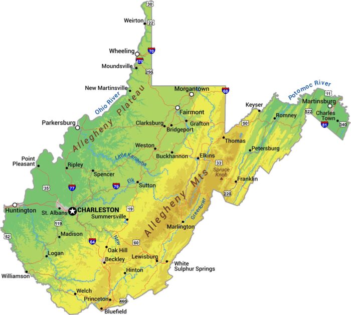
There’s a reason they call it the Mountain State. Our physical map of West Virginia shows some of the most rugged terrain in eastern US.
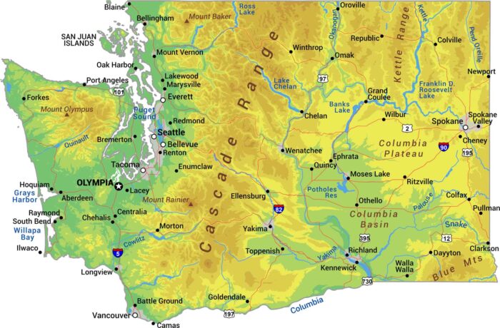
Without further ado, I bring to you our physical map of Washington. We’re showing the Cascade Range with Mount Rainier, Olympus and Baker.
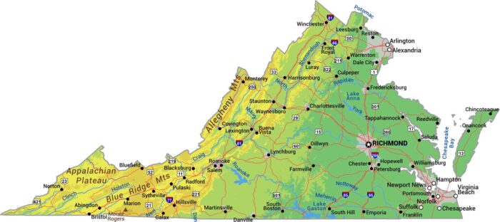
Our physical map shows Virginia climbing from tidewater to mountain peaks. You’ll see the Appalachians and Blue Ridge Mountains.
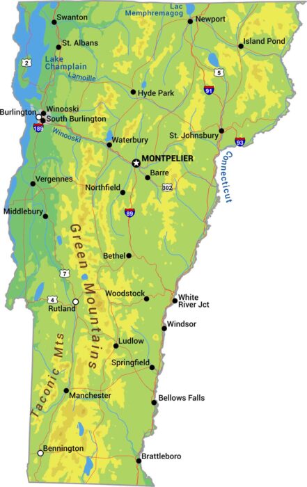
Vermont is the state of the Green Mountains. Its peaks define the state with forests covering most of the terrain between valleys.
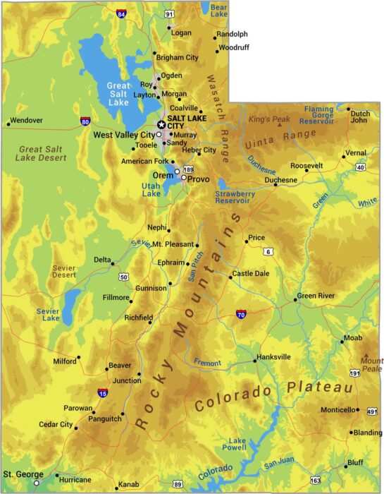
Utah is canyon country with mountains like the Rockies and the Great Salt Lake Desert. See it all with our physical map of Utah.
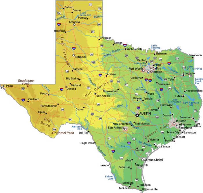
Everything’s bigger in Texas, including the geography. Our physical map of Texas shows a state with more variety than most countries.