Map of Benicia, California
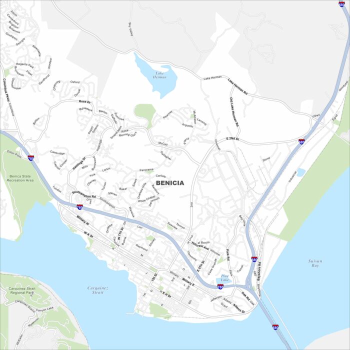
Benicia, California sits on the Carquinez Strait in the Bay Area. Our map highlights waterfront streets and major highways.
Benicia, California sits on the Carquinez Strait in the Bay Area. Our map highlights waterfront streets and major highways.
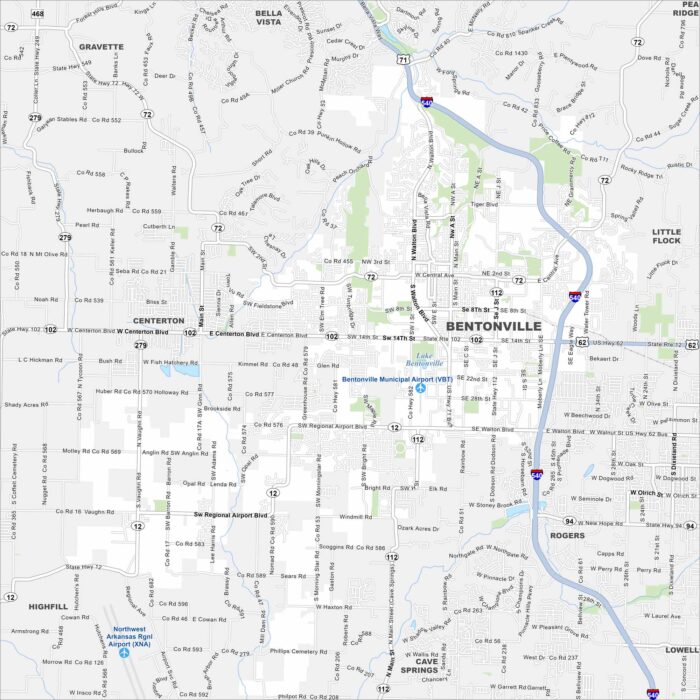
Explore Bentonville on our map in northwest Arkansas. The map includes roads, green spaces, and major highways.
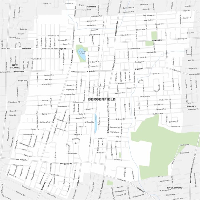
Want to explore Bergenfield? Bergenfield is in northern New Jersey. Use our map to explore this borough just outside New York City.
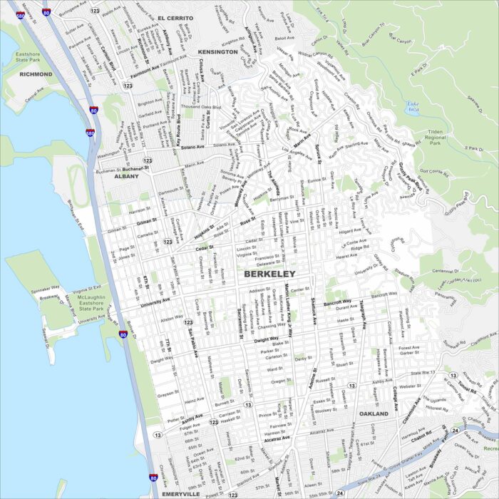
Here’s a simple map of Berkeley. Our map of Berkeley shows its streets stretching from the bay to the hills.
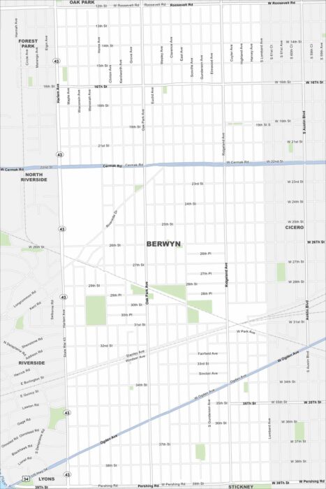
Berwyn is a near-west suburb of Chicago. Our map outlines grid-style streets, rail lines, and neighborhood parks.
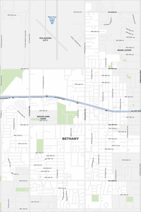
See Bethany on our map with highways and green spaces. It’s situated just west of Oklahoma City. The city is known for its Route 66 heritage.
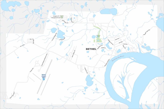
Get around Bethel with our map. It’s a hub and gateway to remote villages. Bethel sits on the Kuskokwim River in western Alaska.
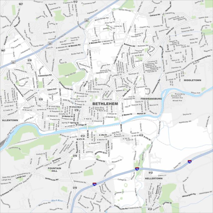
Our map of Bethlehem highlights the Lehigh River, bridges, and major highways. Neighborhood roads and green hills shape the layout.
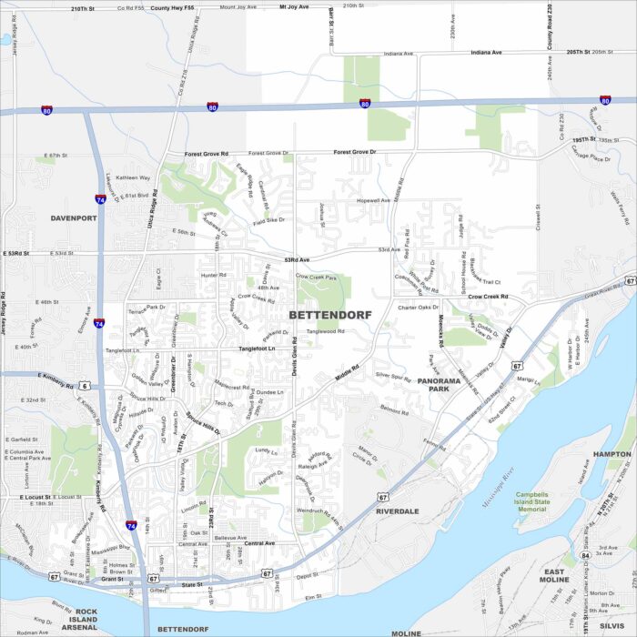
See Bettendorf on our map along the Mississippi River. Parks, winding roads, and riverfront trails are a big part of the city.
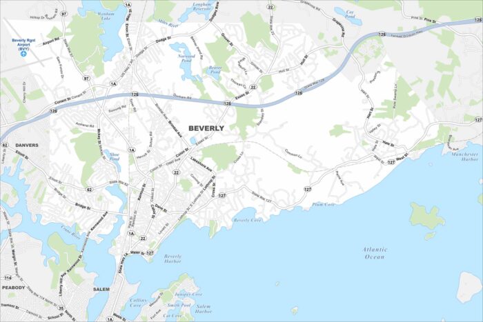
Beverly, Massachusetts is a coastal city north of Boston. Our map highlights harbors, parks, and neighborhood streets.
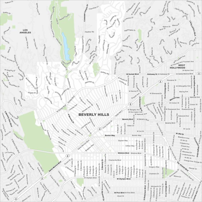
Explore Beverly Hills with our map west of Los Angeles. Palm-lined streets and landscaped neighborhoods fill the layout.
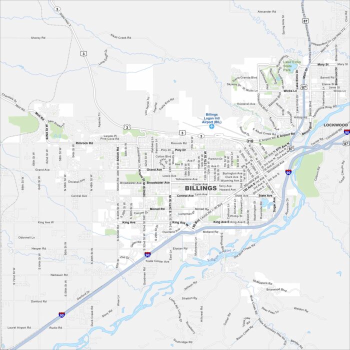
Billings is the largest city in Montana. Our map shows the Yellowstone River in the south. It also has wide roads and nearby bluffs.
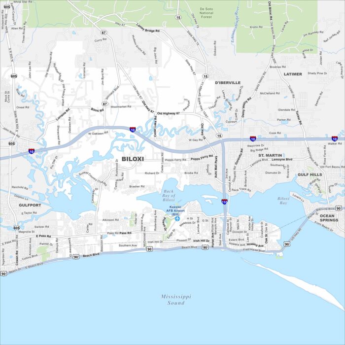
Biloxi is a Gulf Coast city with beaches and a deep maritime history. Our map highlights these features, including its roads/highways.
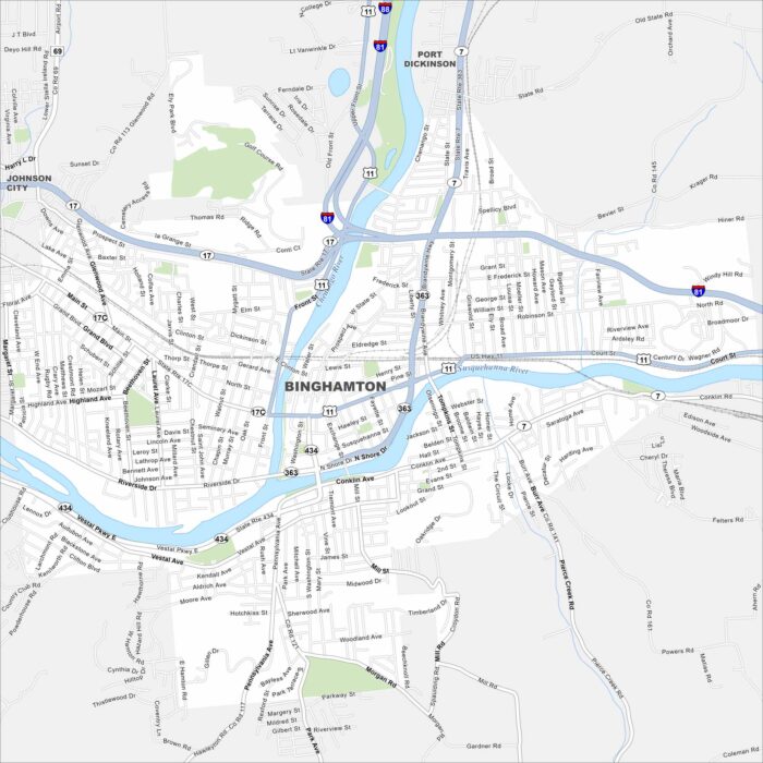
Check out Binghamton with our map in southern New York. Streets follow the Susquehanna and Chenango Rivers.
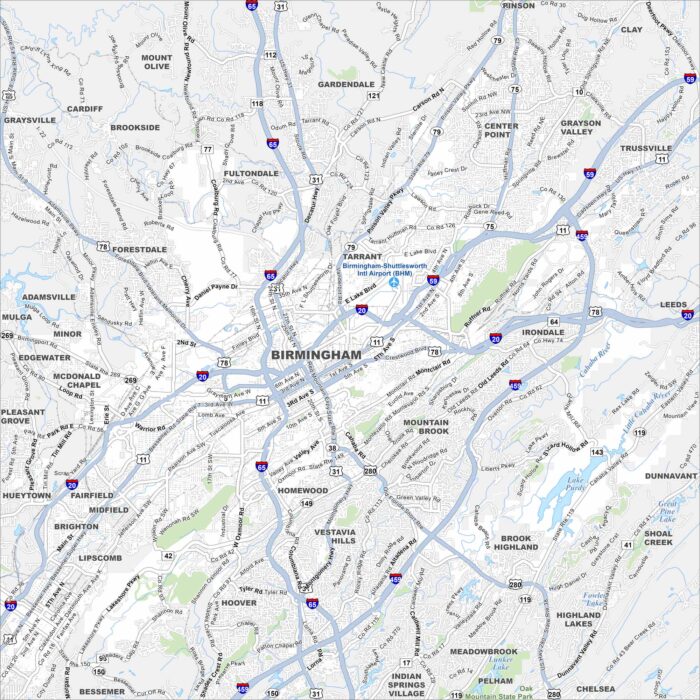
Our map of Birmingham shows you around its downtown core and historic districts. Birmingham is in north-central Alabama.