Map of Pleasant Hill, California
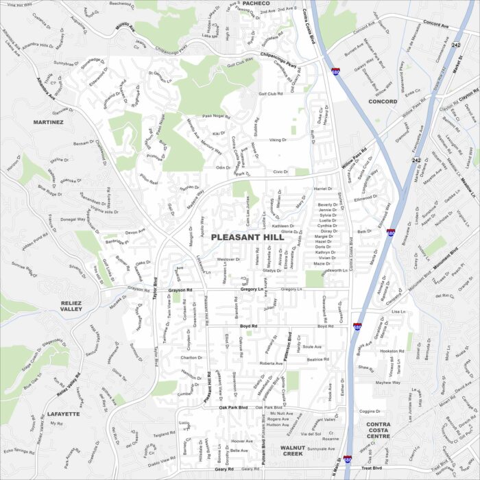
Our map of Pleasant Hill shows its suburban grid tucked between Concord and Walnut Creek. Parks and open spaces are scattered throughout.
Our map of Pleasant Hill shows its suburban grid tucked between Concord and Walnut Creek. Parks and open spaces are scattered throughout.
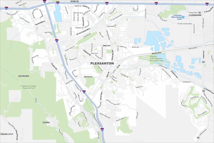
Our map highlights Pleasanton’s easy freeway access and historic downtown. The Alameda County Fairgrounds are a major local landmark.
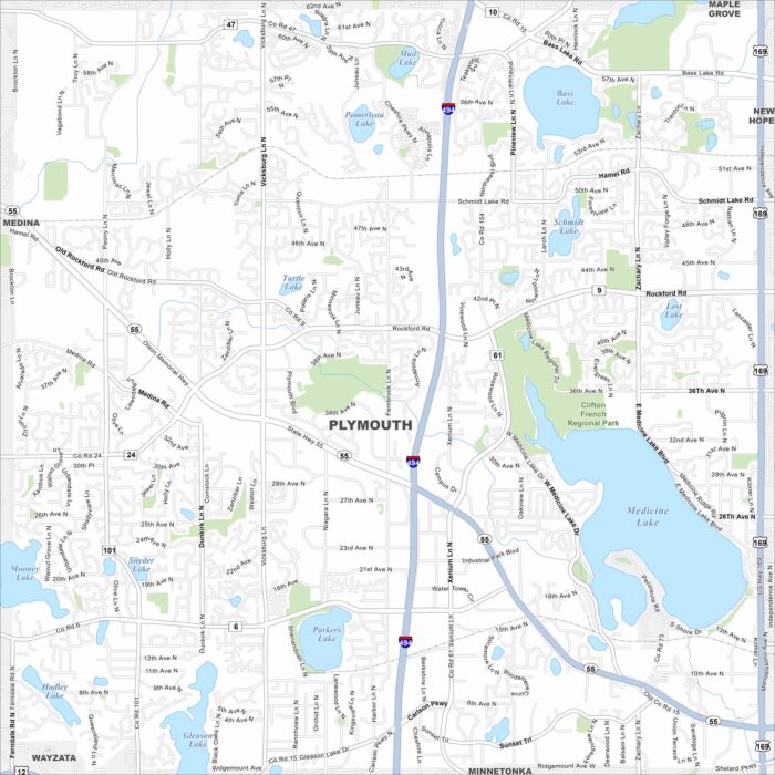
Plymouth sits among rolling lakes just west of Minneapolis. Our map highlights Medicine Lake, which stands out as the city’s centerpiece.
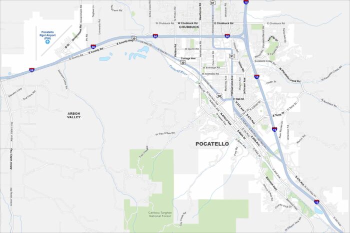
Take a look at Pocatello stretching along the Portneuf River valley. This map shows how the city is framed by mountain ridges.
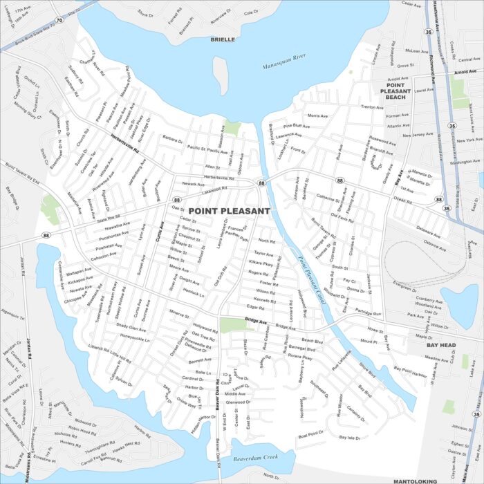
Point Pleasant borough lies along the Manasquan River. Our map makes the shore, boardwalk, and neighborhood streets easy to follow.
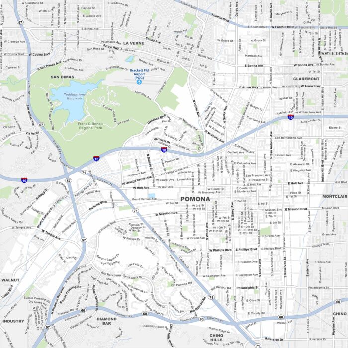
Our map of Pomona highlights a large city in the Inland Empire. Major freeways cut across it, linking neighborhoods and business districts.
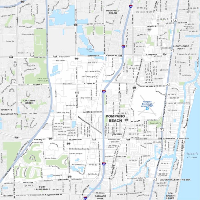
Check out Pompano Beach stretching along the Atlantic shoreline. The map points out beaches, canals, and residential communities.
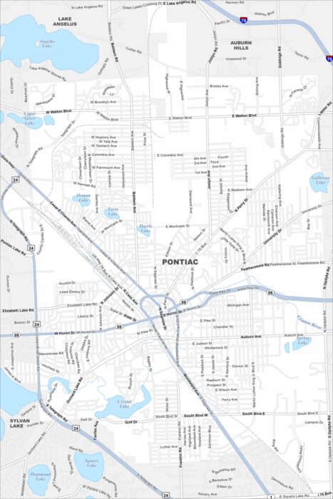
Pontiac sits north of Detroit with a mix of historic and industrial areas. Our map shows its downtown core and highway loops.
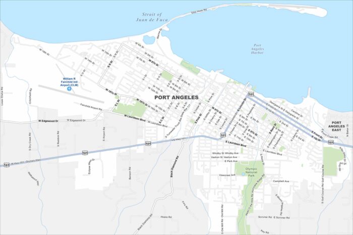
Port Angeles faces the Strait of Juan de Fuca at the edge of the Olympic Peninsula. Use our map to see its streets, parks and airport.
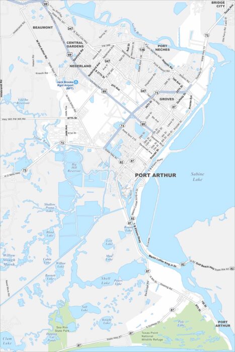
Our map of Port Arthur outlines its waterfront location on Sabine Lake. Refineries and residential areas dominate much of the landscape.
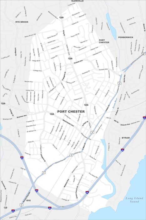
Our map of Port Chester shows its compact downtown along the Byram River. The streets lead right into the Long Island Sound.
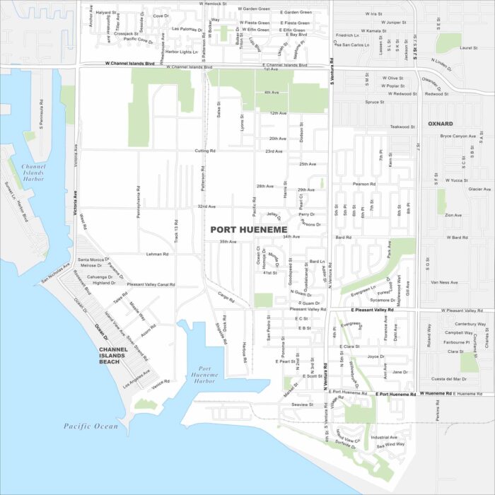
Check out Port Hueneme’s grid of streets leading straight to the Pacific coast. This map highlights its harbor and beach access.
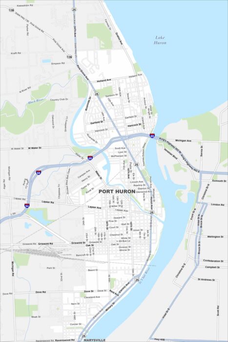
Port Huron sits at the base of Lake Huron where the St. Clair River begins. Our map shows the downtown stretch along the waterfront and more.
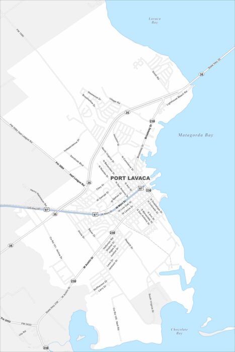
Take a look our map of Port Lavaca. This map shows connections to the Gulf Coast and local parks. Fishing and birdwatching are popular here.
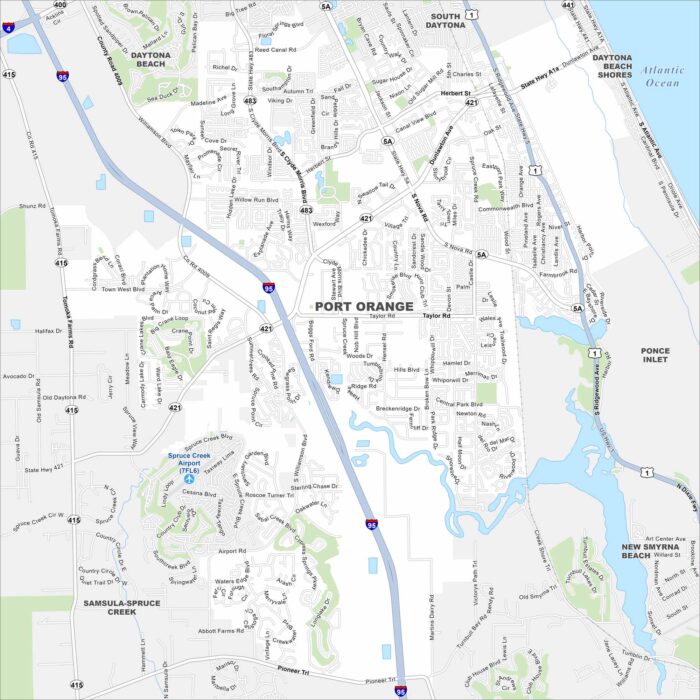
Our map of Port Orange lays out suburban neighborhoods along the Halifax River. You’ll see easy access to nearby beaches and wetlands.