Map of Piedmont, California
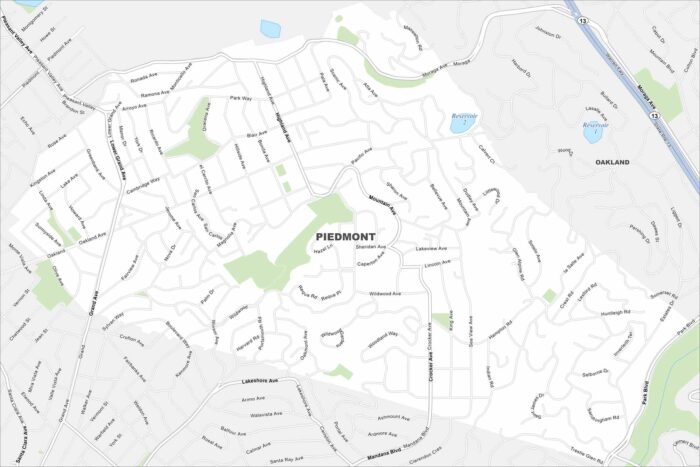
Piedmont is an enclave surrounded entirely by Oakland. Check out our map to see its residential streets in the East Bay hills.
Piedmont is an enclave surrounded entirely by Oakland. Check out our map to see its residential streets in the East Bay hills.
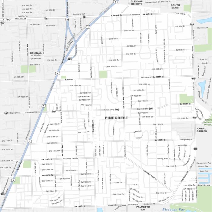
Pinecrest lies just south of Miami with leafy streets and large homes. Our map highlights its parks and easy access to major highways.
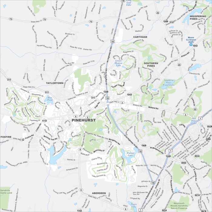
Take a look at Pinehurst, famous for its golf courses. Our map shows its winding streets around resort communities and green spaces.
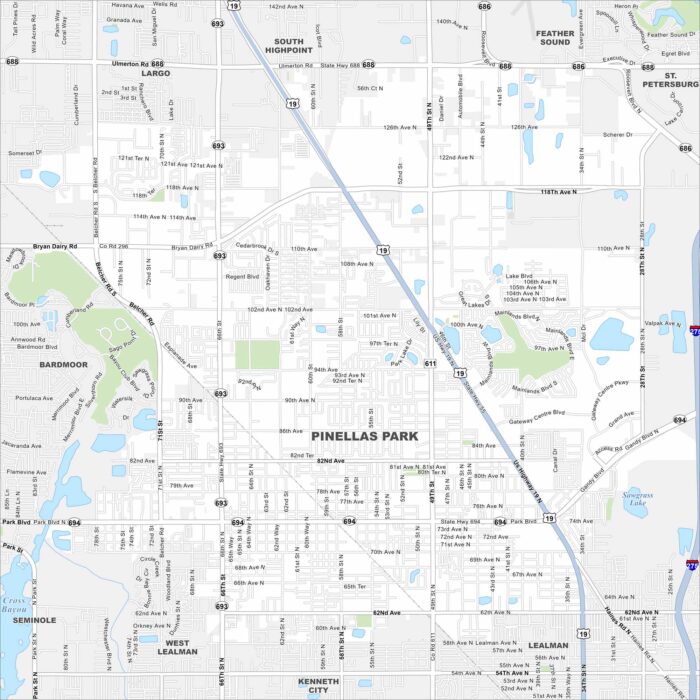
Our map of Pinellas Park shows a central location in Pinellas County. It’s a city with easy routes to Tampa Bay and the Gulf beaches.
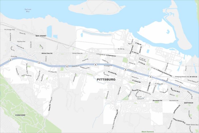
Pittsburg sits on the southern edge of Suisun Bay. Check out our map to see its waterfront, neighborhoods, and highway links.
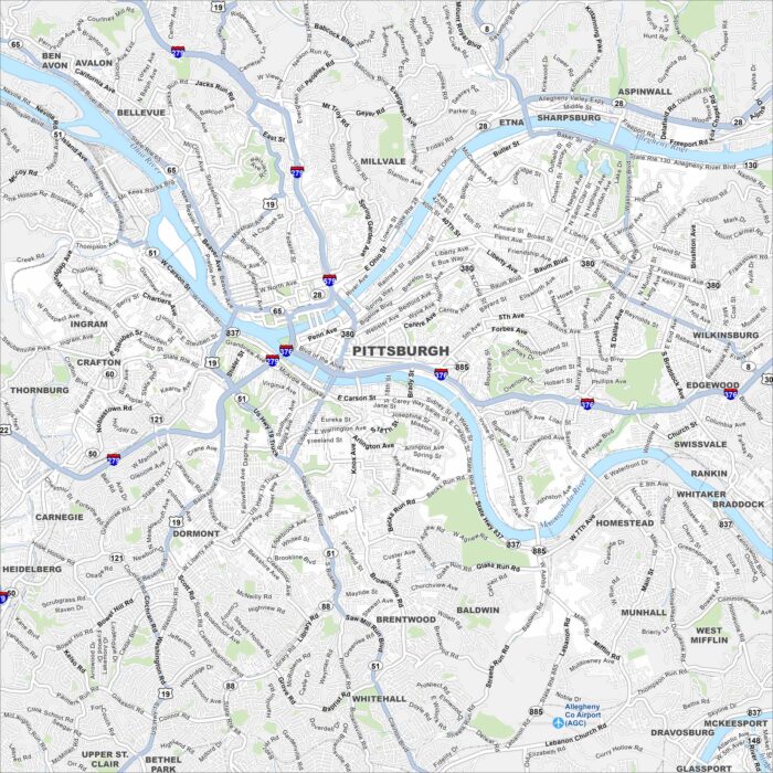
Pittsburgh sits at the confluence of three rivers, with bridges everywhere you look. Our map shows how hills and valleys shape Pittsburgh.
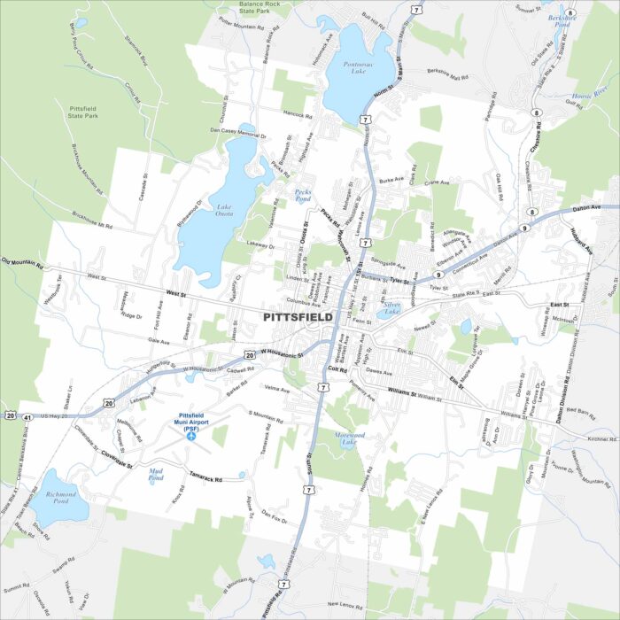
Check out Pittsfield in the heart of the Berkshires. This map highlights its compact downtown and nearby lakes. It’s a cultural hub.
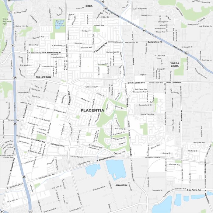
Our map of Placentia shows the suburban grid northeast of Anaheim. Residential neighborhoods dominate, with parks scattered throughout.
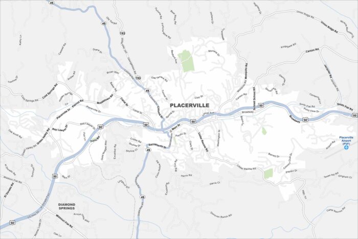
Placerville rests in the Sierra Nevada foothills, once central to the Gold Rush. Our map shows the winding streets climbing the hills.
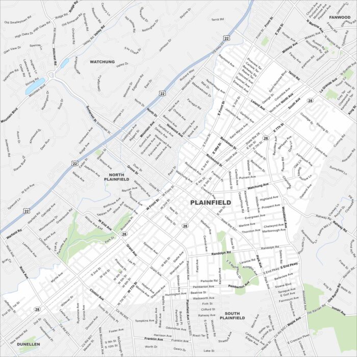
Plainfield lies just west of Staten Island with easy commuter routes into New York City. Our map highlights its grid of streets and highways.
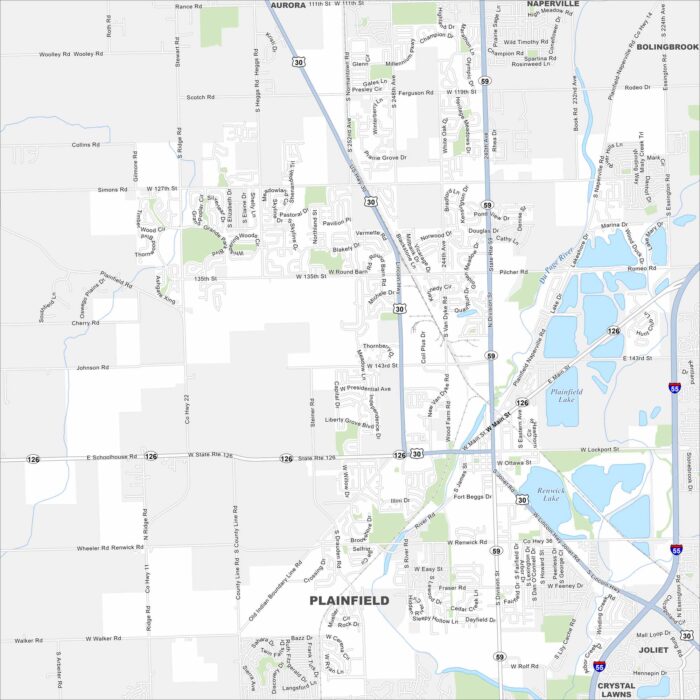
Check out our Plainfield map, which sits southwest of Chicago. This map shows suburban sprawl mixed with farmland edges.
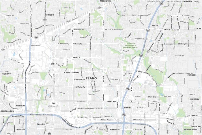
Our map of Plano shows a fast-growing suburb north of Dallas. Highways cut across the city, linking business districts and neighborhoods.
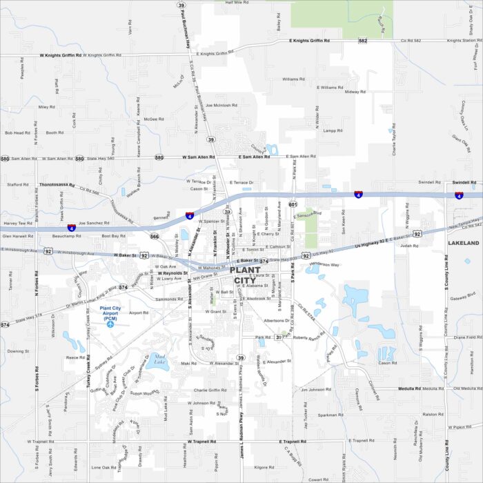
Plant City is famous for strawberries and farmland surrounding its core. Take a look at this map to see its roads spreading outward.
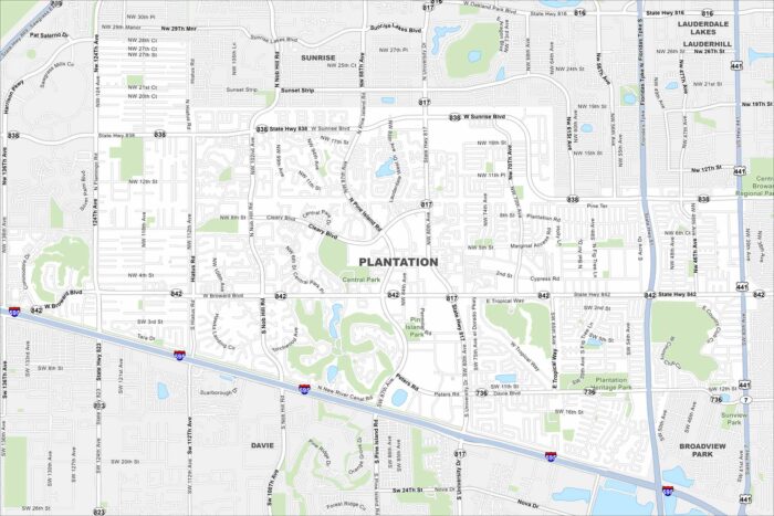
Check out our map of Plantation, west of Fort Lauderdale. It highlights residential neighborhoods, highways, and canals.
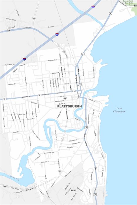
Plattsburgh sits on the western shore of Lake Champlain. This map shows its waterfront, marinas, and grid of downtown streets.