Map of Pasadena, California
Pasadena rests at the foot of the San Gabriel Mountains. Check out our map to see its wide boulevards and nearby freeways.
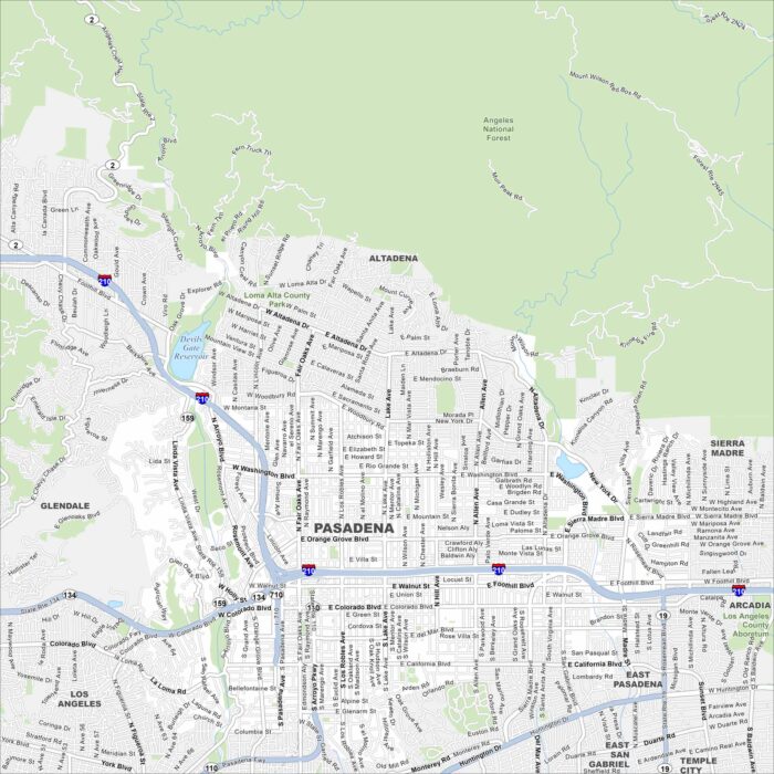
Pasadena rests at the foot of the San Gabriel Mountains. Check out our map to see its wide boulevards and nearby freeways.
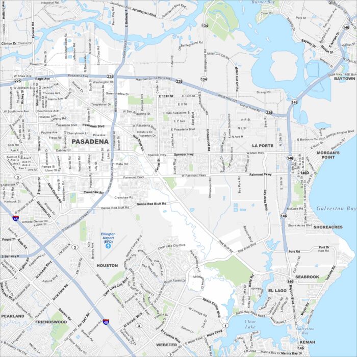
Our map of Pasadena shows this community southeast of Houston. Refineries and industry dominate much of the landscape.
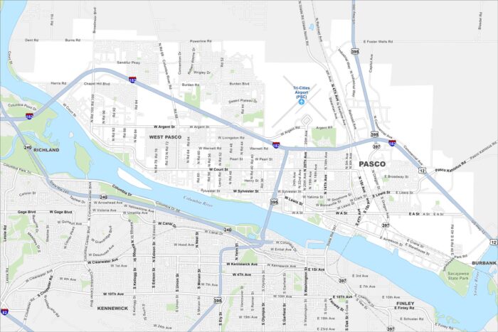
Pasco sits along the Columbia River in the Tri-Cities region. Take a look at our map to see parks, highways, and riverfront development.
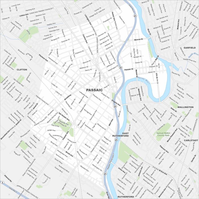
Check out Passaic on the Passaic River in northern New Jersey. Our map shows a dense grid of neighborhoods and downtown streets.
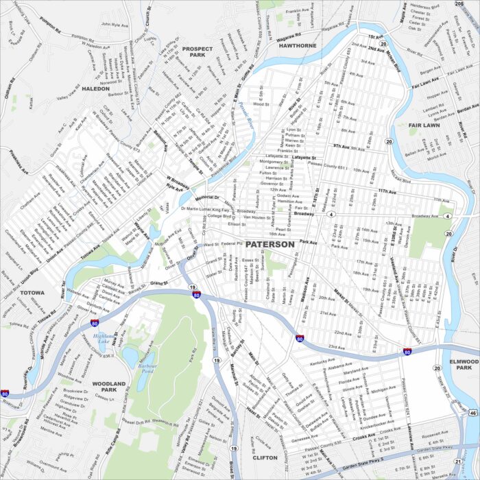
Our map of Paterson highlights a city built around the Great Falls of the Passaic River. You’ll find roads, parks and more.
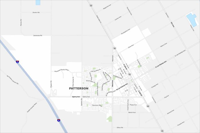
Our map of Patterson shows a small city at the base of the Diablo Range. It’s surrounded by farmland in the Central Valley.
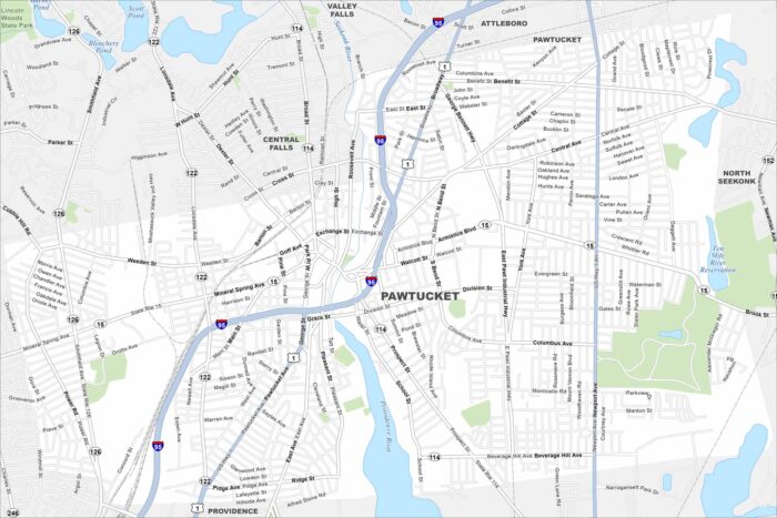
Check out Pawtucket, located northeast of Providence. Our map highlights its dense neighborhoods and roads.
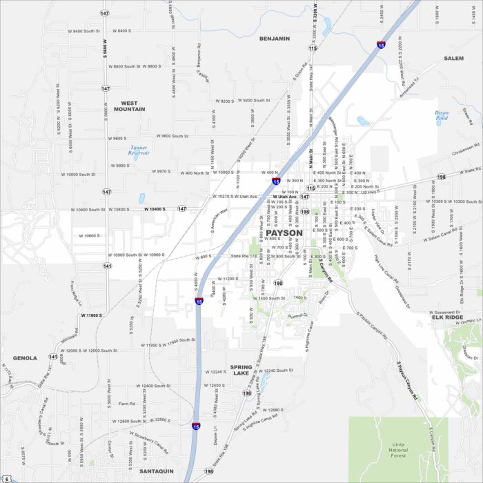
Payson rests against the foothills of the Wasatch Range. Our map points out its downtown area and nearby Nebo Loop scenic drive.
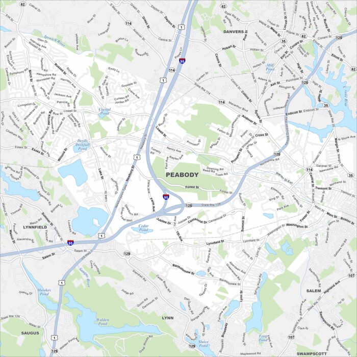
Peabody lies just inland from the North Shore. Take a look at our map to see its suburban areas and city highways.
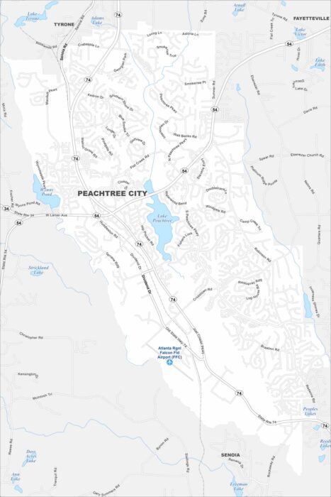
Our map of Peachtree City highlights a network of winding through neighborhoods. Lakes and greenbelts are everywhere here.
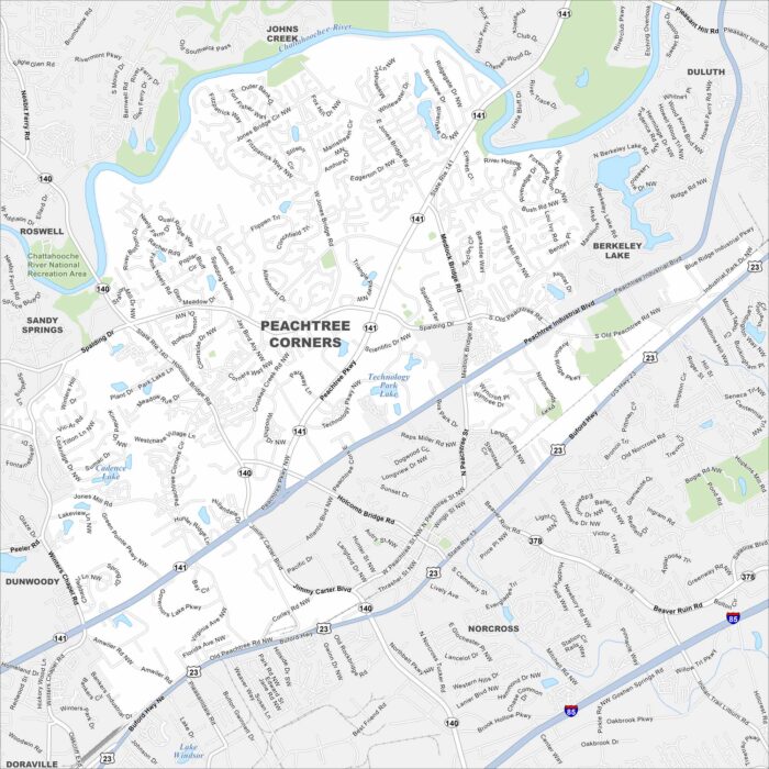
Peachtree Corners sits along the Chattahoochee River northeast of Atlanta. Check out the map to see its residential areas and business parks.
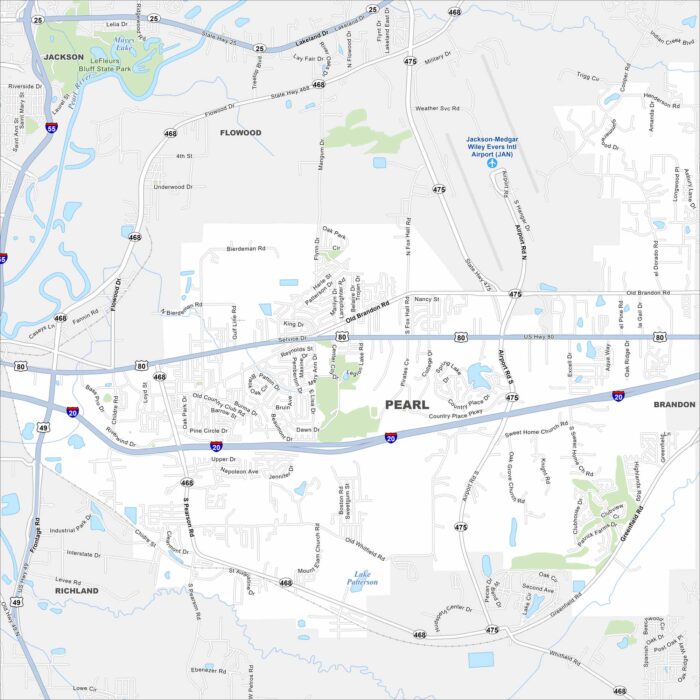
Pearl stretches along the Pearl River just east of Jackson. Our map shows neighborhoods, highways, and open green spaces.
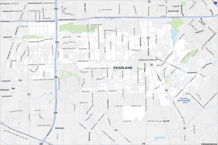
Take a look at Pearland, one of the fastest-growing cities near Houston. The map shows expanding suburbs mixed with parks and lakes.
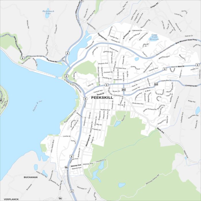
Our map of Peekskill outlines a small city on the Hudson River. Hills rise behind its downtown and riverfront.
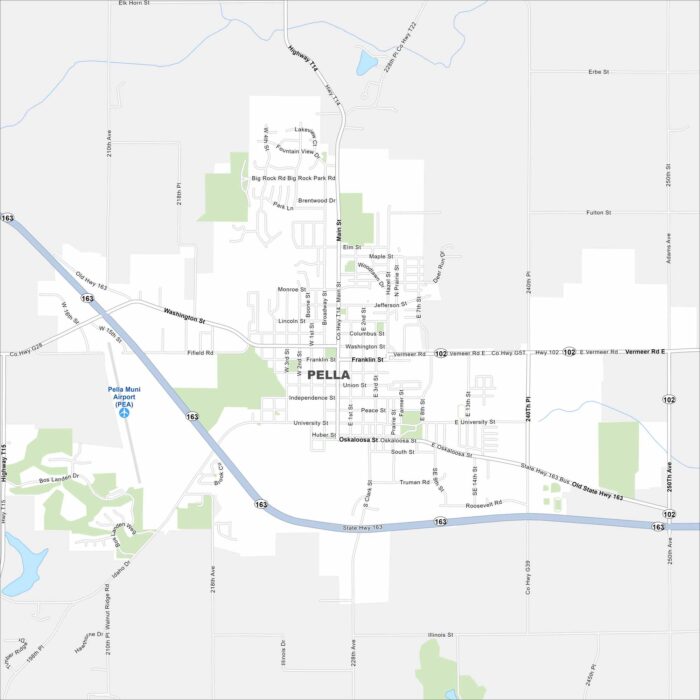
Pella was founded by Dutch immigrants and still celebrates that heritage. Check out our map to see its central square and roads.