Map of Lodi, California
Our map of Lodi places it in the Central Valley north of Stockton. The city is part of the San Joaquin County.
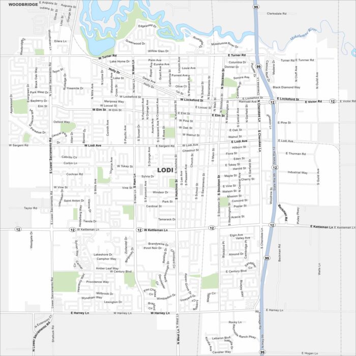
Our map of Lodi places it in the Central Valley north of Stockton. The city is part of the San Joaquin County.
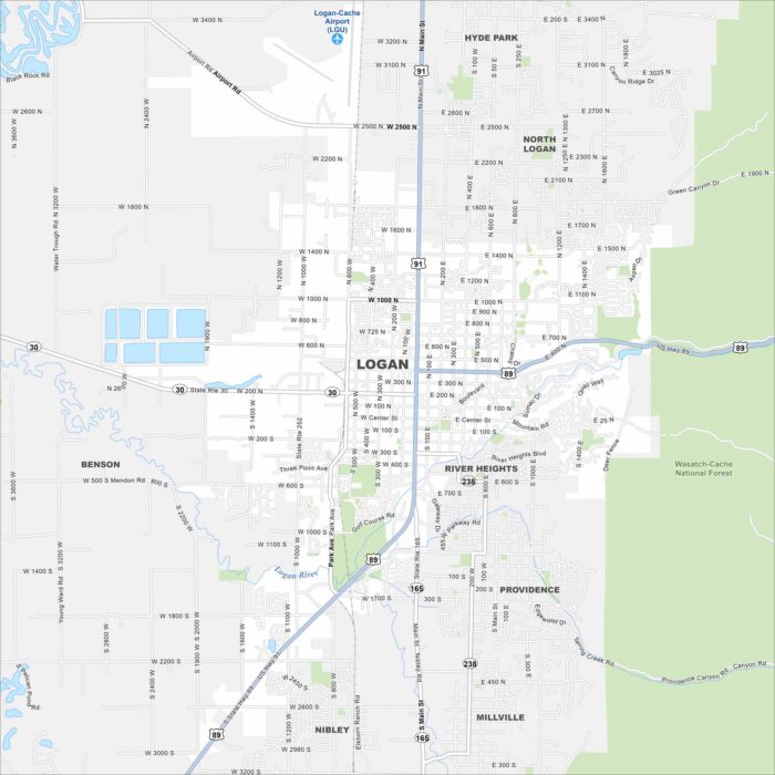
Explore Logan at the northern end of Utah’s Cache Valley. The Logan River winds through the southern section of the city.
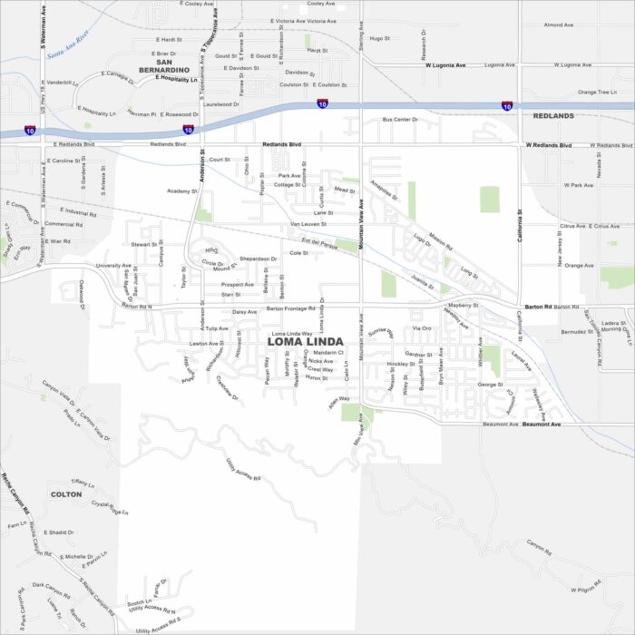
Loma Linda sits in San Bernardino County. Our map shows Interstate 10 running east-west across its neighborhoods.
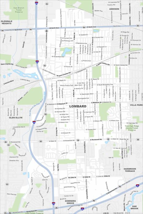
Check out Lombard in suburban DuPage County. Our road map shows its grid of neighborhoods west of Chicago.
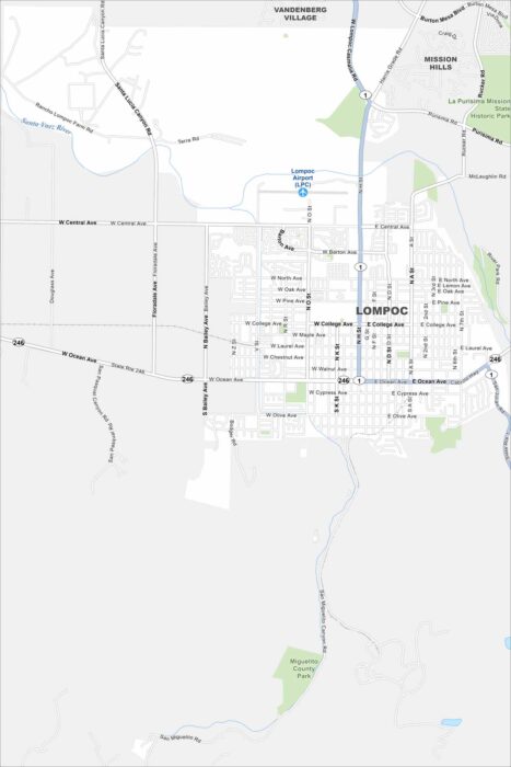
Our map of Lompoc highlights its spot in a coastal valley. Highways 1 and 246 cut through town. The city lies just inland from the Pacific.
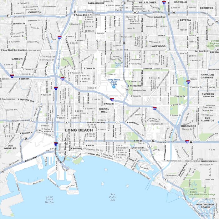
Long Beach sits on the Pacific coast south of Los Angeles. Our map shows its port and shoreline. Freeways tie the city to Southern California.
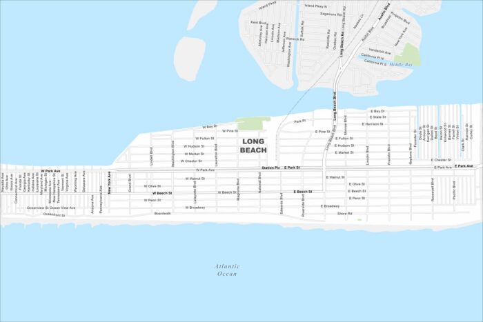
Take a look at Long Beach on a barrier island off Long Island’s south shore. The Atlantic Ocean lines its southern edge.
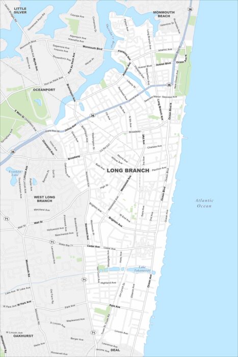
Our map of Long Branch runs along the Jersey Shore. The city fronts directly on the Atlantic. Routes connect it north to New York City.
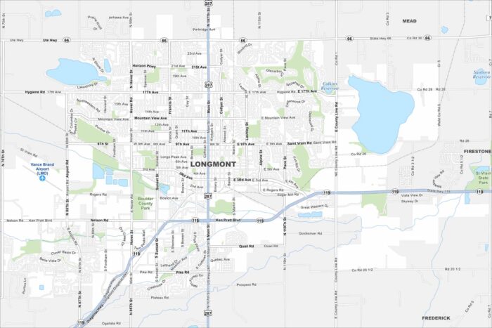
Longmont lies northeast of Boulder on the Front Range. Our map shows highways reaching out toward Denver and Fort Collins.
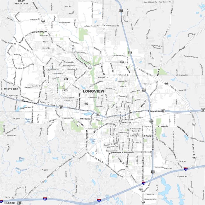
See Longview on our map in east Texas. You’ll find interstates and rail lines that cut through the city. Pine forests surround the area.
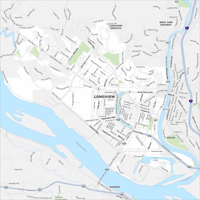
Our map of Longview follows the Columbia River on the city’s edge. Bridges link it to Oregon. Highways spread out through forested hills.
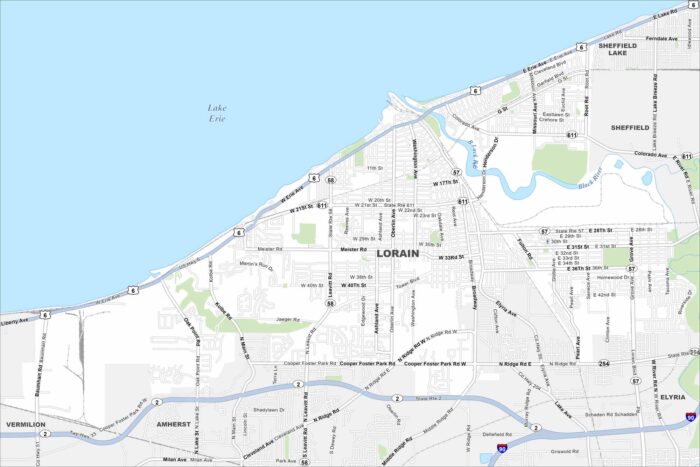
Lorain sits on Lake Erie west of Cleveland. Our map shows the Black River flowing into the harbor. Highways connect the city inland.
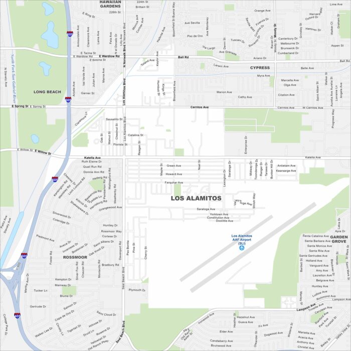
Check out Los Alamitos in northwest Orange County. Freeways and surface streets cross through the area. Our map highlights its location.
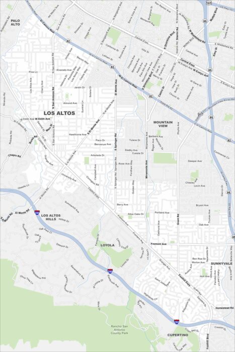
Los Altos rests at the edge of the Santa Cruz Mountains. Our map shows its neighborhoods blending into Silicon Valley.
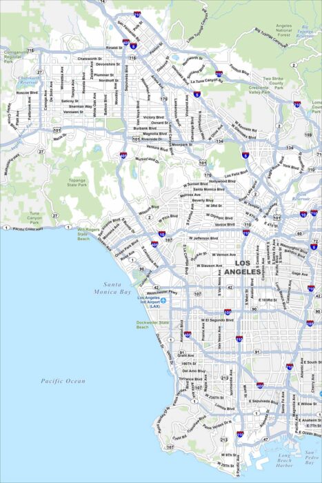
Our map of Los Angeles stretches from the Pacific coast to the San Gabriel Mountains. Freeways form a road network across the city.