Map of Ketchikan, Alaska
Ketchikan clings to a narrow strip of land between mountains and water. Our map shows harbors and docks lining Tongass Narrows.
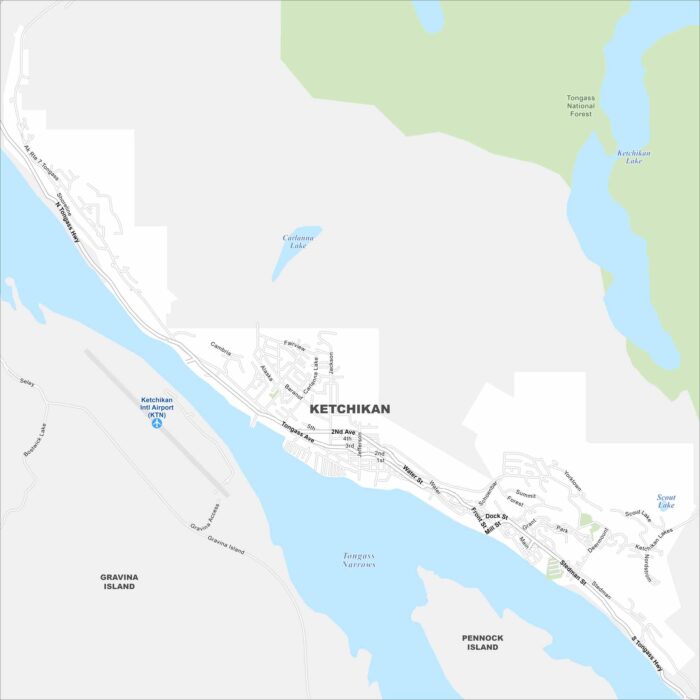
Ketchikan clings to a narrow strip of land between mountains and water. Our map shows harbors and docks lining Tongass Narrows.
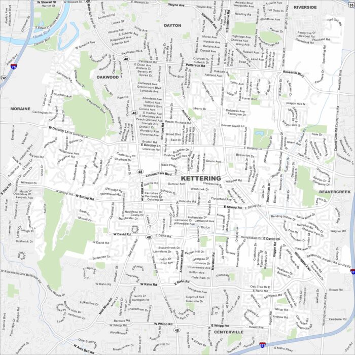
Our map of Kettering shows it blending into greater Dayton. Parks and residential areas cover much of the area.
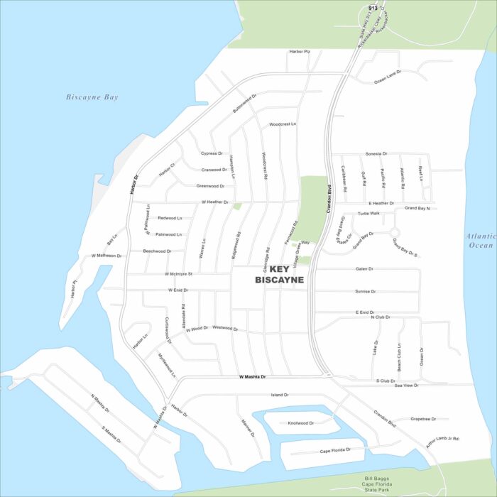
Key Biscayne is a barrier island south of Miami. This map shows it linked by the Rickenbacker Causeway. Beaches run along both shores.
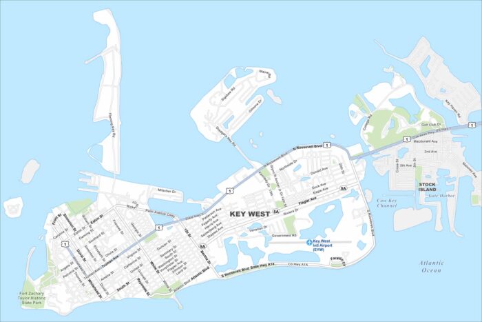
Key West sits at the end of the island chain. Our map highlights the Overseas Highway leading in. The Gulf and Atlantic meet near here.
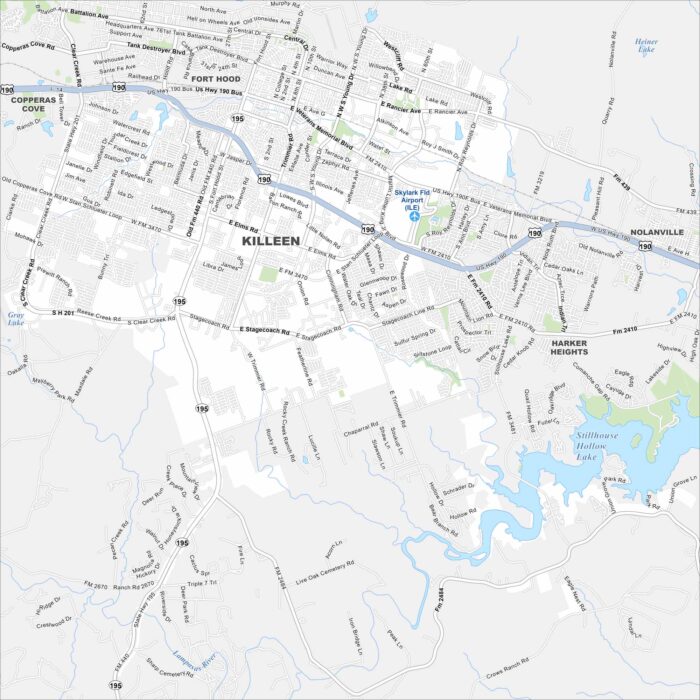
Killeen is anchored by Fort Hood. Our map shows wide highways cutting through the city. Neighborhoods sprawl outward from the military base.
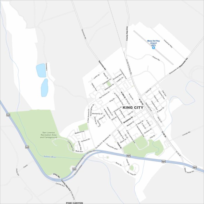
Our map of King City shows it in the Salinas Valley. Vineyards and farmland stretch in every direction. The Salinas River flows just west.
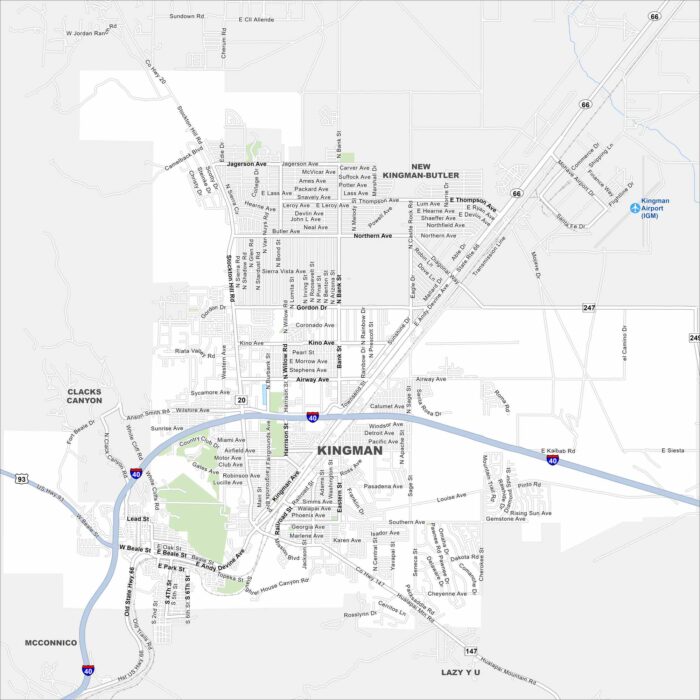
Check out our map of Kingman along historic Route 66. The city sits between desert plains and rugged mountains.
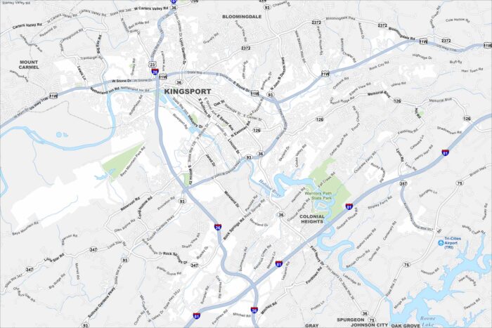
Kingsport is laid out along the Holston River. Our map shows winding roads leading into the Appalachian foothills.
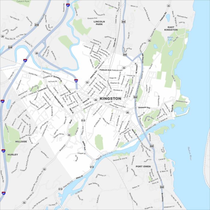
Kingston sits on the Hudson River, just below the Catskills. Our map shows old neighborhoods clustered near the water.
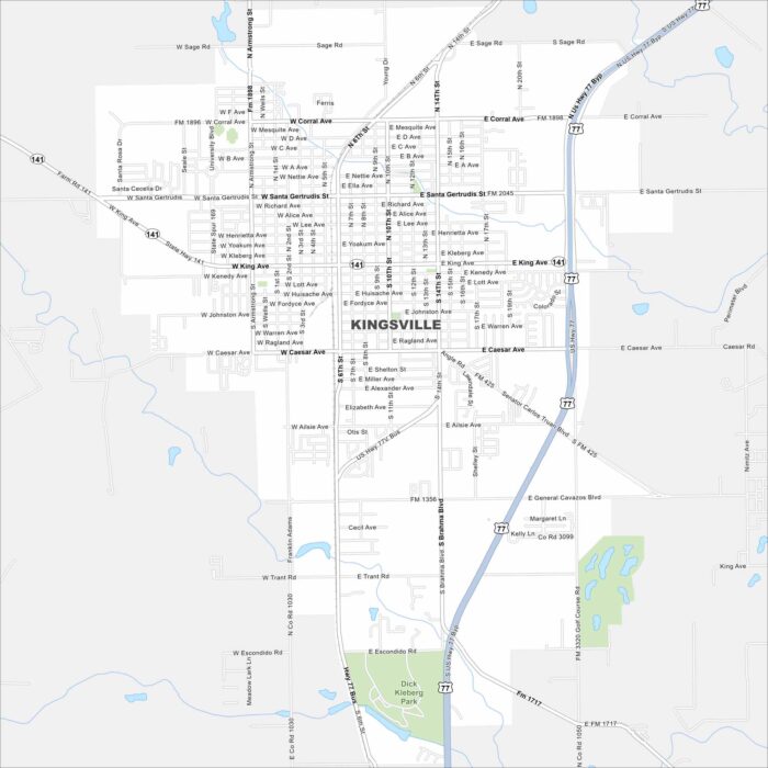
Our map of Kingsville shows its roads and open land around the city. It lies just west of the Gulf Coast with US Highway 77 cutting through.
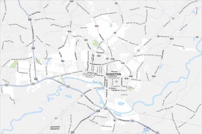
Kinston is set on the Neuse River. This map shows its downtown surrounded by farmland. Highways branch out toward Greenville and New Bern.
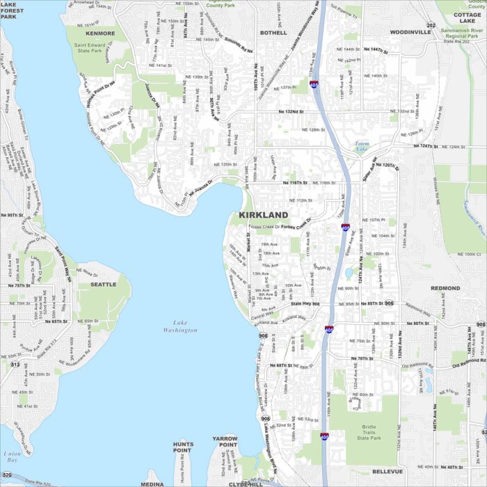
Kirkland is right on the shore of Lake Washington. Our map highlights highways, roads, and parks. Seattle sits just across the water.
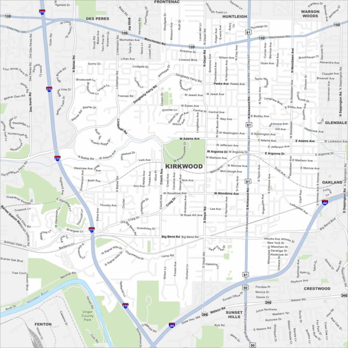
Our map of Kirkwood shows a leafy suburb west of St. Louis. Railroad tracks cut through the heart of downtown.
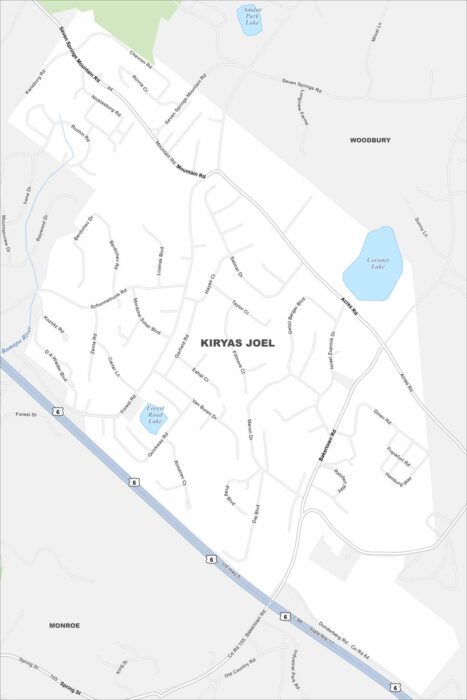
Kiryas Joel is a dense community in Orange County. The map shows compact neighborhoods built close together.
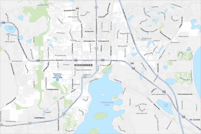
Kissimmee lies just south of Orlando. Our map shows lakes across the landscape and roads leading toward Disney parks.