Map of Highland, California
Explore our map of Highland in Southern California, which sits at the base of the San Bernardino Mountains.
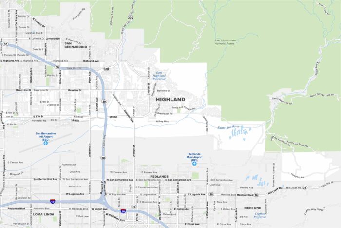
Explore our map of Highland in Southern California, which sits at the base of the San Bernardino Mountains.
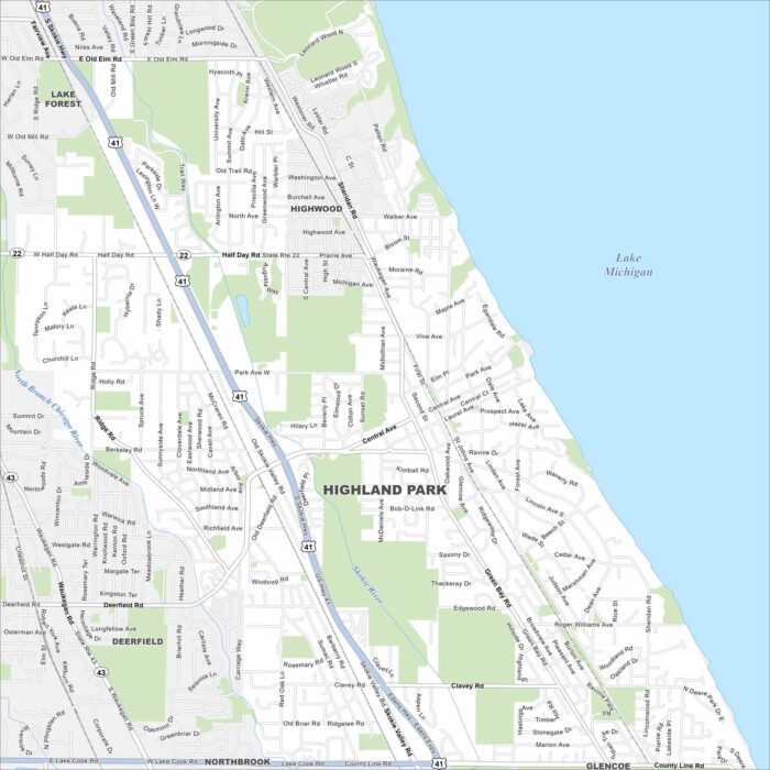
Highland Park lies on the shore of Lake Michigan north of Chicago. This map shows a mix of lakeshore and wooded areas.
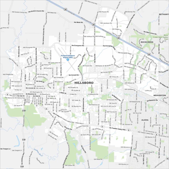
Hillsboro is in the Tualatin Valley just west of Portland. Our map shows farmland giving way to urban and built-up areas.
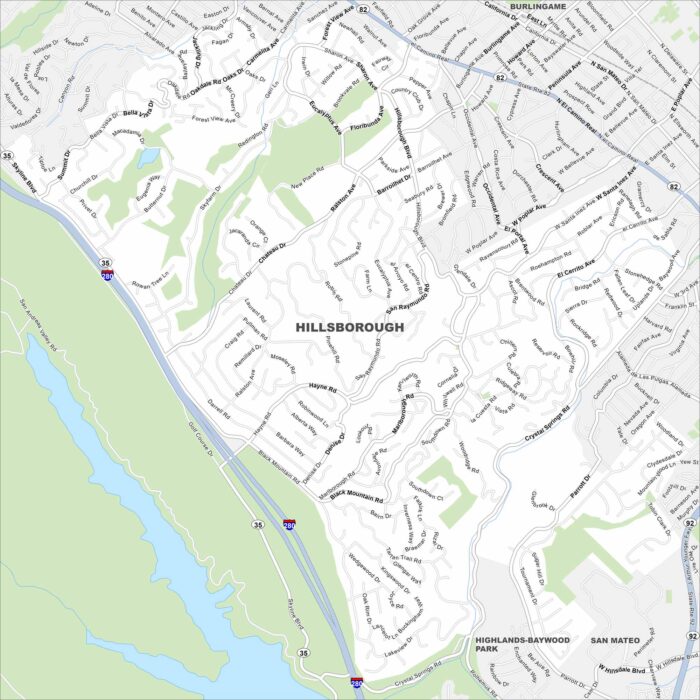
Our map of Hillsborough shows winding roads through wooded hills. It’s mostly residential, with large estates tucked between canyons.
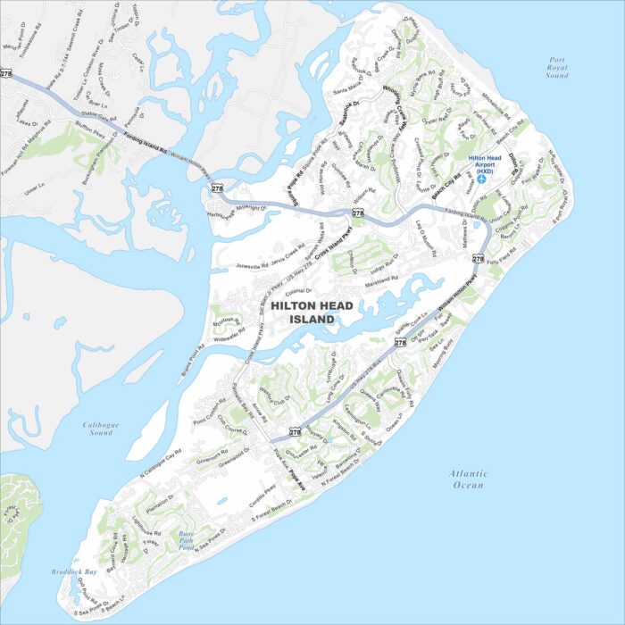
Explore our map of Hilton Head Island on the Atlantic coast. You’ll notice beaches, green spaces, and lagoons scattered across the island.
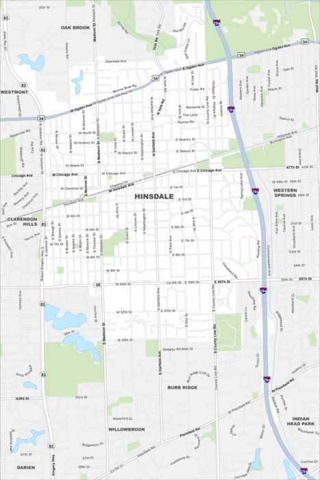
Hinsdale is a suburb west of Chicago. This map highlights its highways, roads and streams cutting through the village.
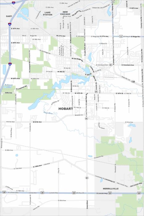
Our map of Hobart shows the downtown built around Lake George. Highways connect the city to nearby Gary and Chicago.
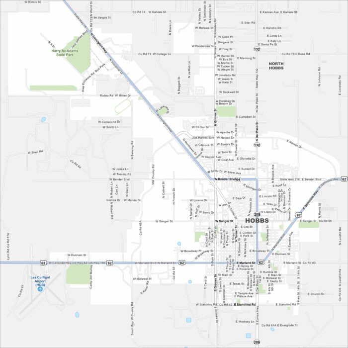
Check out our map of Hobbs near the Texas border. The grid of roads spreads into open plains and oil fields.
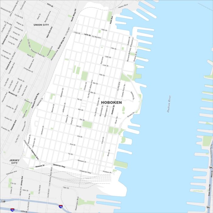
Hoboken is located on the west bank of the Hudson River across from Manhattan. Our map shows a tight street grid leading to the waterfront.
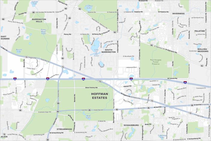
Our map of Hoffman Estates shows neighborhoods stretching along I-90 northwest of Chicago. Parks and forest preserves stand out quite a lot.
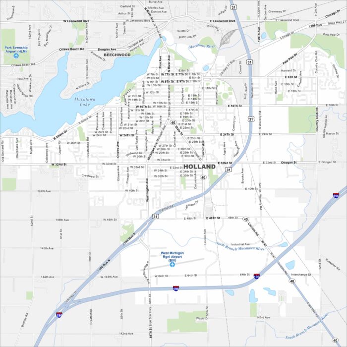
Holland sits on Lake Macatawa, which connects to Lake Michigan. It’s famous for its Dutch heritage and annual tulip festival.
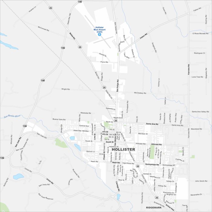
Our map of Hollister shows a grid of streets surrounded by farmland. The city sits in a valley ringed by low mountains.
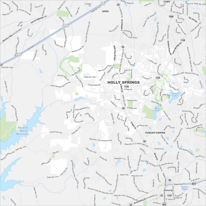
Holly Springs is southwest of Raleigh in the Research Triangle region. Our map shows a mix of lakes, greenways and residential areas.
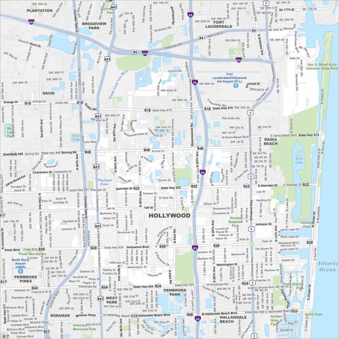
Hollywood, Florida is set between Miami and Fort Lauderdale. Our map highlights its roads, lakes and beachfront boardwalk.
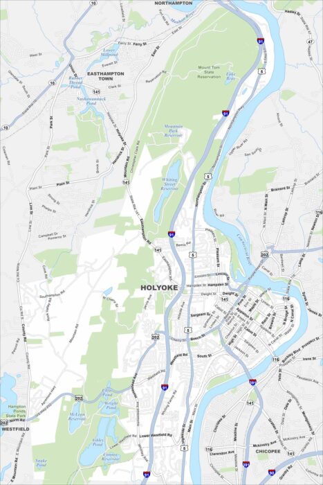
Explore our map of Holyoke by the Connecticut River. Old mill buildings line the water. The Mount Tom Range rises just to the northwest.