Map of Green Bay, Wisconsin
Our map of Green Bay shows it at the mouth of the Fox River. Green Bay defines its geography. But the Green Bay Packers is the lifeblood.
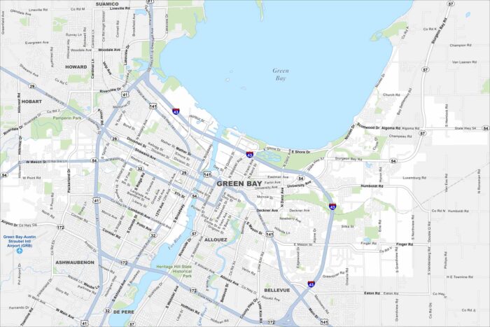
Our map of Green Bay shows it at the mouth of the Fox River. Green Bay defines its geography. But the Green Bay Packers is the lifeblood.
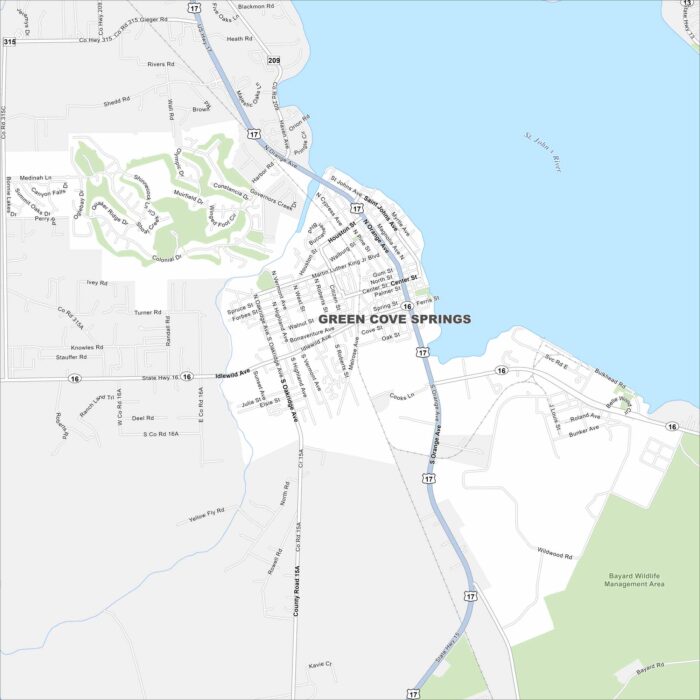
Green Cove Springs is along the St. Johns River in northeast Florida. On the map, you’ll see the river shaping the city’s edge.
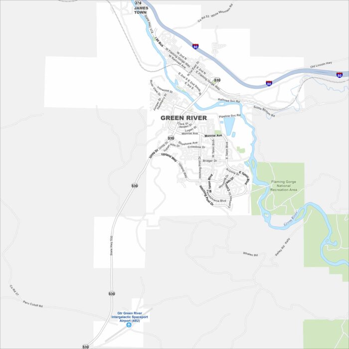
Explore our map of Green River in southwest Wyoming. The city sits along the Green River itself. Rugged canyons and mesas rise nearby.
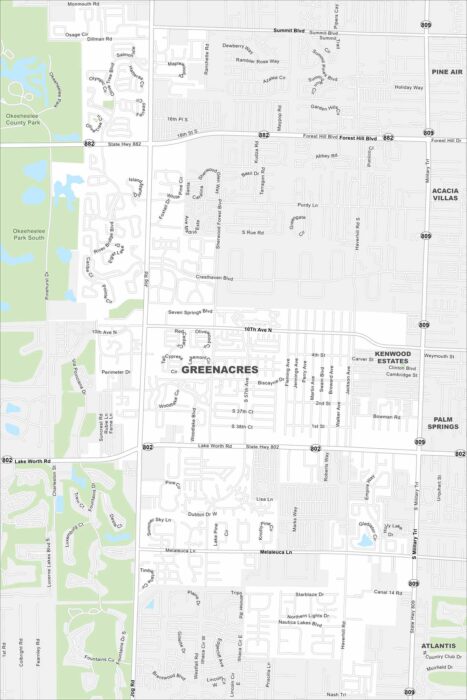
Our map of Greenacres places it inland in Palm Beach County. Neighborhoods fill the inner city grid. Larger roads connect it to the Atlantic.
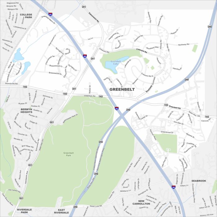
Greenbelt is just northeast of Washington, D.C. This map shows parkland and green space surrounding the community.
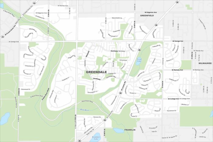
Greendale is a planned community just southwest of Milwaukee. Our map shows neat neighborhoods with parks and green space. Highways tie it directly into the metro area. Map Information On the Map Interstates/Highways: State Rte 36, State Rte 24 Major Roads: Loomis Rd, 76th St, 60th St, 92nd St, Forest Home Ave, Grange Ave, Ramsey…
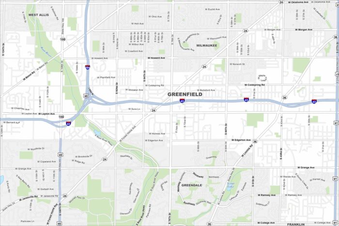
Our map of Greenfield highlights its spot south of Milwaukee. The street layout mixes older subdivisions with newer ones.
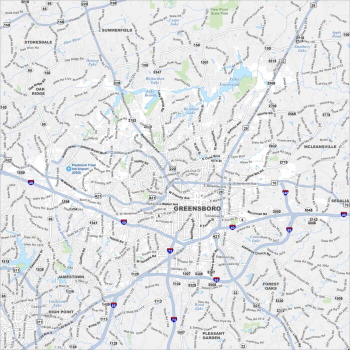
Explore our map of Greensboro in central North Carolina. Interstates 40, 85, and 73 all meet here. Lakes and green spaces surround the area.
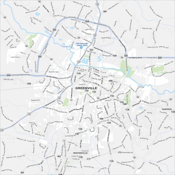
Greenville is in eastern North Carolina along the Tar River. Our map shows the river running near the center of town.
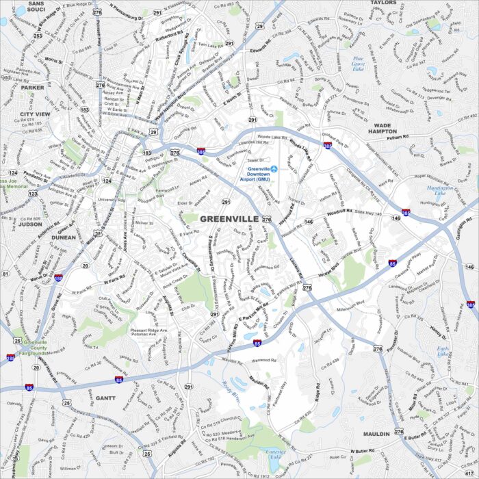
Check out our map of Greenville in the foothills of the Blue Ridge Mountains. The Reedy River cuts through downtown.
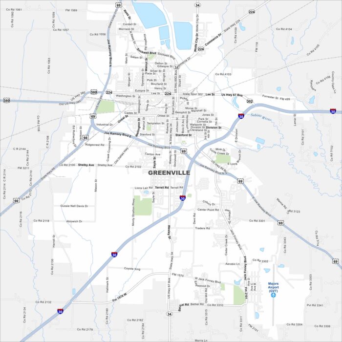
Our map of Greenville shows this city northeast of Dallas. The layout centers around U.S. Highway 69 and Interstate 30.
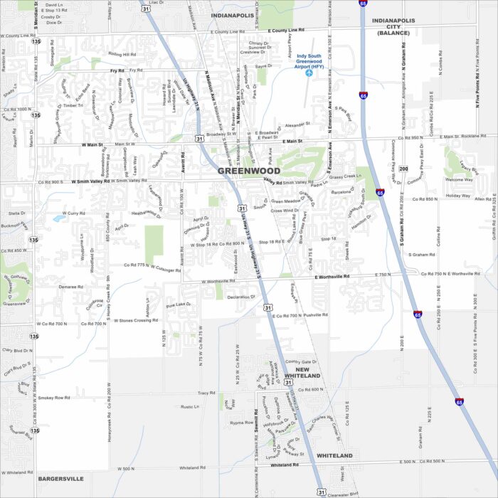
Greenwood is just south of Indianapolis in central Indiana. On the map, you’ll see dense suburban neighborhoods.
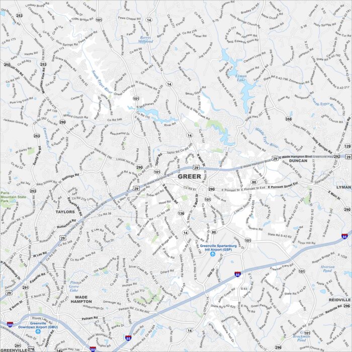
Take a look at our map of Greer between Greenville and Spartanburg. Its location is near Greenville-Spartanburg International Airport.
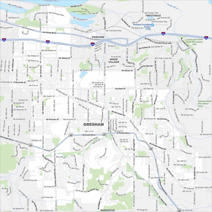
Our map of Gresham places it east of Portland. The layout spreads toward the Columbia River Gorge. Residential areas fill most of the city.
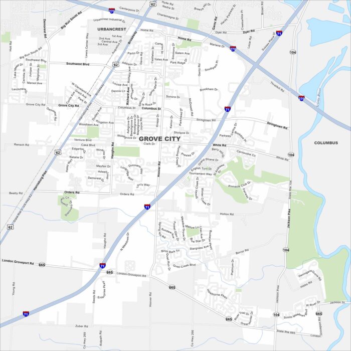
Grove City is in central Ohio. It’s located just south of Columbus. Interstates 71 and 270 connect it into the region.