Map of Appleton, Wisconsin
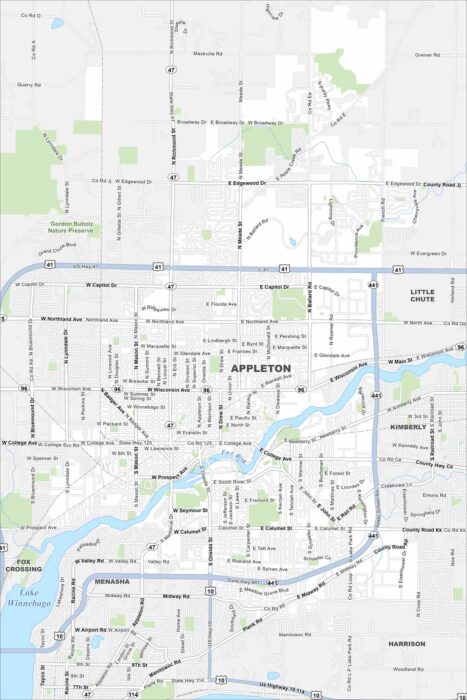
Here’s our map of Appleton, Wisconsin. Two major features are the Fox River and Lake Winnebago. You’ll also find roads, parks and lakes.
Here’s our map of Appleton, Wisconsin. Two major features are the Fox River and Lake Winnebago. You’ll also find roads, parks and lakes.
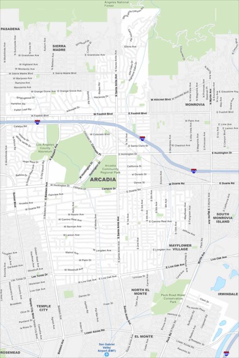
Our map of Arcadia shows the waterways, Interstate 210, and nearby mountain edges. Roads connect it toward Pasadena.
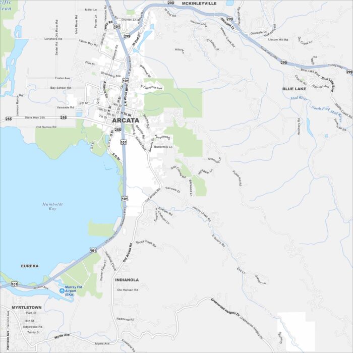
Arcata sits right next to Humboldt Bay in Northern California. Our map shows its coastal surroundings and much more.
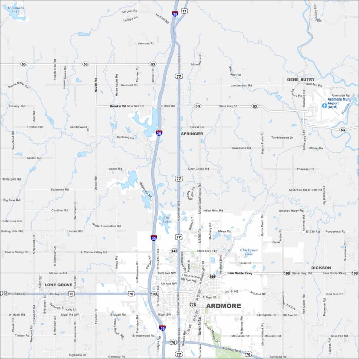
Our map of Ardmore shows its lakes, rivers, roads and parks. The city grew quite a bit as it’s positioned between Oklahoma City and Dallas.
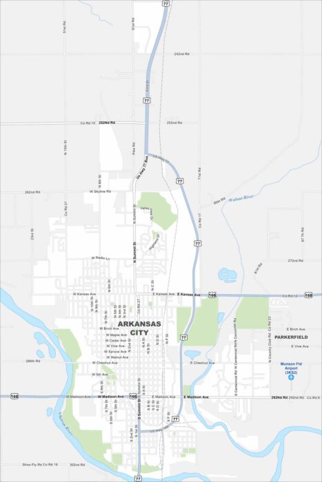
Not to be confused with the state of Arkansas. But Arkansas City sits at the meeting of the Arkansas and Walnut Rivers in Kansas.
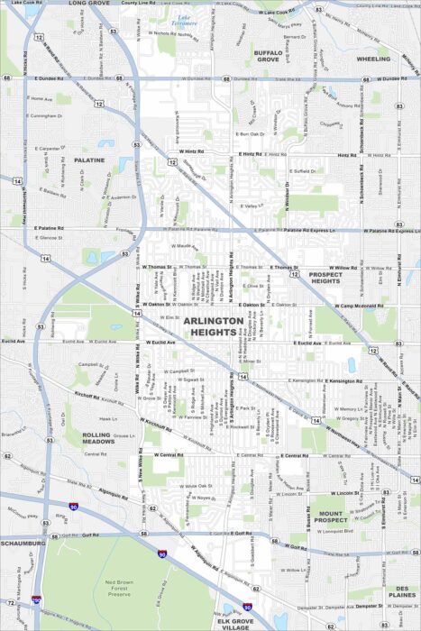
Our map of Arlington Heights lays out the roadways, waterways, and local parks. Roads tie into Chicago, which is located to the southeast.
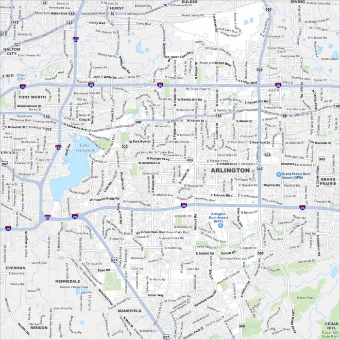
See the highways, airports, and parks of Arlington, Texas. Our map shows how this city stretches between Dallas and Fort Worth.
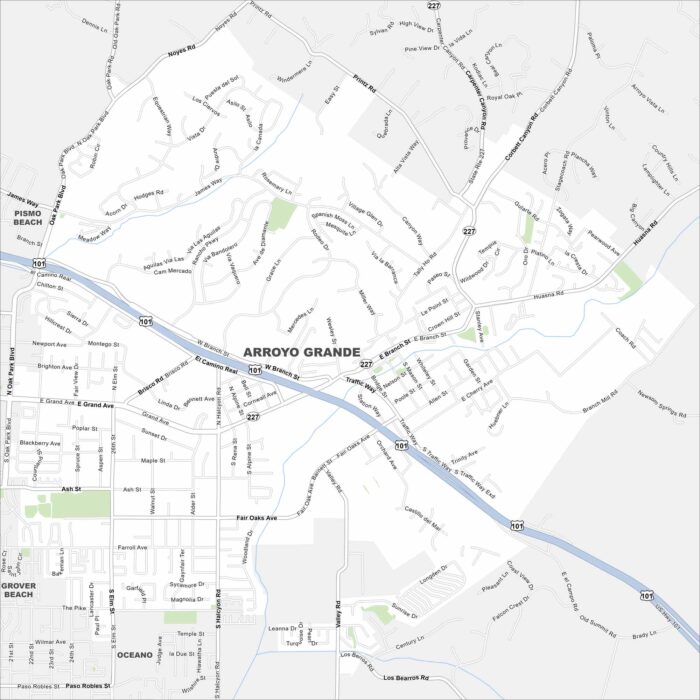
Here’s our map of Arroyo Grande. You’ll find roads that run through vineyards. It’s known for being a historic village.
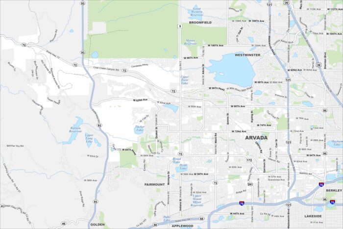
Arvada is located northwest of Denver. Our map of Arvada shows the roads, waterways, and park spaces. Streets connect to Denver.
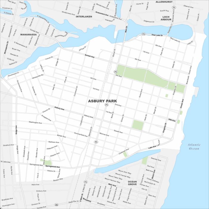
See the streets, highways, and waterfront edges on this map. Our map of Asbury Park highlights its roads leading to the shore.
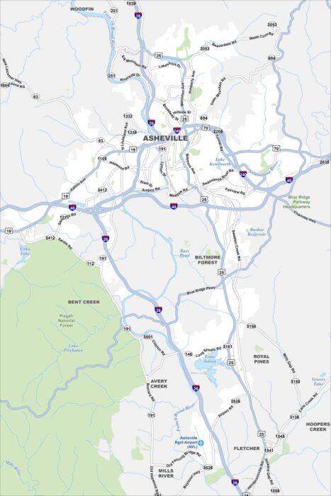
Asheville is mapped with its highways, streets, and riverside routes. Roads wind here because the city sits in the Blue Ridge Mountains.
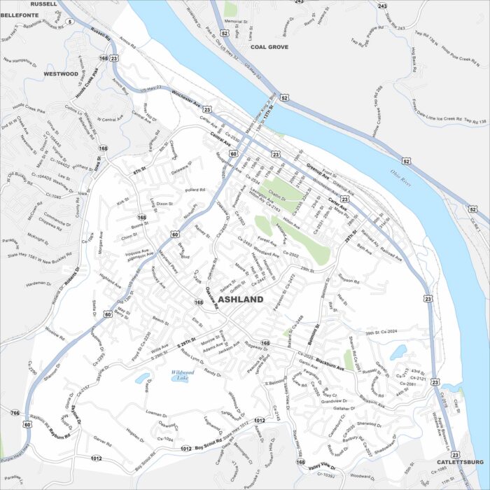
Our map of Ashland shows its highways, parks, and waterways. Roads and railways follow the Ohio River on the east side of the city.
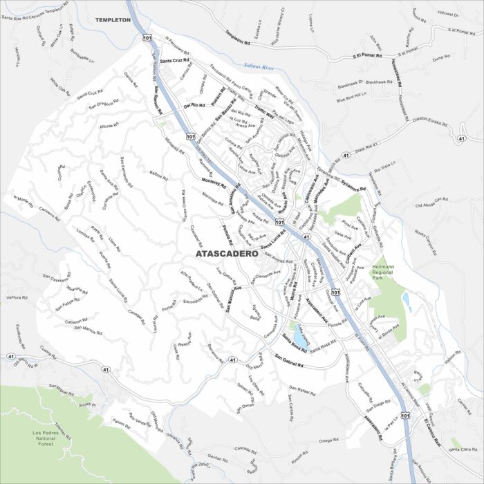
Atascadero is shown with its highways, streets, and forests. Roads cut through the rolling hills. The city is part of San Luis Obispo County.
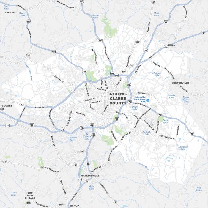
Get to know Athens, Georgia with our road map. It highlights the streets, highways, and parks. Roads wrap around the University of Georgia.
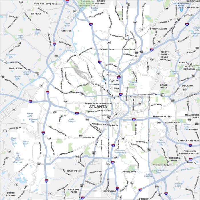
Atlanta is mapped with its highways, streets, and tree-filled spaces. You can see how the interstates connect with the downtown area.