Map of El Segundo, California
El Segundo hugs the coast just south of LAX. On the map, you’ll spot its wide beaches and industrial areas inland.
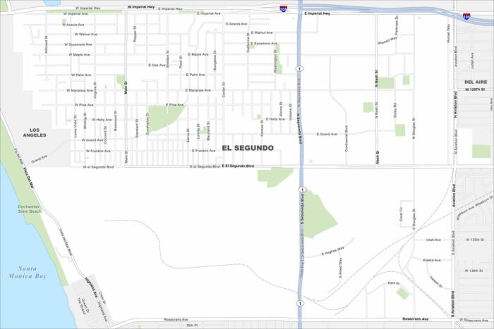
El Segundo hugs the coast just south of LAX. On the map, you’ll spot its wide beaches and industrial areas inland.
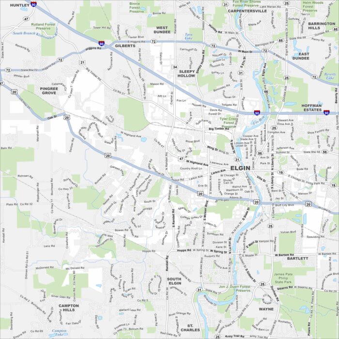
Our map of Elgin highlights the Fox River. Green parks and trails line both riverbanks. It’s known as “The City in the Suburbs”
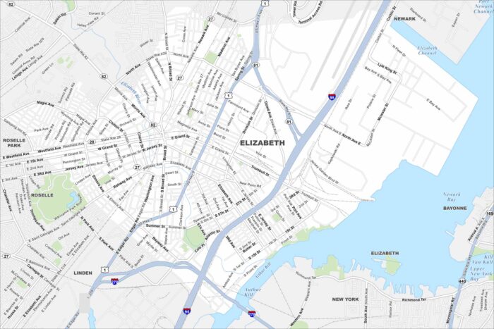
Elizabeth sits on Newark Bay with busy port terminals along the shoreline. Dense city blocks stretch westward.
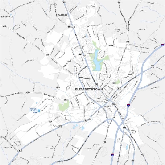
Check out Elizabethtown in the heart of Kentucky. Our map shows its compact downtown. Locals simply call it “E-town”.
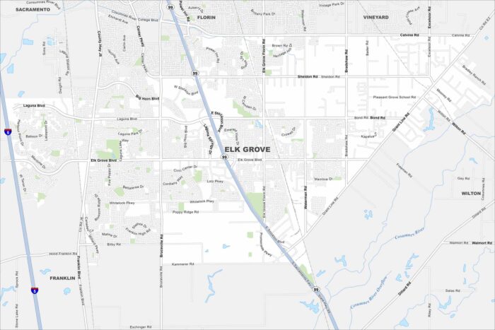
Elk Grove lies just south of Sacramento. It’s now one of California’s fastest-growing cities, thanks to its location near the capital.
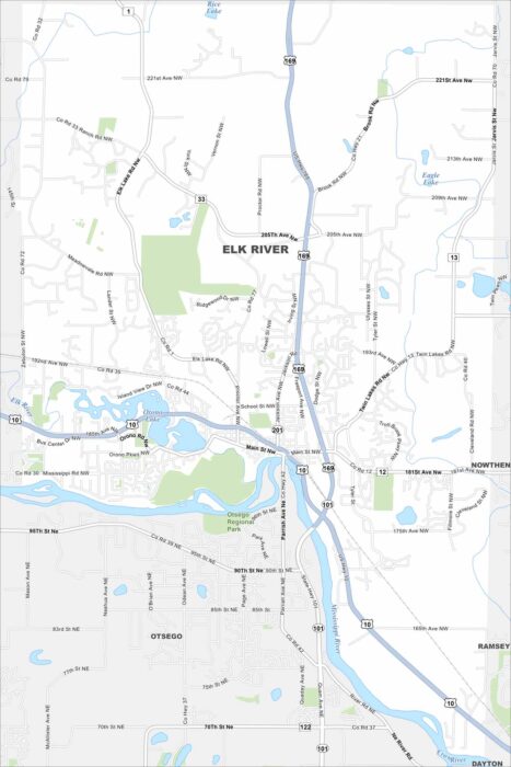
Explore our map of Elk River to see the junction of Highways 10 and 169. The Mississippi River runs along the city’s edge.
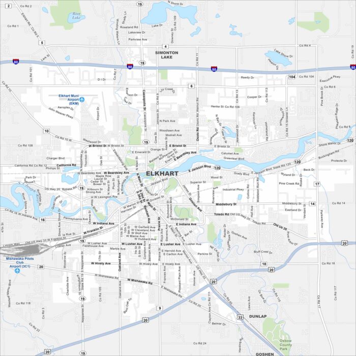
Our map of Elkhart shows the St. Joseph River flowing through the city. Major routes like the I-80 and U.S. 20 pass nearby.
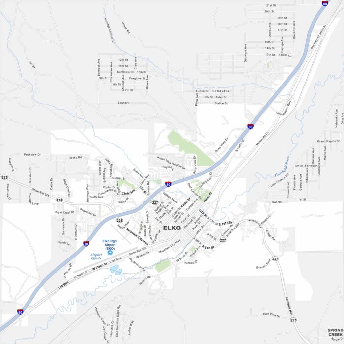
Elko is a high-desert city surrounded by mountain ranges. You’ll spot I-80 running east–west across the area.
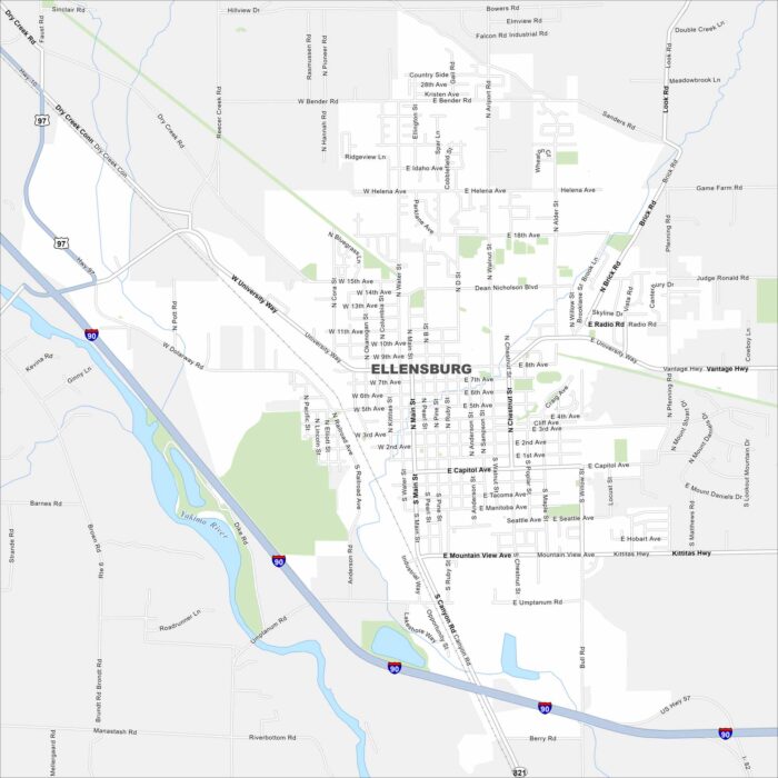
Check out our map of Ellensburg with I-90 cutting right through on the west side. The Yakima River flows nearby on the west as well.
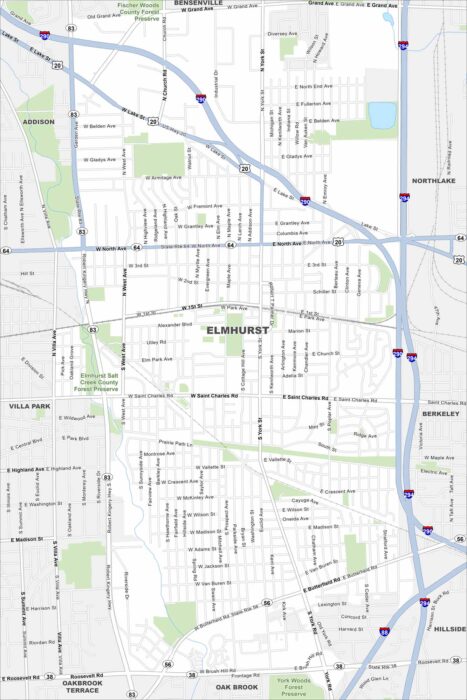
Elmhurst is a western suburb of Chicago with lots of parks. Our map of Elmhurst highlights its main routes like I-290.
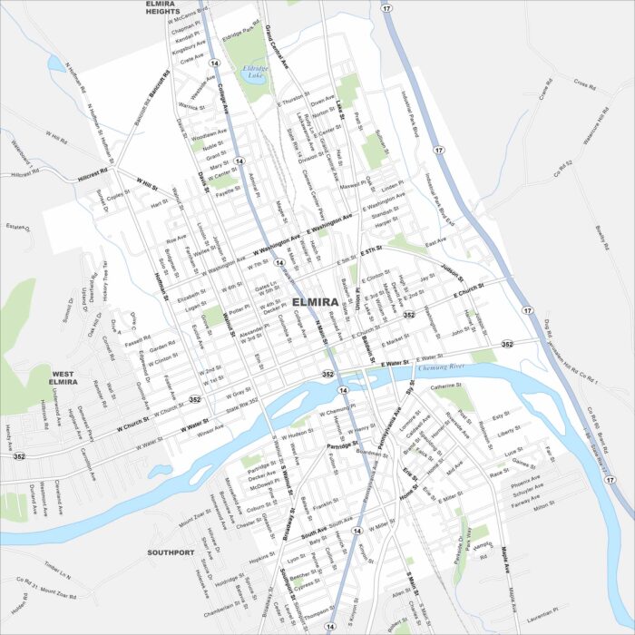
Elmira is located along the Chemung River in southern New York. The city connects to Route 14 and 17. It’s often known as the “Queen City”.
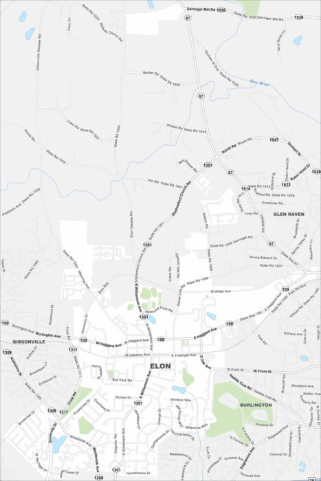
See Elon on our map with S Williamson Ave as the main route here. The town has a small, walkable street network.
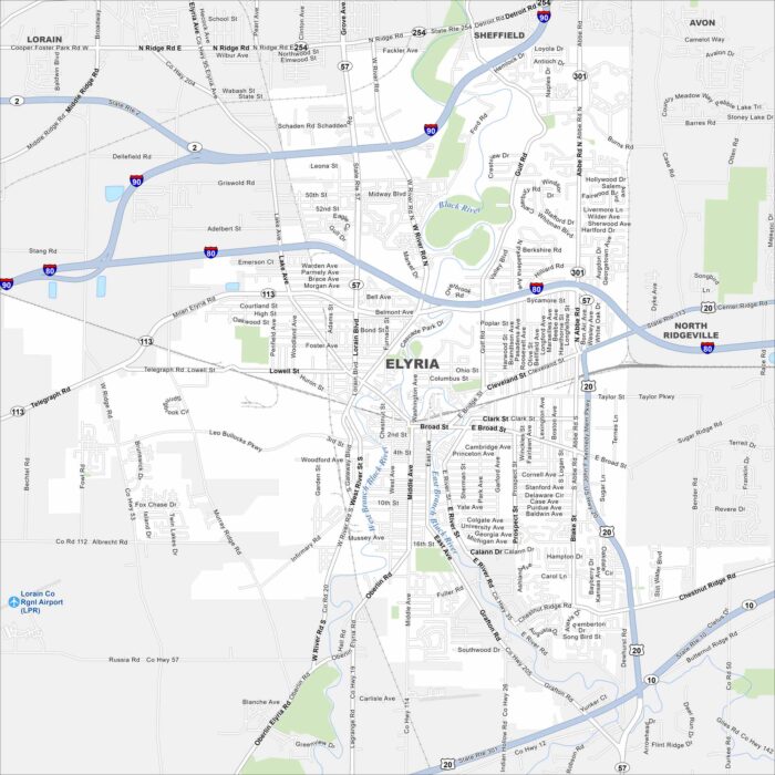
Our map of Elyria shows I-80 and I-90 running just north of the city. The Black River cuts through its center in two branches (west and east).
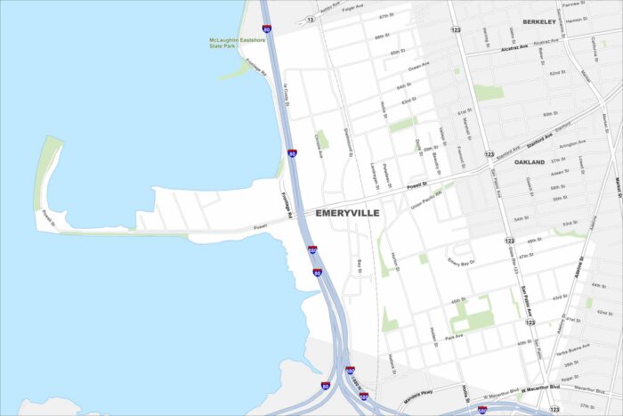
Emeryville is located between Oakland and Berkeley along I-80. The city borders the San Francisco Bay with views of the Bay Bridge.
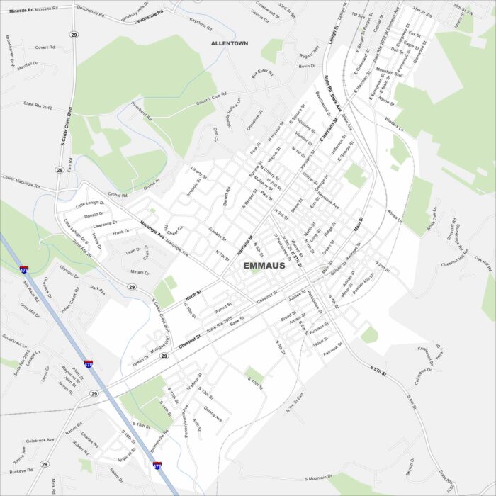
Look at Emmaus on our map just south of Allentown. Main roads like Chestnut Street and Cedar Crest Boulevard shape the borough.