Map of Bremerton, Washington
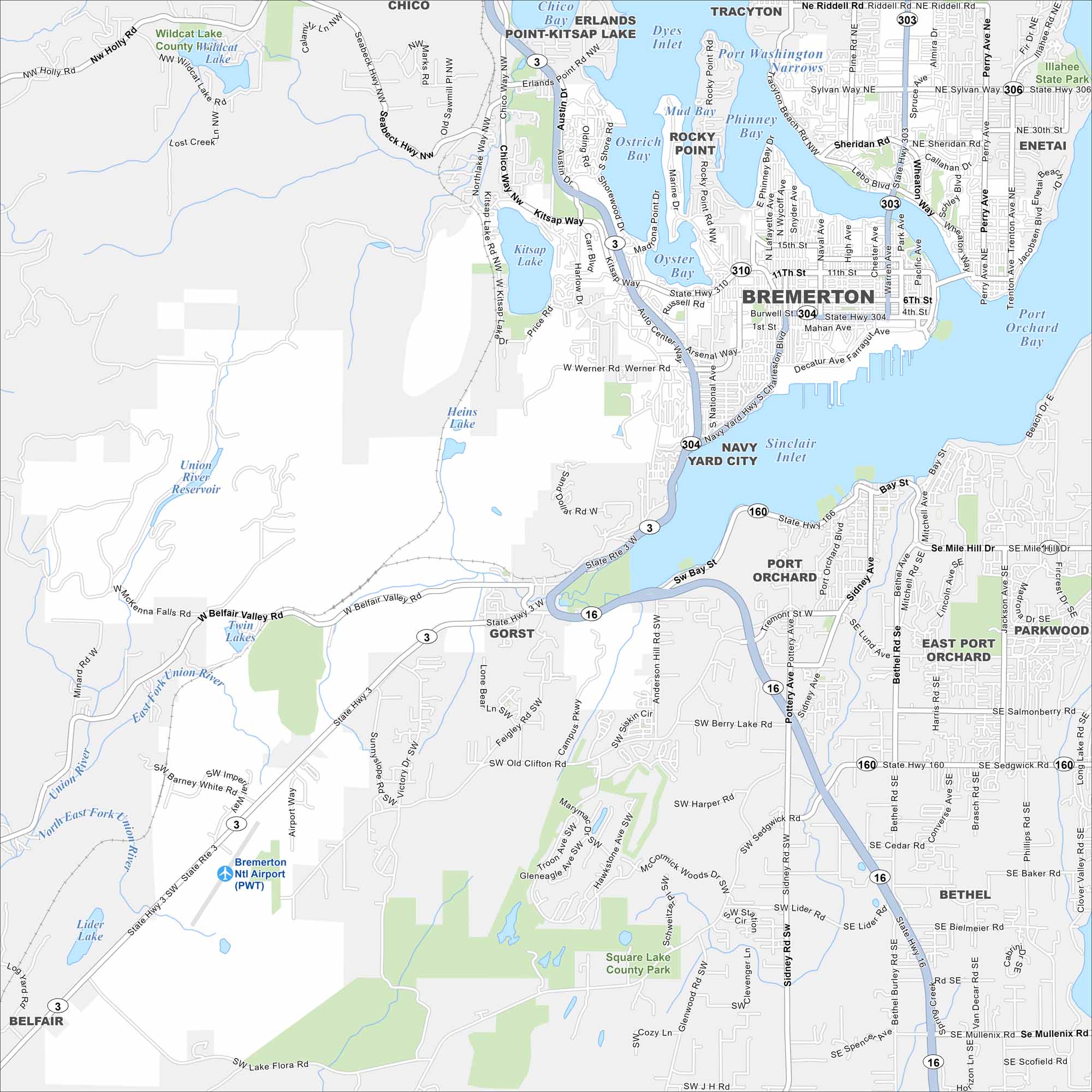
See Bremerton on our map, where the city meets Puget Sound. The naval base dominates but ferries still link it easily to Seattle. Water and forest surround its neighborhoods.
Map Information
On the Map
Interstates/Highways: State Rte 3, State Rte 304, State Rte 310, State Rte 16, State Rte 160, State Rte 166 Major Roads: Kitsap Way, Wheaton Way, Warren Ave, Marine Dr, Charleston Blvd, Burwell St, 6th St, 11th St, Wycoff Ave, Naval Ave, Callow Ave, Loxie Eagans Blvd, Arsenal Way, Werner Rd, Old Clifton Rd, Sunnyslope Rd, Anderson Hill Rd, Sidney Rd, Bethel Rd, Sedgwick Rd Airports: Bremerton Ntl Airport Lakes and Reservoirs: Dyes Inlet, Port Washington Narrows, Ostrich Bay, Phinney Bay, Mud Bay, Oyster Bay, Sinclair Inlet, Port Orchard Bay, Kitsap Lake, Heins Lake, Wildcat Lake, Union River Reservoir, Twin Lakes, Lider Lake, Square Lake, Berry Lake Major Rivers: Union River Parks and Preserves: Wildcat Lake County Park, Illahee State Park, Square Lake County Park Nearby Communities: Chico, Erlands Point-Kitsap Lake, Tracyton, Rocky Point, Navy Yard City, Port Orchard, Parkwood, East Port Orchard, Gorst, Bethel, BelfairWashington State Maps
Move through the Evergreen State with our map collection.


City Maps of Washington
Check out our city maps of Washington


