Map of Bothell, Washington
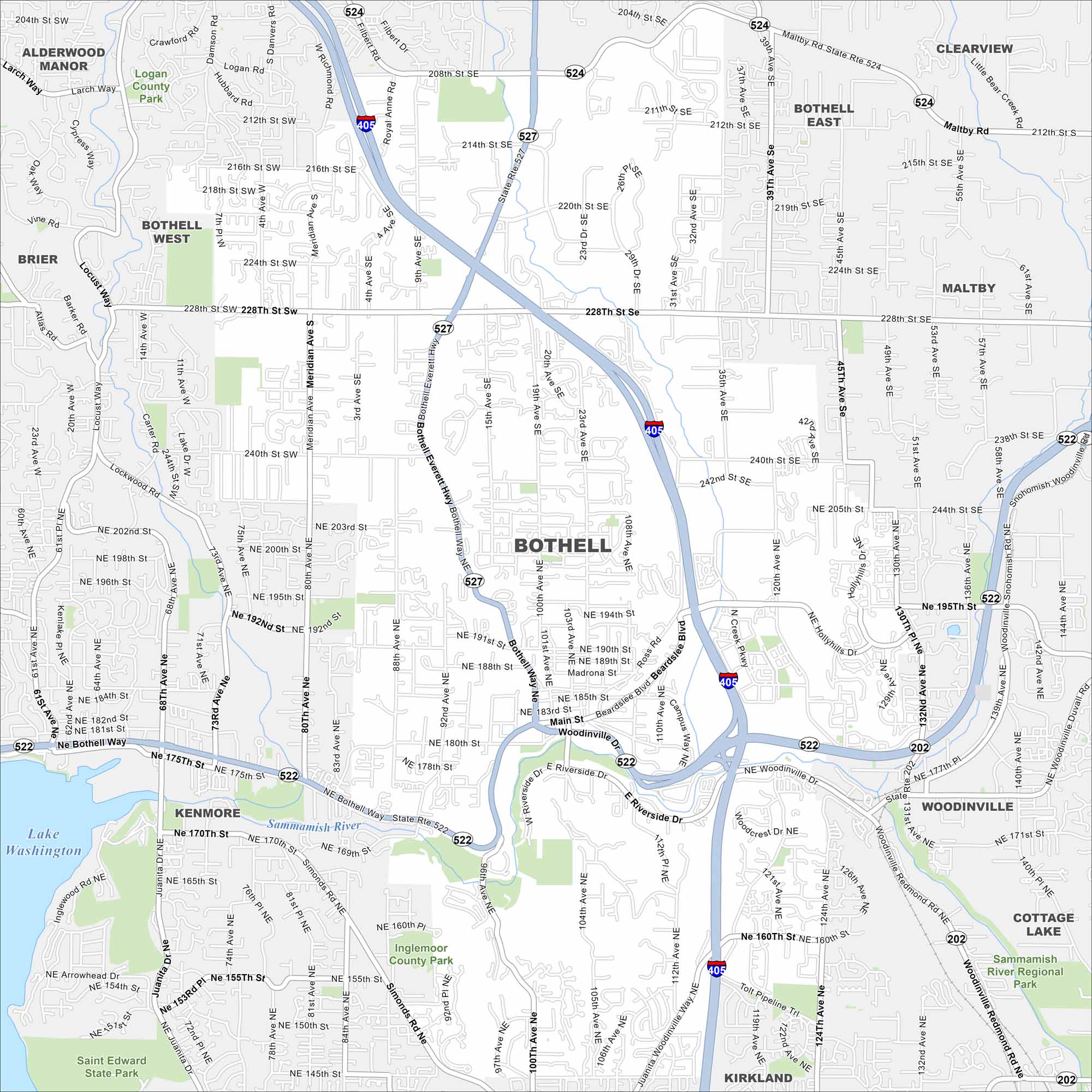
Check out Bothell, Washington on our map. This city is located north of Seattle and is shaped by the Sammamish River. Although it’s growing fast, it still has older, quiet neighborhoods.
Map Information
On the Map
Interstates/Highways: I-405, State Rte 522, State Rte 527, State Rte 524, State Rte 202 Major Roads: Bothell Everett Hwy, Bothell Way, Woodinville Dr, Main St, Beardslee Blvd, 100th Ave, Juanita Dr, Simonds Rd, 124th Ave, Brickyard Rd, Woodinville Redmond Rd, NE 145th St, NE 160th St, NE 175th St, NE 195th St, 228th St, 240th St, Maltby Rd, Filbert Rd, Damson Rd Lakes and Reservoirs: Lake Washington Major Rivers: Sammamish River Parks and Preserves: Saint Edward State Park, Inglemoor County Park, Logan County Park, Sammamish River Regional Park Nearby Communities: Alderwood Manor, Brier, Bothell West, Kenmore, Kirkland, Woodinville, Cottage Lake, Maltby, Clearview, Bothell EastWashington State Maps
Move through the Evergreen State with our map collection.


City Maps of Washington
Check out our city maps of Washington


