Map of Bellingham, Washington
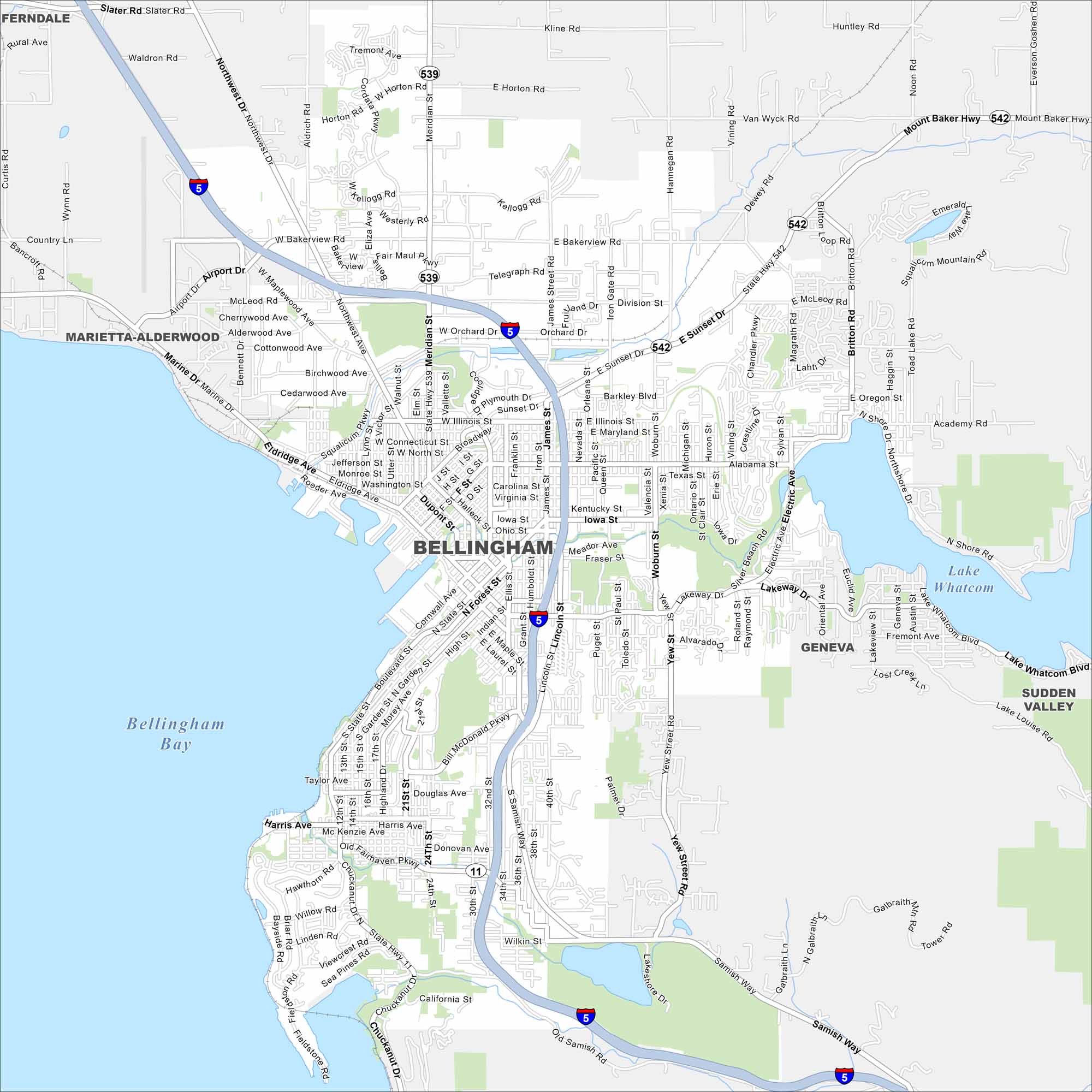
Explore Bellingham on our map at the edge of Bellingham Bay. The city spreads from the waterfront into the surrounding hills. It’s a gateway to the San Juan Islands and Mount Baker.
Map Information
On the Map
Interstates/Highways: I-5, State Rte 539, State Rte 542, State Rte 11 Major Roads: Meridian St, Guide Meridian, Lakeway Dr, Holly St, State St, Cornwall Ave, Broadway, Northwest Ave, Airport Dr, Bakerview Rd, Telegraph Rd, Sunset Dr, Alabama St, Iowa St, Woburn St, Samish Way, Old Samish Rd, Chuckanut Dr, Lake Whatcom Blvd, Mount Baker Hwy Lakes and Reservoirs: Bellingham Bay, Lake Whatcom, Lake Louise Nearby Communities: Ferndale, Marietta-Alderwood, Geneva, Sudden ValleyWashington State Maps
Move through the Evergreen State with our map collection.


City Maps of Washington
Check out our city maps of Washington


