Map of Beaverton, Oregon
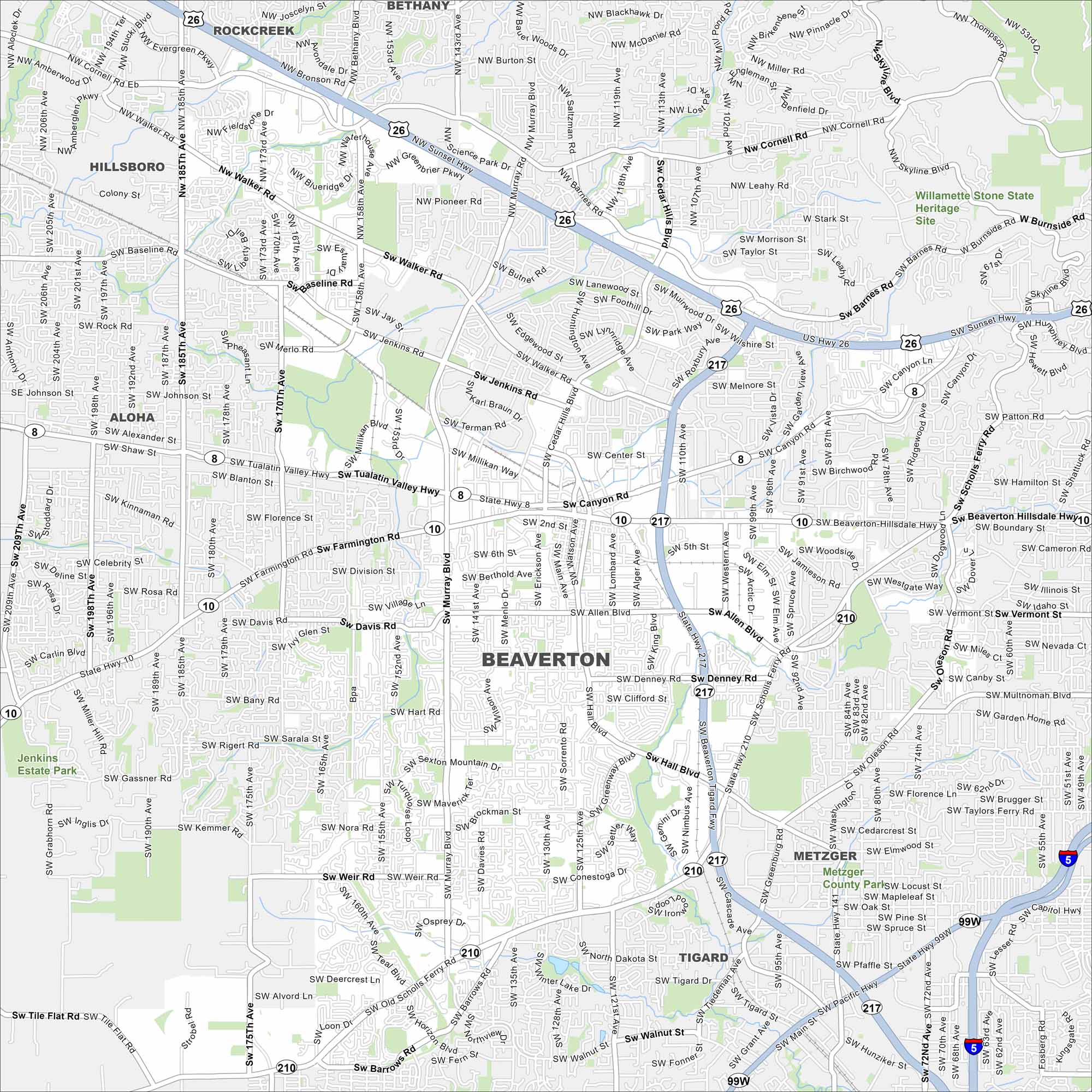
Get oriented with our Beaverton map. Close to Portland, our map shows its network of roads, parks, and railways. The city is known as a hub for tech companies and outdoor access.
Map Information
On the Map
Interstates/Highways: US Hwy 26, State Hwy 217, State Hwy 8, State Hwy 10, State Hwy 210, US Hwy 99W Major Roads: Tualatin Valley Hwy, Beaverton Hillsdale Hwy, Walker Rd, Murray Blvd, Cedar Hills Blvd, Hall Blvd, Scholls Ferry Rd, Farmington Rd, Allen Blvd, Cornell Rd, Jenkins Rd, Baseline Rd, 185th Ave, 170th Ave, 158th Ave, Watson Ave, Lombard Ave, Denney Rd, Oleson Rd, Garden Home Rd Parks and Preserves: Willamette Stone State Heritage Site Nearby Communities: Hillsboro, Aloha, Rockcreek, Bethany, Tigard, MetzgerOregon State Maps
Here is our state map collection of Oregon.


City Maps of Oregon
Get to know Portland and Oregon’s urban areas.


