Map of Baton Rouge, Louisiana
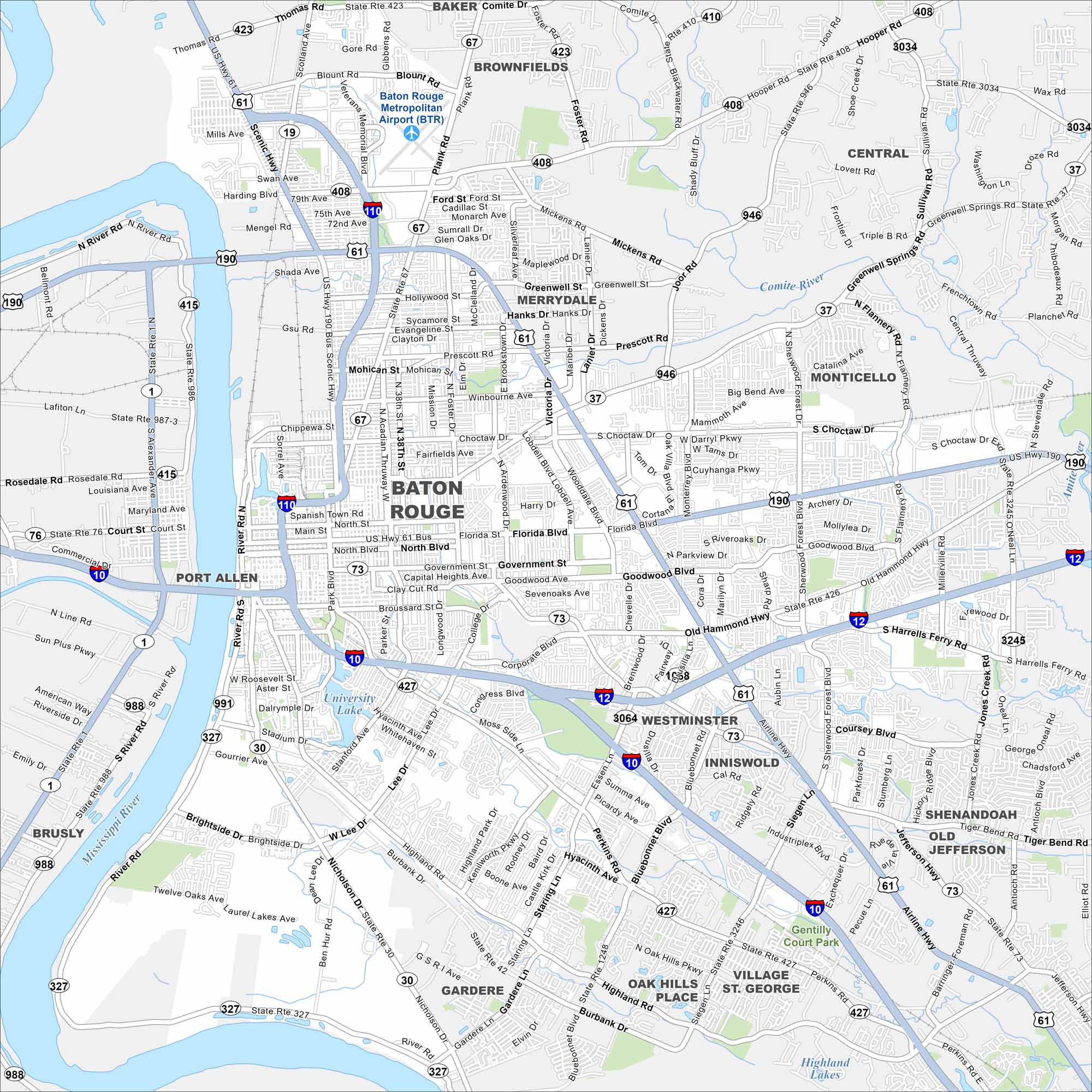
Here’s our map of Baton Rouge, sitting proudly on the Mississippi River. Explore the capital’s downtown and riverfront views. Our map of Baton Rouge shows waterways, downtown core, and spreading suburbs.
Louisiana State Maps
Here are maps showcasing the state of Louisiana


Map Information
On the Map
Interstates/Highways: I-10, I-12, I-110, US Hwy 61, US Hwy 190, State Rte 19, State Rte 30, State Rte 37, State Rte 67, State Rte 73, State Rte 76, State Rte 408, State Rte 410, State Rte 415, State Rte 426, State Rte 427, State Rte 946, State Rte 988 Major Roads: Florida Blvd, Airline Hwy, Government St, Nicholson Dr, Burbank Dr, Perkins Rd, Siegen Ln, Essen Ln, Sherwood Forest Blvd, O’Neal Ln, Coursey Blvd, Bluebonnet Blvd, Joor Rd, Greenwell Springs Rd, Hooper Rd, Sullivan Rd, Mickens Rd, North Blvd, Scenic Hwy, Harding Blvd Airports: Baton Rouge Metropolitan Airport (BTR) Lakes and Reservoirs: University Lake Major Rivers: Mississippi River, Comite River, Amite River Nearby Communities: Baker, Brownfields, Central, Merrydale, Monticello, Port Allen, Brusly, Westminster, Inniswold, Shenandoah, Old Jefferson, Village St. George, Oak Hills Place, GardereCity Maps of Louisiana
Explore New Orleans and Louisiana’s urban centers with our city maps