Map of Bainbridge Island, Washington
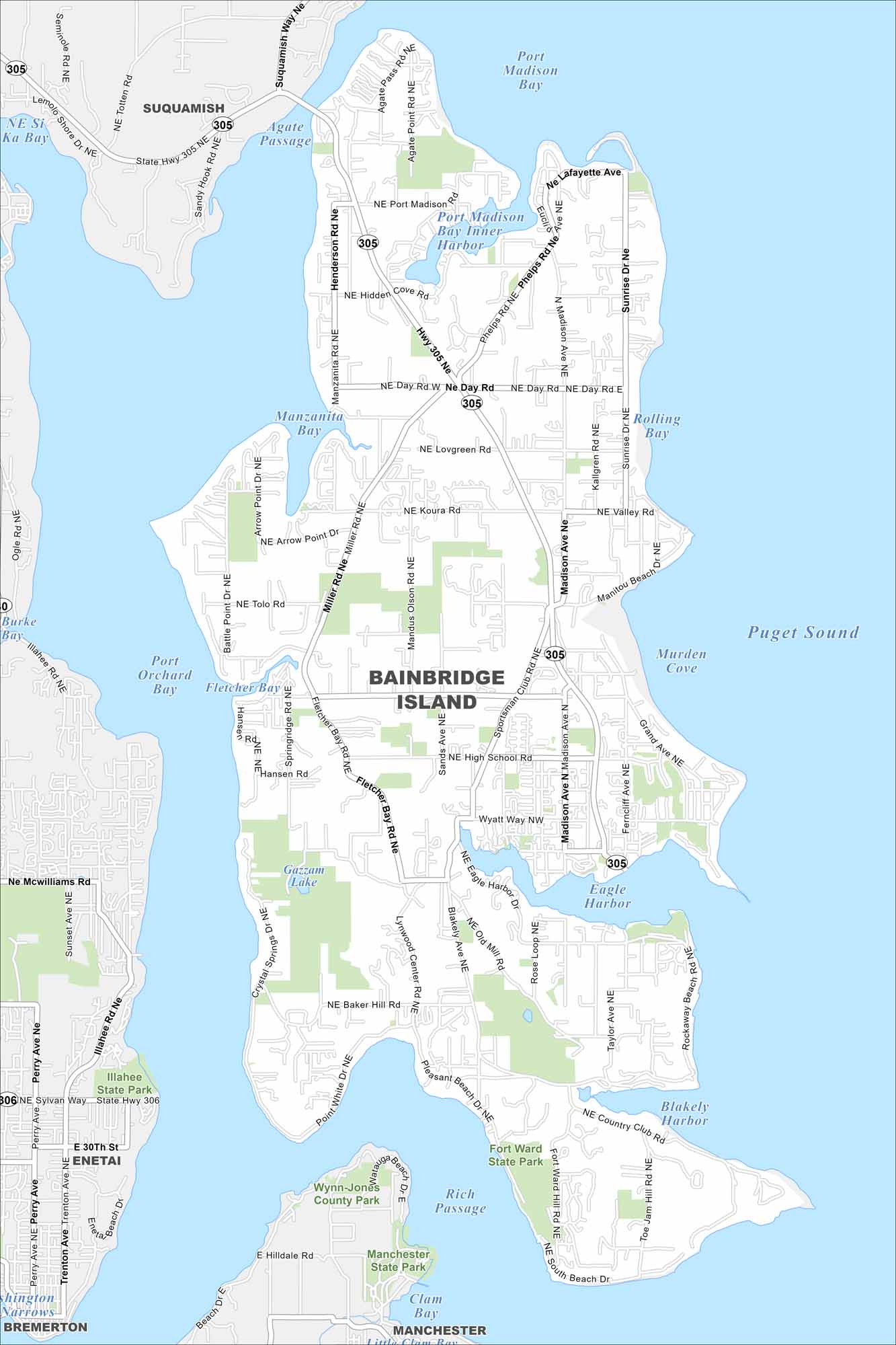
Our map of Bainbridge Island shows its roads, highways, and shoreline curves. Streets travel around bays because the city is surrounded by Puget Sound. Bainbridge is known for its ferry link to Seattle.
Map Information
On the Map
Interstates/Highways: State Rte 305 Major Roads: Miller Rd, Sportsman Club Rd, Madison Ave, High School Rd, Wyatt Way, Eagle Harbor Dr, Baker Hill Rd, Lynwood Center Rd, Pleasant Beach Dr, Point White Dr, Fletcher Bay Rd, New Brooklyn Rd, Day Rd, Koura Rd, Valley Rd, Sunrise Dr, Phelps Rd, Port Madison, Agate Pass Rd, Tolo Rd Lakes and Reservoirs: Puget Sound, Port Orchard Bay, Port Madison Bay, Murden Cove, Eagle Harbor, Blakely Harbor, Rich Passage, Clam Bay, Gazzam Lake Major Rivers: Agate Passage Parks and Preserves: Illahee State Park, Fort Ward State Park, Wynn-Jones County Park, Manchester State Park Nearby Communities: Suquamish, Rolling Bay, Enetai, Illahee, Bremerton, ManchesterWashington State Maps
Move through the Evergreen State with our map collection.


City Maps of Washington
Check out our city maps of Washington


