Map of Avon, Indiana
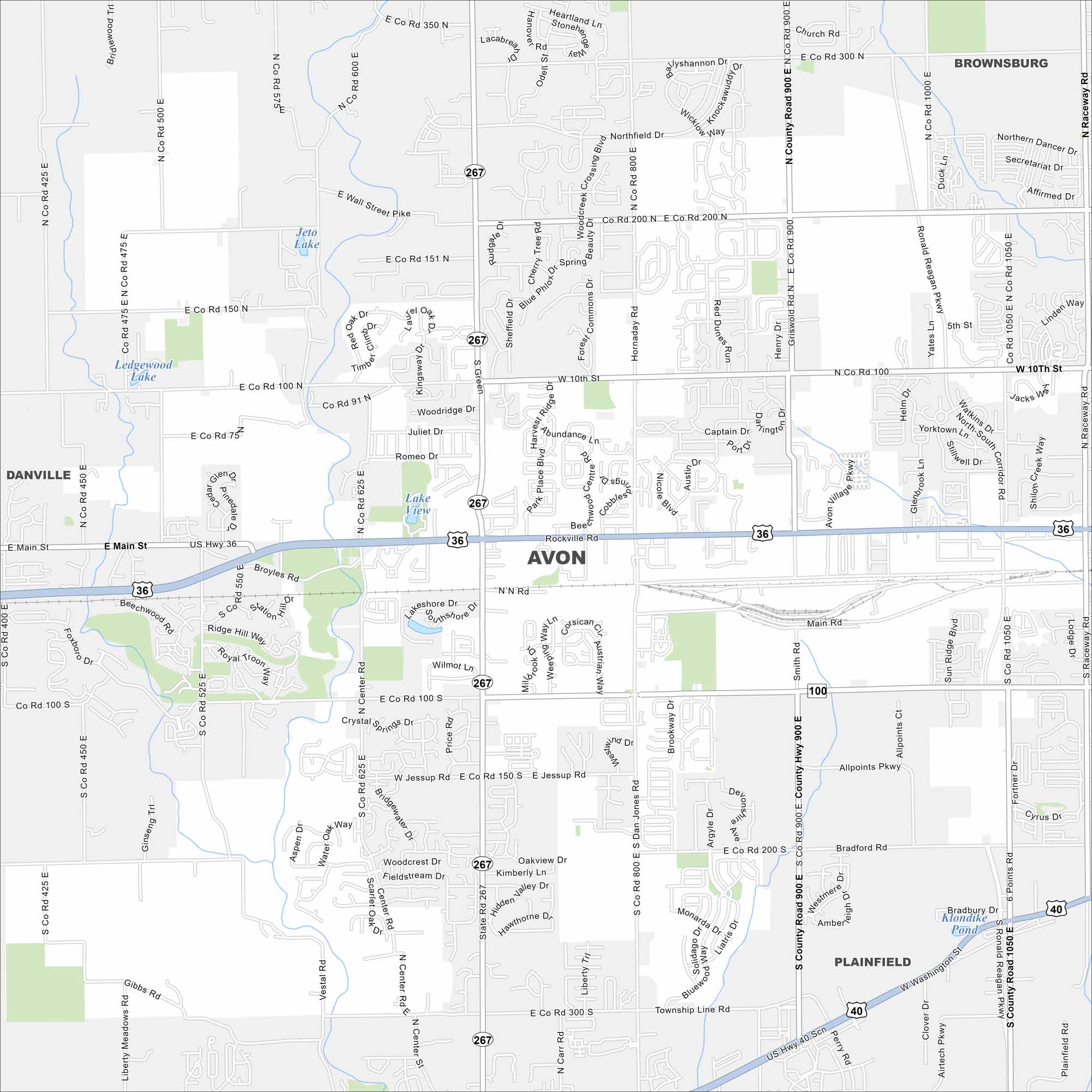
Avon is mapped with its streets, highways, and parkland. This town is known for its strong school system and family-friendly fun. It actually connects to Indianapolis but still feels like its own town.
Indiana State Maps
Study about Indiana with our map collection


Map Information
On the Map
Interstates/Highways: US Hwy 36, US Hwy 40, State Rte 267, State Rte 100 Major Roads: Dan Jones Rd, County Rd 900, Ronald Reagan Pkwy, Main Rd, Rockville Rd, Washington St, 10th St, 200 S, 100 N, 200 N, 300 S, 150 N, 100 S, Raceway Rd, 6 Points Rd, Moon Rd, Avon Village Pkwy, Sun Ridge Blvd, Allpoints Pkwy Lakes and Reservoirs: Jeto Lake, Lake View, Ledgewood Lake, Klondike Pond Nearby Communities: Brownsburg, Plainfield, DanvilleIndiana City Maps
Here are our maps of Indianapolis and Indiana cities


