Map of Auburn, Alabama
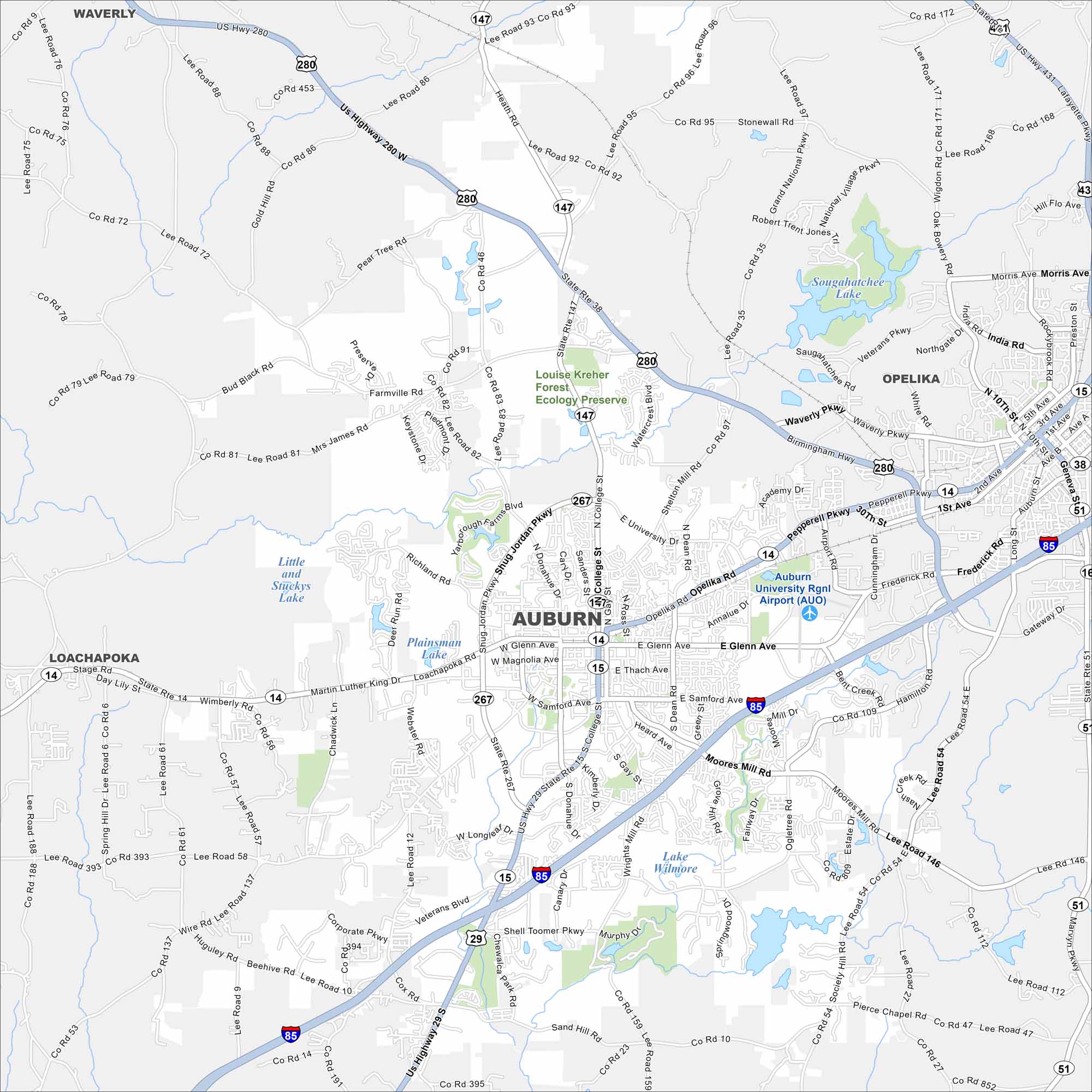
Our map of Auburn displays its highways, streets, and parks. The Auburn University campus is a key location within the city. Auburn is called the “Loveliest Village on the Plains”. But it’s not a village either.


Map Information
On the Map
Interstates/Highways: I-85, US-29, US-280, AL-14, AL-15, AL-147 Major Roads: College Street, Opelika Road, Shug Jordan Parkway, East Glenn Avenue, West Glenn Avenue, Magnolia Avenue, Samford Avenue, Donahue Drive, Gay Street, Dean Road, Wire Road, Moores Mill Road, Shell Toomer Parkway, Waverly Parkway, Veterans Boulevard, Martin Luther King Drive, Richland Road, Cox Road, Ogletree Road, Farmville Road Airports: Auburn University Regional Airport (AUO) Lakes and Reservoirs: Saugahatchee Lake, Lake Wilmore, Plainsman Lake, Little and Stickys Lake Rivers and Creeks: Saugahatchee Creek Parks/Preserves: Louise Kreher Forest Ecology Preserve Nearby Communities: Opelika, Loachapoka, WaverlyAlabama City Maps
Here are our city maps of Alabama


