Map of Anderson, Indiana
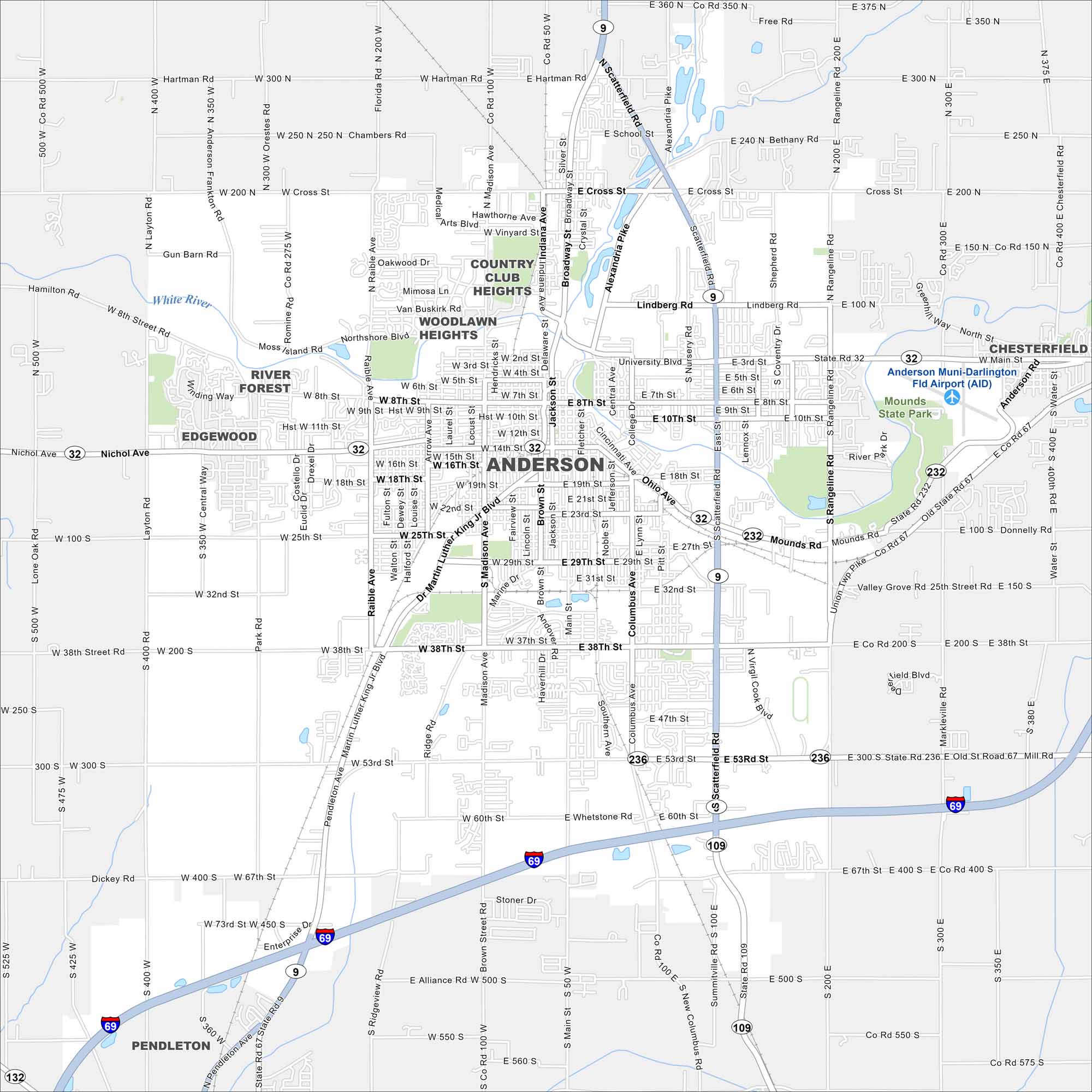
Anderson carries an industrial past but leans into small-city charm today. It’s a crossroads town with roots in the auto industry. It also has easy access to Indianapolis. See it on our map of Anderson.
Indiana State Maps
Study about Indiana with our map collection


Map Information
On the Map
Interstates/Highways: I-69, State Rte 9, State Rte 32, State Rte 232, State Rte 236 Major Roads: Scatterfield Rd, Broadway St, Madison Ave, Main St, Jackson St, Columbus Ave, 38th St, 53rd St, 10th St, 16th St, 25th St, 29th St, 32nd St, 8th St, MLK Jr Blvd, Alexandria Pike, Mounds Rd, Cross St, Hartman Rd, Lindberg Rd Airports: Anderson Muni-Darlington Fld Airport (AID) Major Rivers: White River Parks and Preserves: Mounds State Park, River Forest, Country Club Heights, Woodlawn Heights Nearby Communities: Chesterfield, Edgewood, PendletonIndiana City Maps
Here are our maps of Indianapolis and Indiana cities


