Map of Albany, Oregon
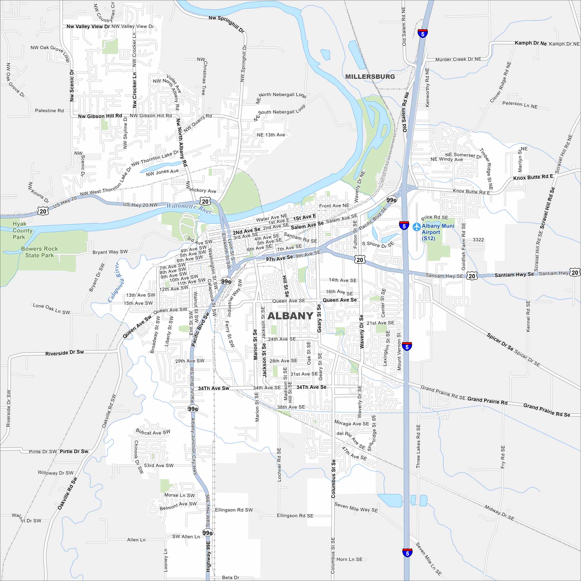
Our map of Albany shows how the city spreads across the Willamette River. Bridges link neighborhoods on both sides of the bank. Known as the “Hub of the Valley”, it has a weird type of small-town aura.
Map Information
On the Map
Interstates/Highways: US Hwy 20, US Hwy 99E Major Roads: Pacific Blvd, Santiam Hwy, Geary St, Queen Ave, Waverly Dr, 34th Ave, 14th Ave, Seven Mile Ln, Columbus St, Hill St, Marion St, Davidson St, Oak St, Grand Prairie Rd, Spicer Rd, Knox Butte Rd, Scravel Hill Rd, Price Rd, Goldfish Farm Rd, Timber Ridge St Airports: Albany Muni Airport (S12) Major Rivers: Willamette River, Calapooia River Parks and Preserves: Hyak County Park, Bowers Rock State Park Nearby Communities: MillersburgOregon State Maps
Here is our state map collection of Oregon.


City Maps of Oregon
Get to know Portland and Oregon’s urban areas.


