Home » State Maps » Alabama National Parks and Forests Map

Alabama National Parks and Forests Map

Alabama National Parks and Forests Map

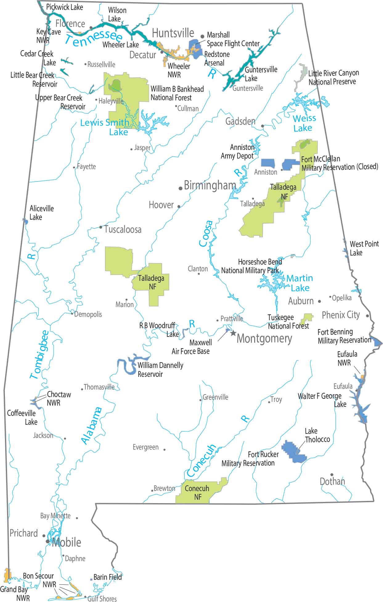
Protected lands in Alabama sit mostly in the north and east. Our map shows forested areas following ridges and river valleys. Talladega National Forest covers a large stretch of higher terrain. Southern Alabama has far fewer federally protected areas.

Map Information

  • National Parks and Forests Map of Alabama
  • Original map provided by National Map. Map updated by our team.
  • Free for personal and commercial purpose. Attribution is required. How to attribute?

Leave a Reply

Your email address will not be published. Required fields are marked *