Map of Aberdeen, Washington
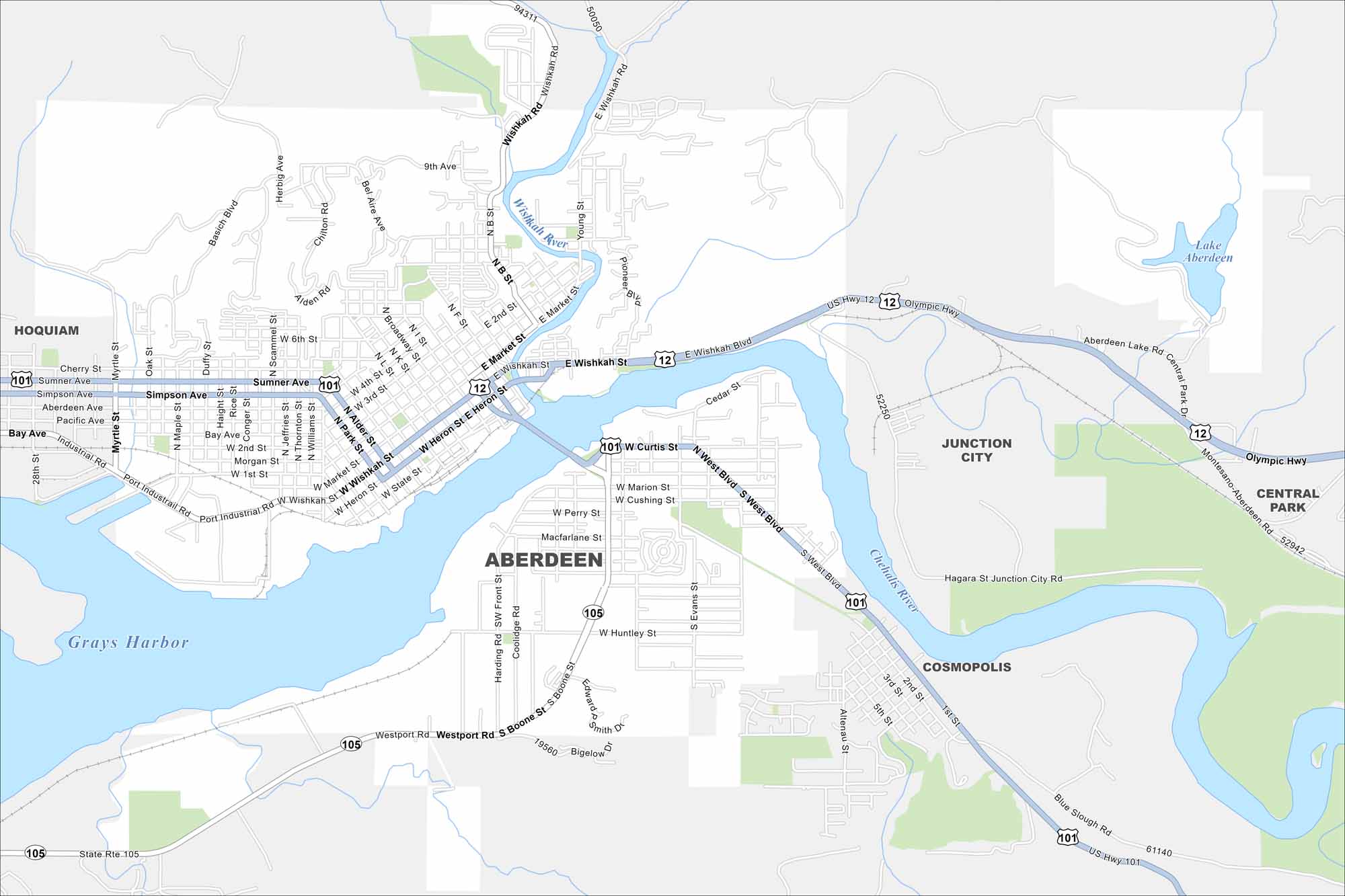
Our map of Aberdeen shows its waterfront location. It’s at the intersection of the Chehalis River and the Pacific Ocean. The city has access to the Olympic Peninsula. But it’s also well-recognized for its timber roots and coastal scenery.
Map Information
On the Map
Interstates/Highways: US Hwy 12, US Hwy 101, State Rte 105 Major Roads: Wishkah Rd, Market St, Wishkah St, Heron St, State St, Curtis St, Sumner Ave, Simpson Ave, Boone St, Westport Rd, Central Park Dr, Blue Slough Rd, Industrial Rd, Port Industrial Rd, 9th Ave, Broadway St, Alder St, Park St, Evans St, Marion St Lakes and Reservoirs: Grays Harbor, Lake Aberdeen Major Rivers: Wishkah River, Chehalis River Nearby Communities: Hoquiam, Junction City, Cosmopolis, Central ParkWashington State Maps
Move through the Evergreen State with our map collection.


City Maps of Washington
Check out our city maps of Washington


