Map of Auburn, Washington
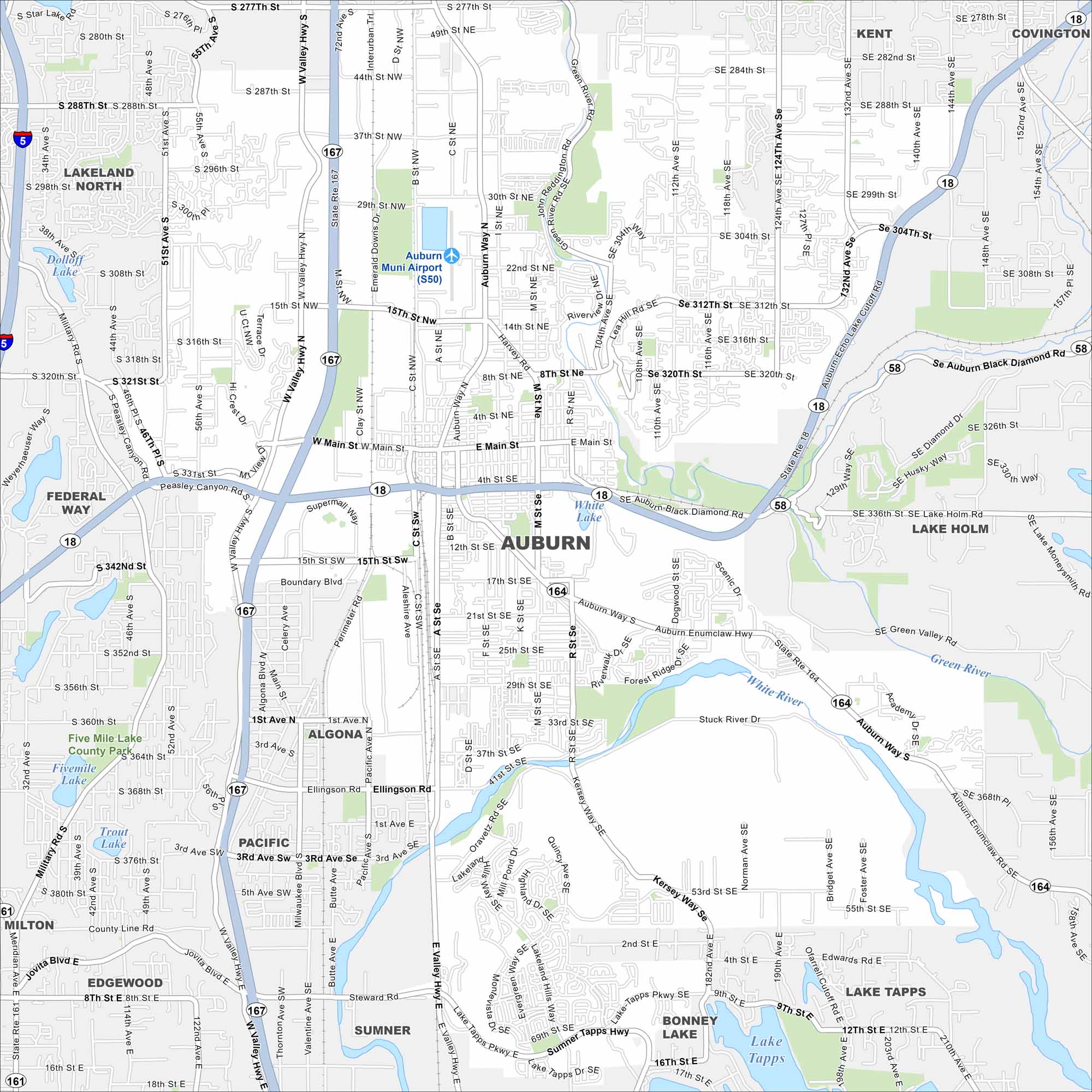
See the highways, streets, and river paths marked here. Our map of Auburn shows roads that run between Seattle and Tacoma. The city is known for its views of Mount Rainier.
Map Information
On the Map
Interstates/Highways: State Rte 167, State Rte 18, State Rte 164, State Rte 161 Major Roads: Auburn Way, Main St, 15th St, Ellingson Rd, 8th St, 37th St, 12th St, 15th St, 41st St, Peasley Canyon Rd, Boundary Blvd, Lakeland Hills Way, Lake Tapps Pkwy, Sumner Tapps Hwy, Green Valley Rd, Academy Dr, 277th St, 288th St, 312th St, 320th St Airports: Auburn Muni Airport (S50) Lakes and Reservoirs: Lake Tapps, White Lake, Lake Holm, Trout Lake, Fivemile Lake, Dolloff Lake Major Rivers: Green River, White River Parks and Preserves: Five Mile Lake County Park Nearby Communities: Kent, Covington, Lakeland North, Lakeland South, Federal Way, Algona, Pacific, Milton, Edgewood, Sumner, Bonney Lake, Lake HolmWashington State Maps
Move through the Evergreen State with our map collection.


City Maps of Washington
Check out our city maps of Washington


