Map of Bellevue, Washington
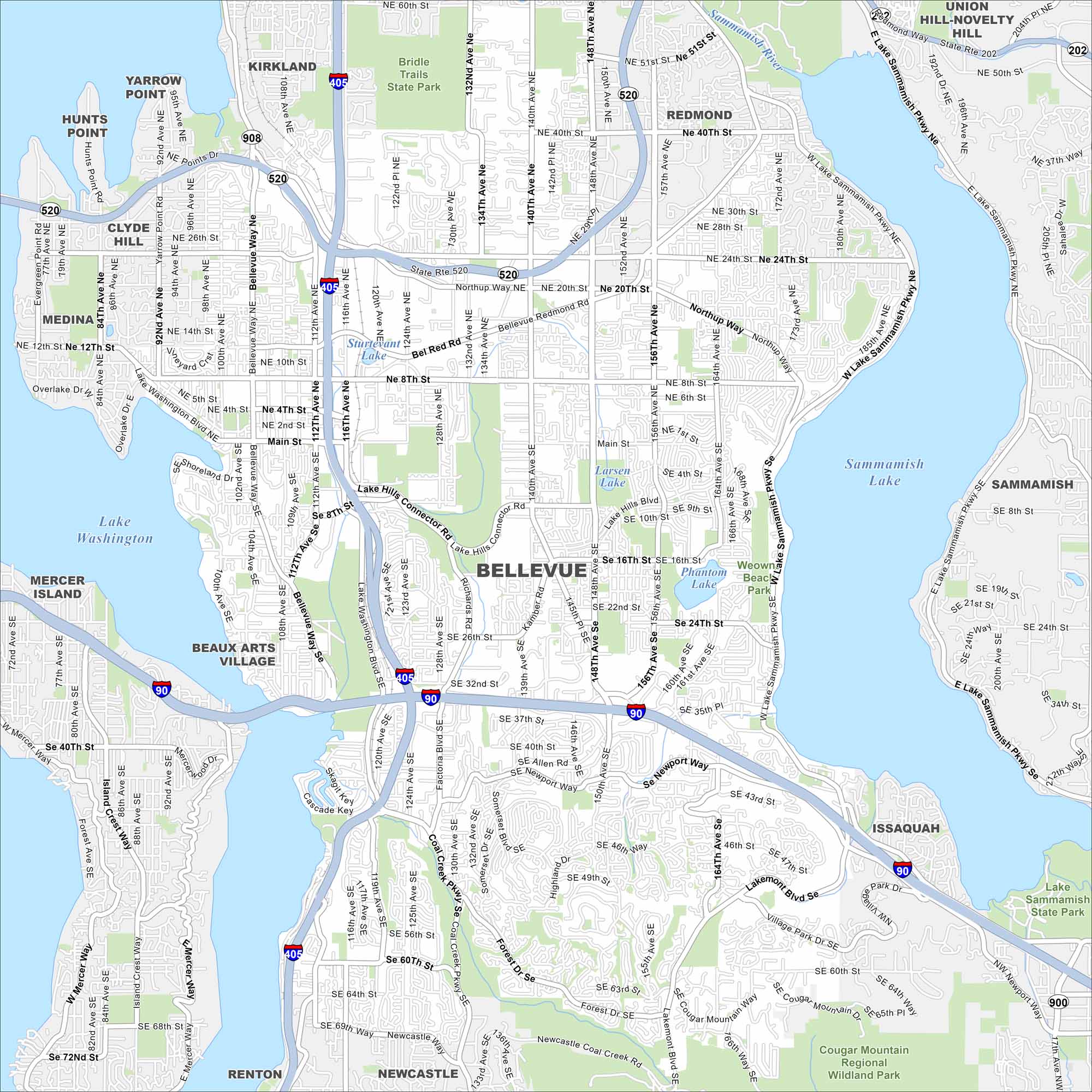
Our map of Bellevue shows highways, lakeshores, and urban streets. It sits east of Seattle, between Lake Washington and Lake Sammamish. The city is a major tech hub.
Map Information
On the Map
Interstates/Highways: I-405, I-90, State Rte 520, State Rte 908, State Rte 900 Major Roads: Bellevue Way, 148th Ave, 156th Ave, 112th Ave, 124th Ave, 140th Ave, Richards Rd, Coal Creek Pkwy, Factoria Blvd, Lakemont Blvd, Main St, 8th St, 24th St, Northup Way, Bel Red Rd, Lake Hills Connector Rd, Newport Way, 10th St, Village Park Dr, Forest Dr Lakes and Reservoirs: Lake Washington, Lake Sammamish, Larsen Lake, Phantom Lake, Sturtevant Lake Major Rivers: Sammamish River Parks and Preserves: Bridle Trails State Park, Cougar Mountain Regional Wildland Park, Lake Sammamish State Park, Weowna Beach Park Nearby Communities: Kirkland, Yarrow Point, Hunts Point, Clyde Hill, Medina, Mercer Island, Beaux Arts Village, Newcastle, Renton, Issaquah, Sammamish, RedmondWashington State Maps
Move through the Evergreen State with our map collection.


City Maps of Washington
Check out our city maps of Washington


