Map of Birmingham, Alabama
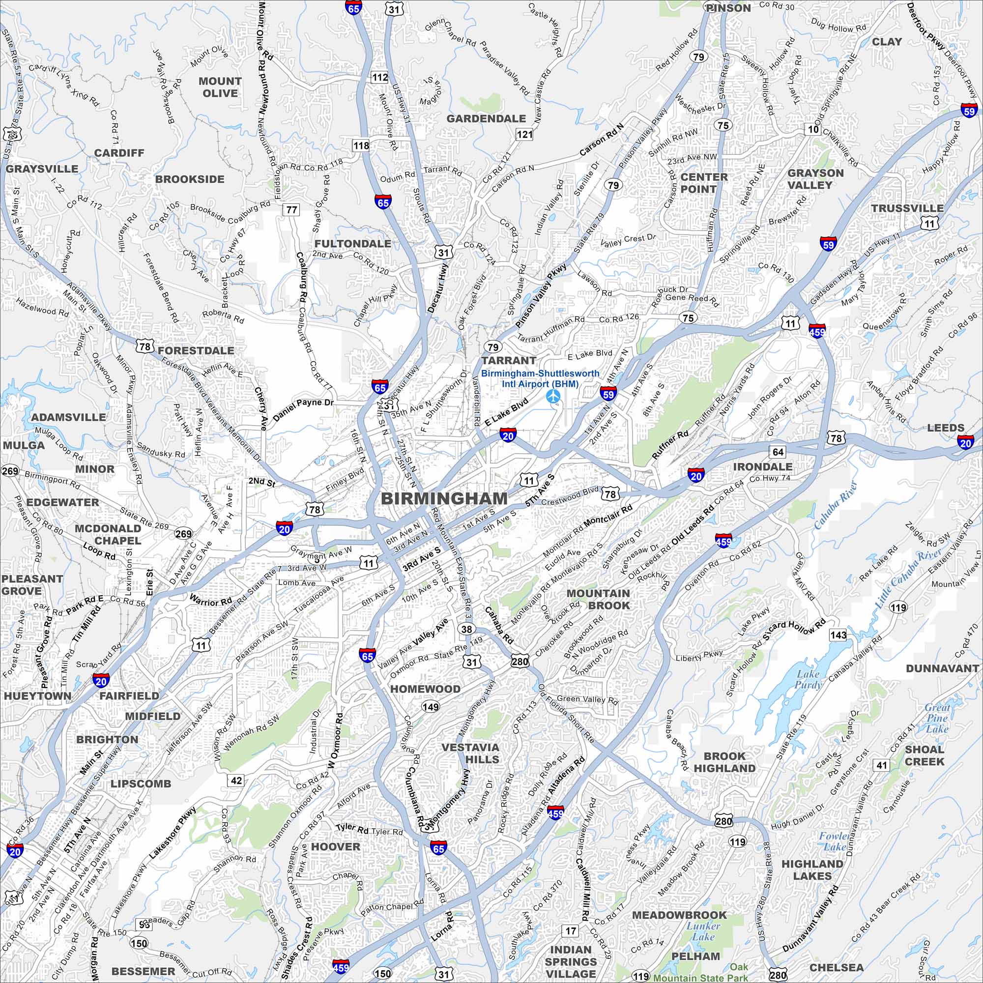
Our map of Birmingham shows you around its downtown core and historic districts. Birmingham is in north-central Alabama and is known as the “Magic City”.


Map Information
On the Map
Interstates/Highways: I-20, I-59, I-65, I-459, US-11, US-31, US-78, US-280, AL-79, AL-150 Major Roads: 3rd Avenue North, 1st Avenue North, 1st Avenue South, 5th Avenue North, 6th Avenue North, 7th Avenue North, University Boulevard, Crestwood Boulevard, Montclair Road, Greensprings Highway, Valley Avenue, Oxmoor Road, Lakeshore Parkway, Shannon Oxmoor Road, Columbiana Road, Tyler Road, John Hawkins Parkway, Cahaba Valley Road, Lakeshore Drive, Liberty Parkway Airports: Birmingham-Shuttlesworth International Airport (BHM) Lakes and Reservoirs: Lake Purdy, Lunker Lake, Great Pine Lake, Fowler Lake Rivers and Creeks: Cahaba River Nearby Communities: Homewood, Hoover, Vestavia Hills, Mountain Brook, Irondale, Tarrant, Fultondale, Gardendale, Fairfield, Midfield, Bessemer, Trussville, Leeds, Pelham, Chelsea, Center Point, Pinson, Clay, Grayson Valley, Brook Highland, Indian Springs, Hueytown, Pleasant Grove, Lipscomb, Brighton, Adamsville, Brookside, Cardiff, GraysvilleAlabama City Maps
Here are our city maps of Alabama


