Map of Bossier City, Louisiana
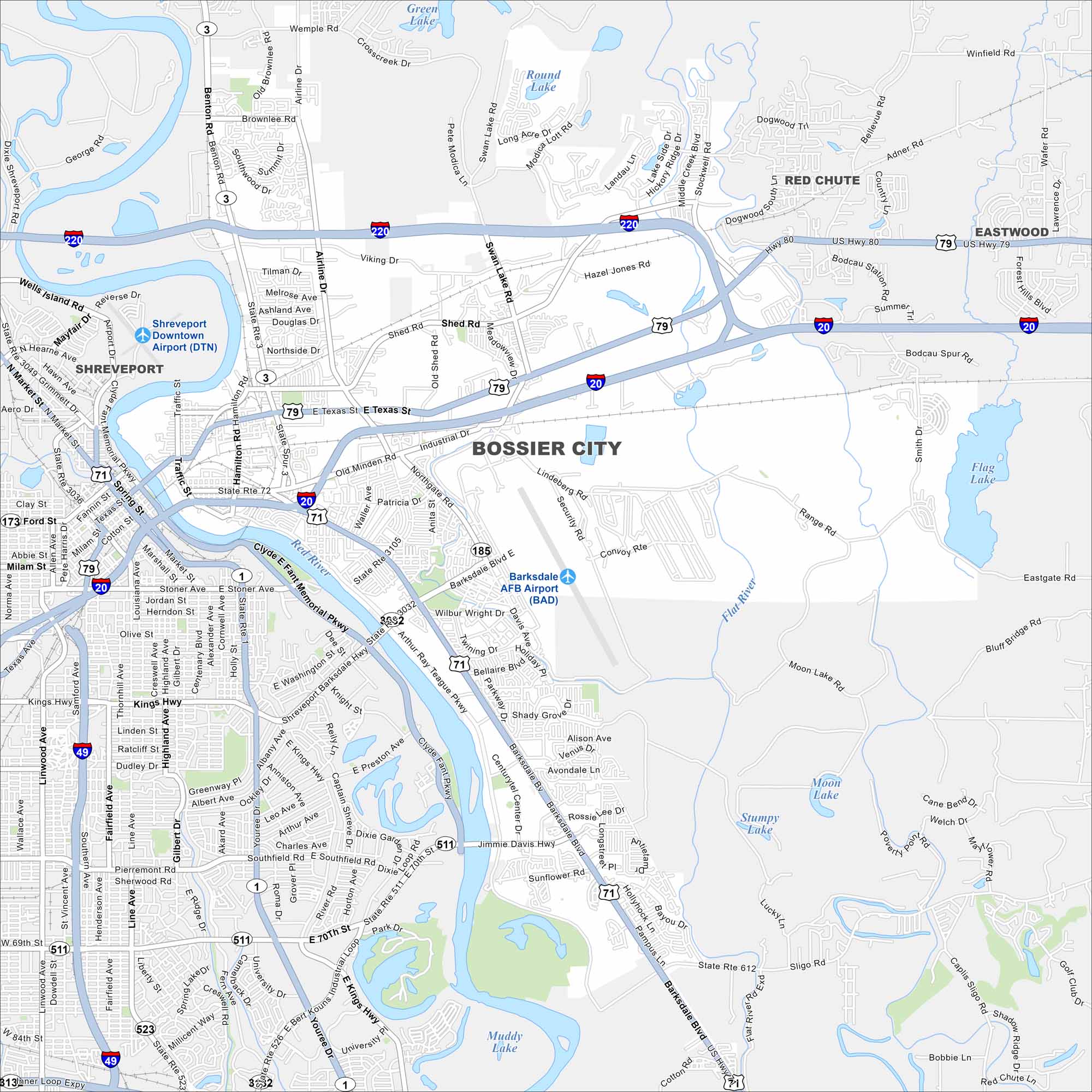
Our map of Bossier City highlights its location along the Red River. Casinos and retail line the waterfront, but neighborhoods stretch inland. The city is tied closely to Shreveport.
Louisiana State Maps
Here are maps showcasing the state of Louisiana


Map Information
On the Map
Interstates/Highways: I-20, I-49, I-220, US Hwy 71, US Hwy 79, US Hwy 80, State Rte 3, State Rte 511, State Rte 523, State Rte 526, State Rte 612 Major Roads: Airline Dr, Barksdale Blvd, Benton Rd, Jimmie Davis Hwy, E 70th St, E Kings Hwy, Shed Rd, Texas St, Industrial Dr, Old Minden Rd, Swan Lake Rd, Viking Dr, Youree Dr, Bert Kouns Industrial Loop, Arthur Ray Teague Pkwy, Clyde Fant Memorial Pkwy, Market St, Spring St, Hearne Ave, Northside Dr Airports: Barksdale AFB Airport (BAD), Shreveport Downtown Airport (DTN) Lakes and Reservoirs: Green Lake, Round Lake, Flag Lake, Moon Lake, Stumpy Lake, Muddy Lake Major Rivers: Red River, Flat River Nearby Communities: Shreveport, Red Chute, EastwoodCity Maps of Louisiana
Explore New Orleans and Louisiana’s urban centers with our city maps