Map of Brownsburg, Indiana
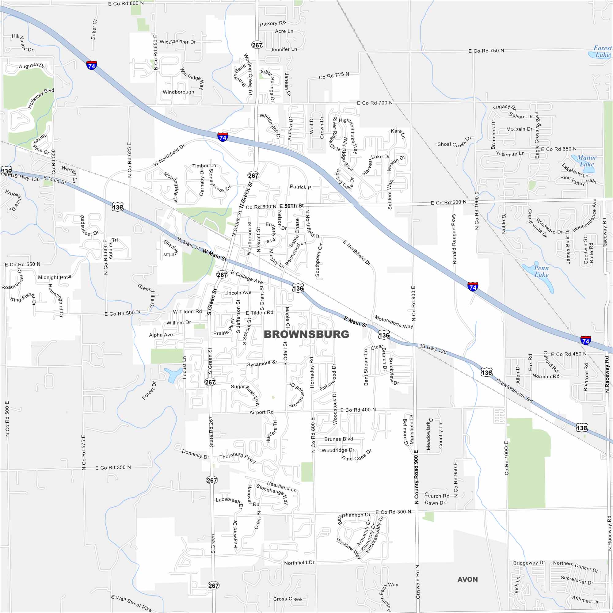
Explore our map of Brownsburg, just west of Indianapolis. Suburban streets meet farmland at the edges. It also has easy access to the metro.
Indiana State Maps
Study about Indiana with our map collection


Map Information
On the Map
Interstates/Highways: I-74, US Hwy 136, State Rte 267 Major Roads: Ronald Reagan Pkwy, Main St, Northfield Dr, 56th St, 300 N, 400 N, 700 N, 750 N, 800 N, 900 E, 1000 E, Raceway Rd, Green St, Tilden Rd, College Ave, Airport Rd, Hornaday Rd, Odell St, Sycamore St, Crawfordsville Rd Lakes and Reservoirs: Penn Lake, Manor Lake, Forest Lake, Lake Red Rock Nearby Communities: AvonIndiana City Maps
Here are our maps of Indianapolis and Indiana cities


