Map of Burien, Washington
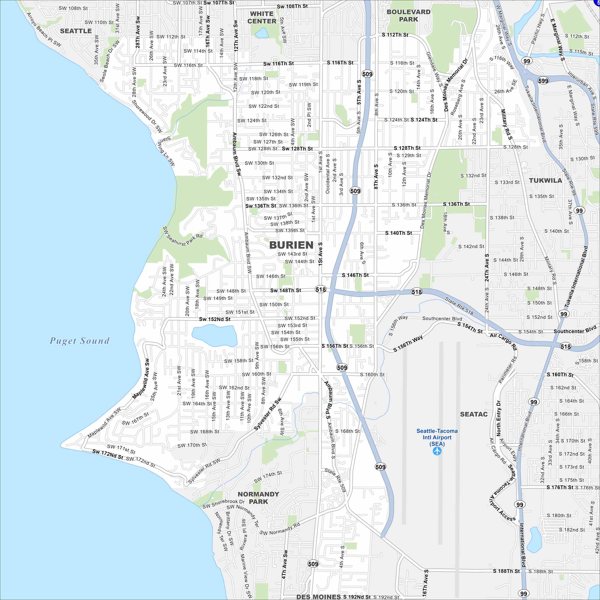
See Burien on our road map, sitting between Seattle and Puget Sound. Parks, lakes, and shoreline stand out in this area. Its location is convenient but still quieter than nearby Seattle.
Map Information
On the Map
Interstates/Highways: State Rte 509, State Rte 518, State Rte 99, State Rte 599 Major Roads: Ambaum Blvd, Des Moines Memorial Dr, Military Rd, 1st Ave, 4th Ave, 8th Ave, 12th Ave, 16th Ave, 24th Ave, 26th Ave, 116th St, 128th St, 136th St, 146th St, 156th St, 160th St, 176th St, 188th St, Southcenter Blvd, International Blvd Airports: Seattle-Tacoma Intl Airport Lakes and Reservoirs: Puget Sound Nearby Communities: Seattle, White Center, Boulevard Park, Tukwila, SeaTac, Des MoinesWashington State Maps
Move through the Evergreen State with our map collection.


City Maps of Washington
Check out our city maps of Washington


