Map of Carmel, Indiana
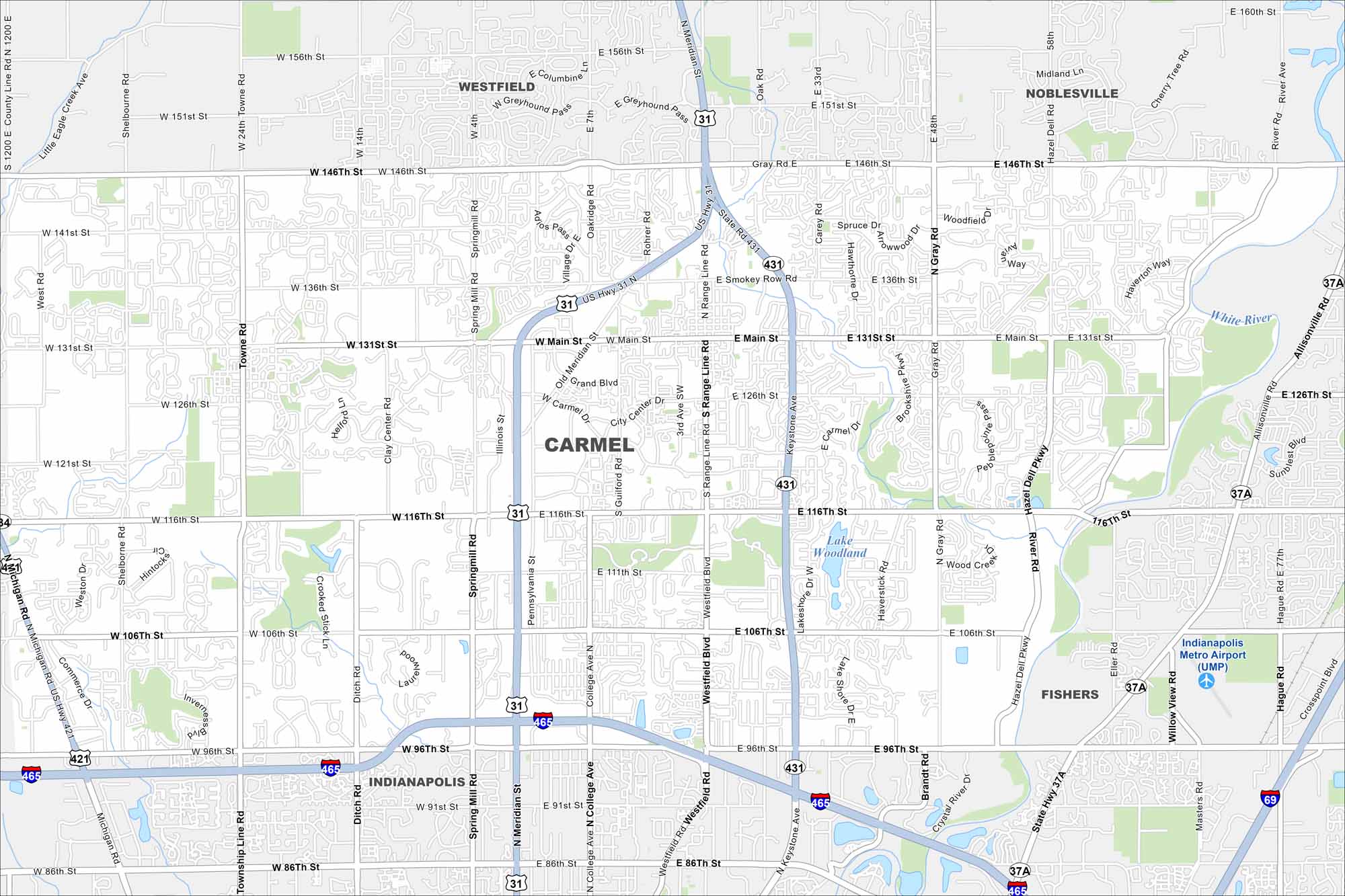
Discover Carmel with our map with its trails and parks. The city is just north of Indianapolis but feels more planned and modern. Roundabouts are a signature feature here. Green spaces give it a relaxed feel.
Indiana State Maps
Study about Indiana with our map collection


Map Information
On the Map
Interstates/Highways: I-465, US Hwy 31, State Rte 431, State Rte 37A Major Roads: Range Line Rd, Main St, 116th St, 106th St, 96th St, Keystone Ave, Meridian St, 146th St, 131st St, 126th St, Gray Rd, Shelborne Rd, Towne Rd, Spring Mill Rd, Illinois St, College Ave, Guilford Rd, Hazel Dell Pkwy, Allisonville Rd, Michigan Rd Airports: Indianapolis Metro Airport (UMP) Lakes and Reservoirs: Lake Woodland Major Rivers: White River Nearby Communities: Indianapolis, Fishers, Westfield, NoblesvilleIndiana City Maps
Here are our maps of Indianapolis and Indiana cities


