Map of Coos Bay, Oregon
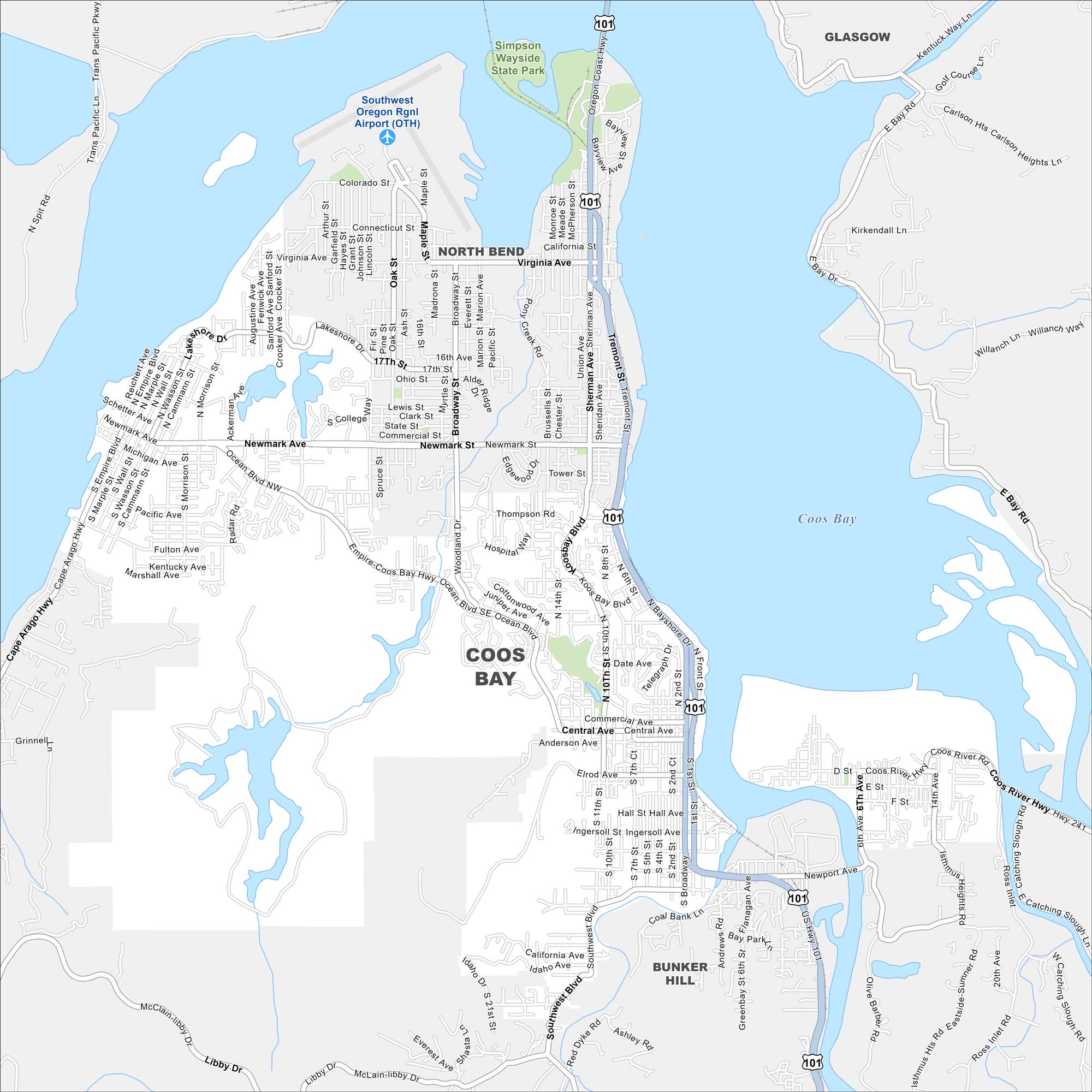
See our Coos Bay map with its streets, highways, and harborfront. This coastal city is Oregon’s largest along the Pacific. It’s heavily been shaped by fishing and shipping.
Map Information
On the Map
Interstates/Highways: US Hwy 101 Major Roads: Newmark Ave, Broadway, Bayshore Dr, Ocean Blvd, Virginia Ave, Cape Arago Hwy, Sherman Ave, Coos River Hwy, 7th St, 10th St, 4th St, Central Ave, Commercial Ave, Empire Coos Bay Hwy, Thompson Rd, Michigan Ave, Noble Ave, Wisconsin Ave, Colorado Ave, Koos Bay Blvd Airports: Southwest Oregon Rgnl Airport (OTH) Lakes and Reservoirs: Coos Bay Parks and Preserves: Simpson Wayside State Park Nearby Communities: North Bend, Bunker Hill, GlasgowOregon State Maps
Here is our state map collection of Oregon.


City Maps of Oregon
Get to know Portland and Oregon’s urban areas.


