Map of West Linn, Oregon
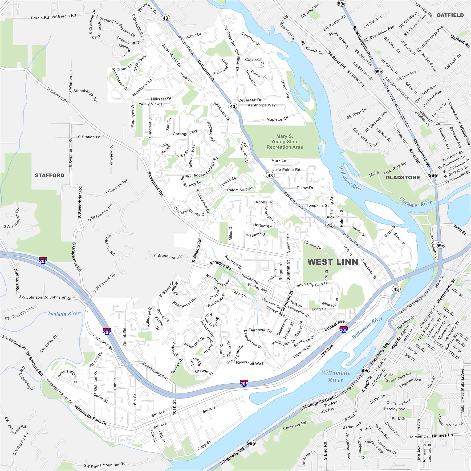
Check out West Linn on this road map. The Willamette River and forested hills frame this scenic suburban city. I-205 also wraps around it for easy access.
Map Information
On the Map
Interstates/Highways: I-205, State Rte 43, State Rte 99E Major Roads: Pacific Hwy, Willamette Falls Dr, Salamo Rd, Santa Anita Dr, Rosemont Rd, Hidden Springs Rd, Cedaroak Dr, Marylhurst Dr, Skyland Dr, Borland Rd, Stafford Rd, Johnson Rd, Skyline Dr, Blankenship Rd, 10th St, 8th Ave, Volpp St, Willamette Dr, Mcloughlin Blvd Major Rivers: Willamette River, Tualatin River, Clackamas River Parks and Preserves: Mary S. Young State Recreation Area Nearby Communities: Stafford, Oatfield, GladstoneOregon State Maps
Here is our state map collection of Oregon.


City Maps of Oregon
Get to know Portland and Oregon’s urban areas.


