Map of Enterprise, Alabama
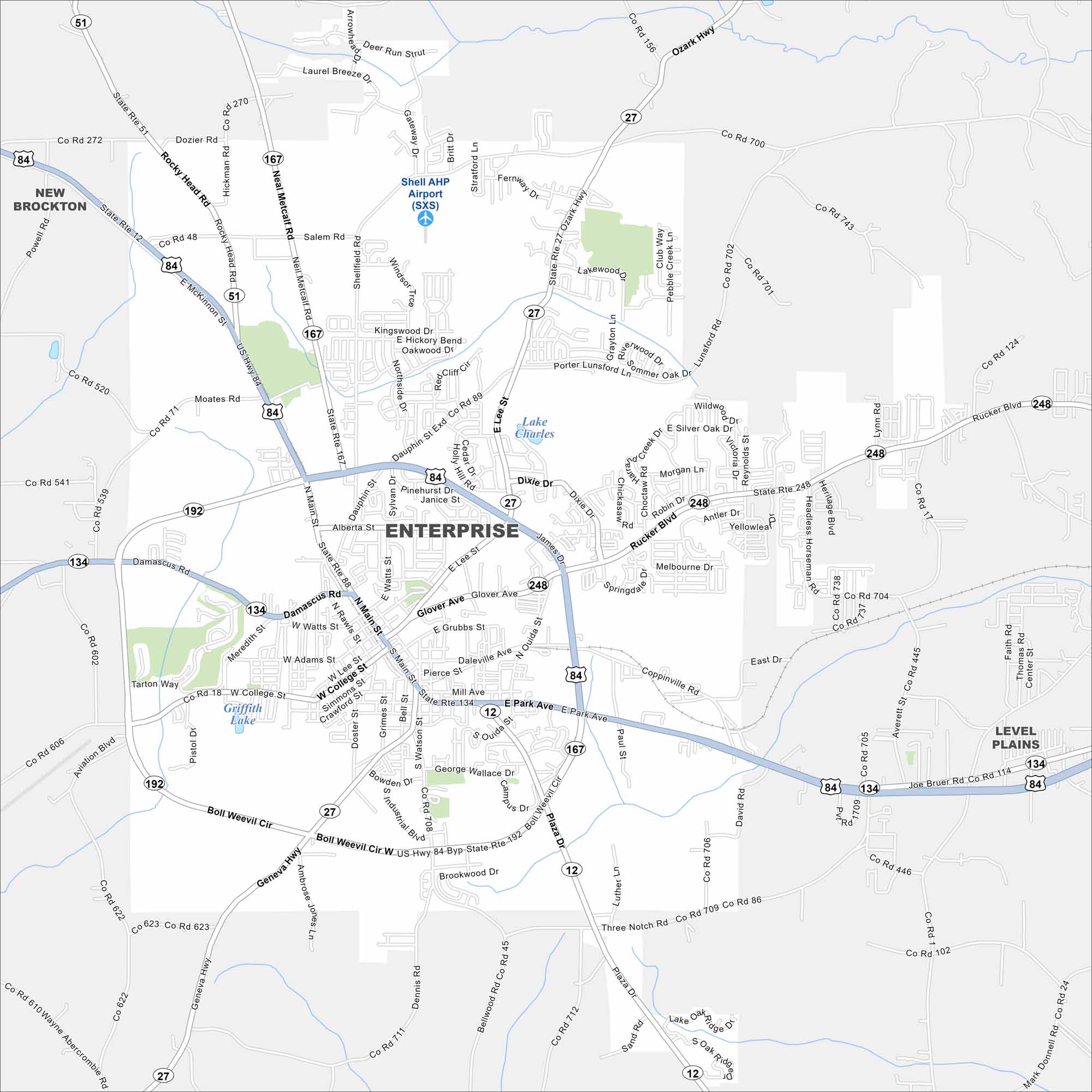
Enterprise sits in the southeastern corner of Alabama. Highways 84 and 167 cross in the heart of the city. Farmland dominates the exterior with several small lakes adding to the area.


Map Information
On the Map
Interstates/Highways: US Hwy 84, US Hwy 84-Byp, State Rte 27, State Rte 167, State Rte 192 (Boll Weevil Cir), State Rte 134, State Rte 12, State Rte 51, State Rte 248 Major Roads: Boll Weevil Cir, Main St, Glover Ave, Rucker Blvd, Damascus Rd, Geneva Hwy, Salem Rd, Ozark Hwy, Shellfield Rd, Dixie Dr, E Park Ave, Coppinville Rd, W College St, Alberta St, Neil Metcalf Rd, Porter Lunsford Rd, Dozier Rd, Rocky Head Rd, Watts St, Bellwood Rd Airports: Shell AHP Airport (SXS) Lakes and Reservoirs: Lake Charles, Griffith Lake Nearby Communities: New Brockton, Level PlainsAlabama City Maps
Here are our city maps of Alabama


