Map of Evansville, Indiana
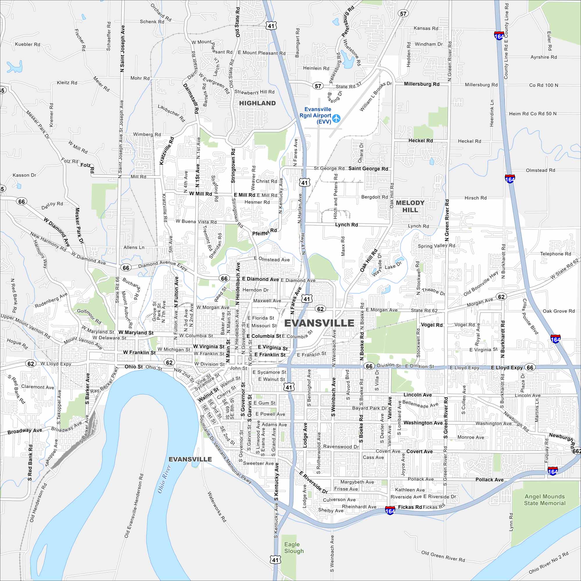
Our map of Evansville shows it curving along a bend in the Ohio River. Streets follow the river’s shape through downtown. It’s also a major commercial and cultural hub for the tri-state region.
Indiana State Maps
Study about Indiana with our map collection


Map Information
On the Map
Interstates/Highways: I-164, US Hwy 41, State Rte 57, State Rte 62, State Rte 66, Lloyd Expy Major Roads: Diamond Ave, Morgan Ave, Lynch Rd, St George Rd, Mill Rd, Mt Pleasant Rd, Green River Rd, Burkhardt Rd, Boeke Rd, Weinbach Ave, Kentucky Ave, Fulton Ave, First Ave, Heidelbach Ave, Fares Ave, Riverside Dr, Broadway Ave, Franklin St, Division St Airports: Evansville Rgnl Airport (EVV) Lakes and Reservoirs: Eagle Slough Major Rivers: Ohio River Parks and Preserves: Angel Mounds State Memorial Nearby Communities: Highland, Melody Hill, DarmstadtIndiana City Maps
Here are our maps of Indianapolis and Indiana cities


