Map of Westfield, Indiana
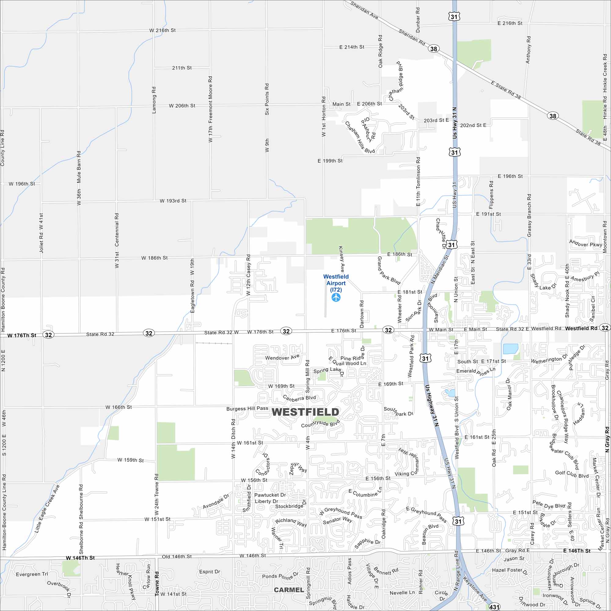
Want to explore Westfield, Indiana? Known for its Grand Park sports complex, it’s one of the fastest-growing cities in Indiana. It is a northern suburb of Indianapolis.
Indiana State Maps
Study about Indiana with our map collection


Map Information
On the Map
Interstates/Highways: US Hwy 31, State Rte 32, State Rte 38, State Rte 431 Major Roads: Main St, 146th St, 161st St, 169th St, 151st St, 156th St, 176th St, 186th St, 191st St, 196th St, 206th St, 216th St, Union St, Greyhound Pass, Towne Rd, Shelborne Rd, Oak Ridge Rd, Ditch Rd, Gray Rd, Carey Rd Airports: Westfield Airport (I72) Nearby Communities: CarmelIndiana City Maps
Here are our maps of Indianapolis and Indiana cities


