Map of Federal Way, Washington
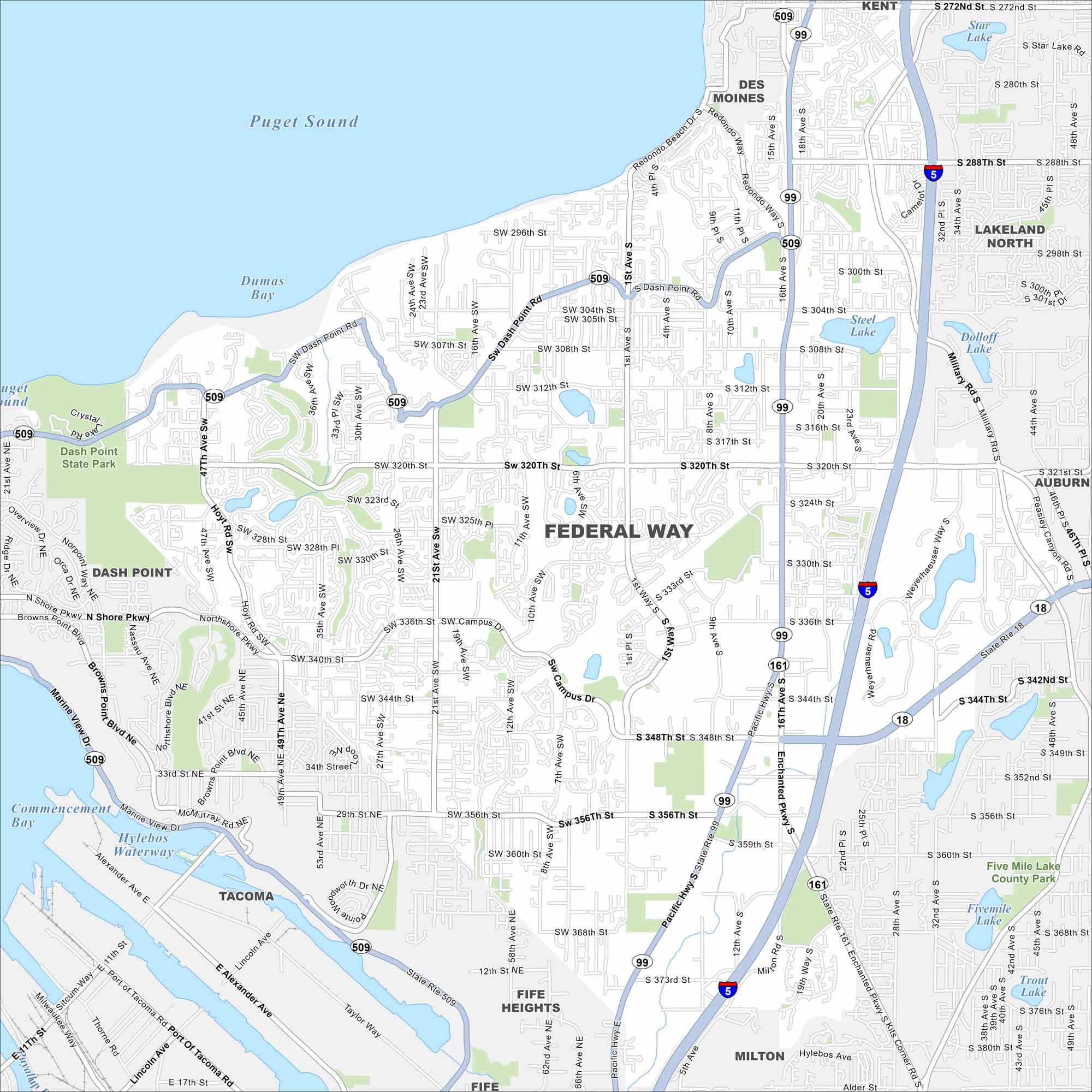
Federal Way lies between Seattle and Tacoma, with Puget Sound to the west. Evergreen forests surround much of the city. On the map, its stretch along I-5 stands out.
Map Information
On the Map
Interstates/Highways: I-5, State Rte 99, State Rte 18, State Rte 161, State Rte 509, State Rte 516 Major Roads: Pacific Hwy, Enchanted Pkwy, Dash Point Rd, Peasley Canyon Rd, Weyerhaeuser Way, Military Rd, Campus Dr, SW 320th St, S 320th St, S 348th St, SW 356th St, S 356th St, SW 312th St, SW 336th St, SW 344th St, S 288th St, SW 296th St, S 312th St, S 336th St, SW 307th St Lakes and Reservoirs: Puget Sound, Dumas Bay, Commencement Bay, Steel Lake, Dolloff Lake, Fivemile Lake, Trout Lake, Meridian Lake, Star Lake, Hylebos Waterway Parks and Preserves: Dash Point State Park, Five Mile Lake County Park Nearby Communities: Des Moines, Lakeland North, Auburn, Kent, Dash Point, Tacoma, Fife Heights, Milton, FifeWashington State Maps
Move through the Evergreen State with our map collection.


City Maps of Washington
Check out our city maps of Washington


