Map of Forest Grove, Oregon
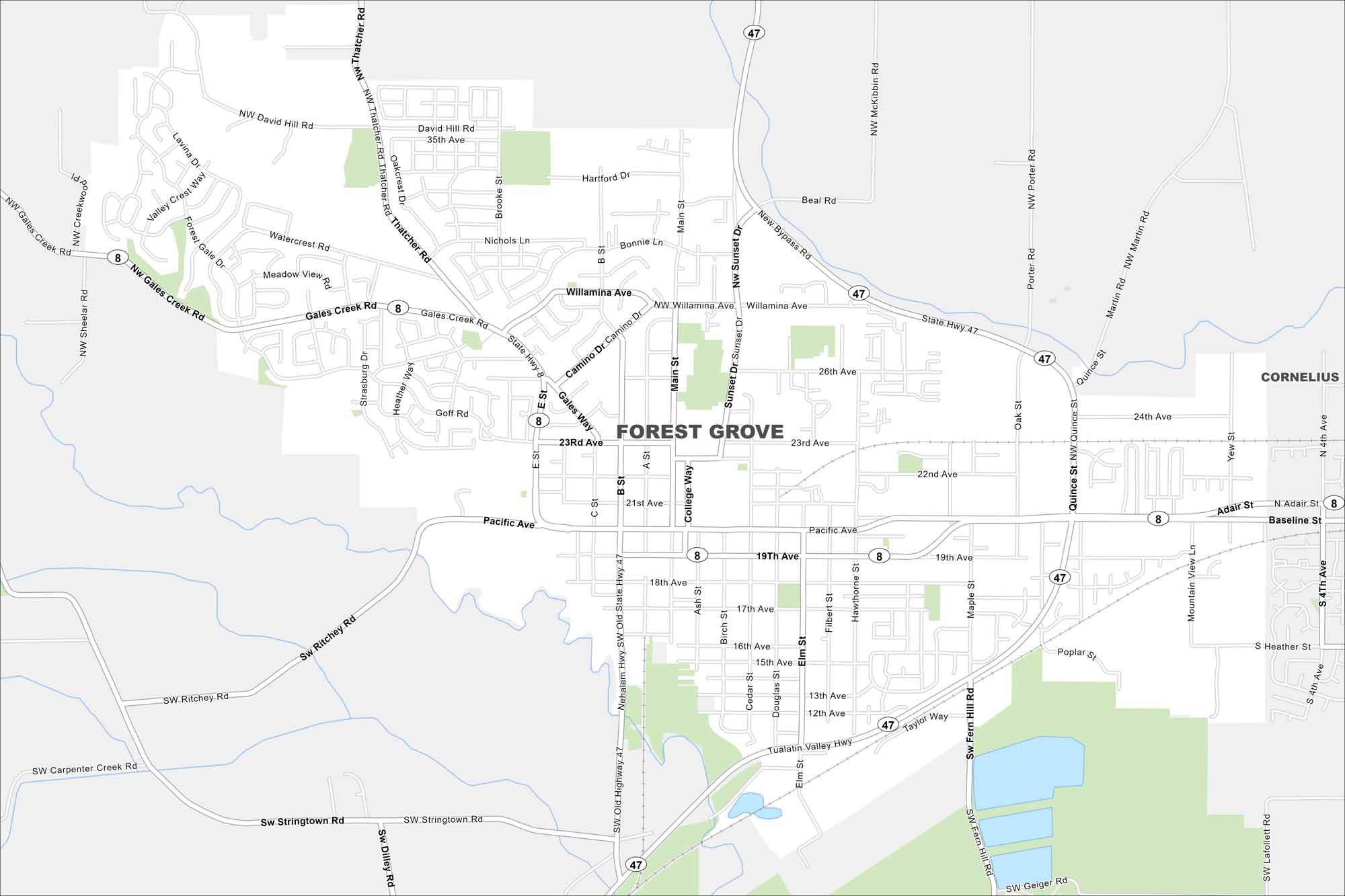
Explore our map of Forest Grove west of Portland. Vineyards and farmland surround the city on all sides. The backdrop of the Coast Range makes the whole area feel tucked in.
Map Information
On the Map
Interstates/Highways: State Hwy 8, State Hwy 47 Major Roads: Pacific Ave, 19th Ave, Main St, 23rd Ave, 22nd Ave, 24th Ave, Gales Creek Rd, Thatcher Rd, David Hill Rd, Sunset Dr, College Way, Elm St, B St, C St, 17th Ave, 15th Ave, Stringtown Rd, Ritchey Rd, Fern Hill Rd, Taylor Way Nearby Communities: CorneliusOregon State Maps
Here is our state map collection of Oregon.


City Maps of Oregon
Get to know Portland and Oregon’s urban areas.


