Map of Gresham, Oregon
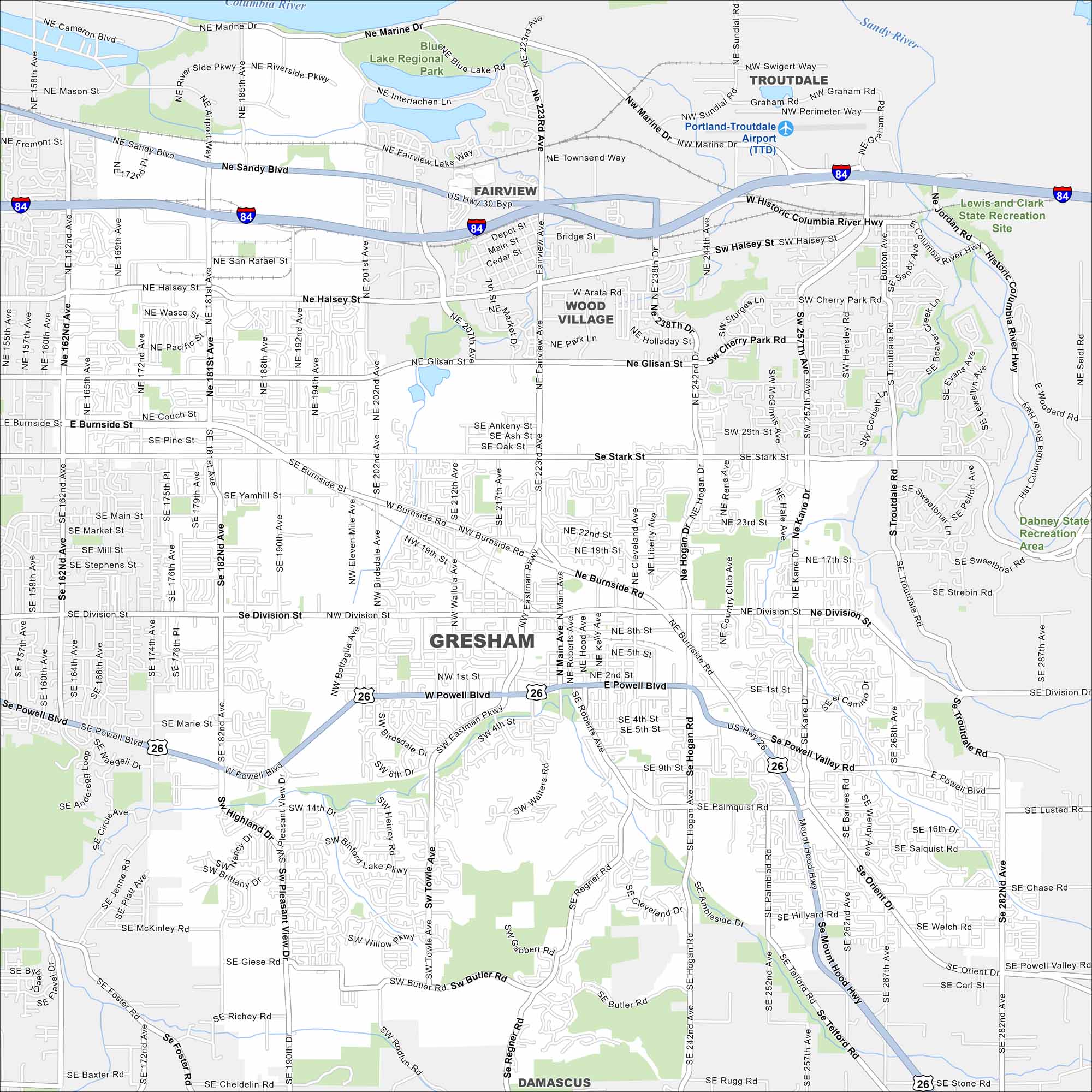
Our map of Gresham places it east of Portland. The layout spreads toward the Columbia River Gorge. But residential neighborhoods fill most of the city.
Map Information
On the Map
Interstates/Highways: I-84, US Hwy 26, State Hwy 212 Major Roads: Powell Blvd, Burnside St, Stark St, Division St, Kane Rd, Hogan Rd, 181st Ave, 182nd Ave, 242nd Ave, 257th Ave, Troutdale Rd, Orient Dr, Eastman Pkwy, Cleveland Ave, Main Ave, Marine Dr, 223rd Ave, Halsey St, Glisan St, Lusted Rd Airports: Portland-Troutdale Airport (TTD) Lakes and Reservoirs: Blue Lake Major Rivers: Columbia River, Sandy River Parks and Preserves: Blue Lake Regional Park, Lewis and Clark State Recreation Site, Dabney State Recreation Area Nearby Communities: Fairview, Troutdale, Wood Village, DamascusOregon State Maps
Here is our state map collection of Oregon.


City Maps of Oregon
Get to know Portland and Oregon’s urban areas.


