Map of Hammond, Indiana
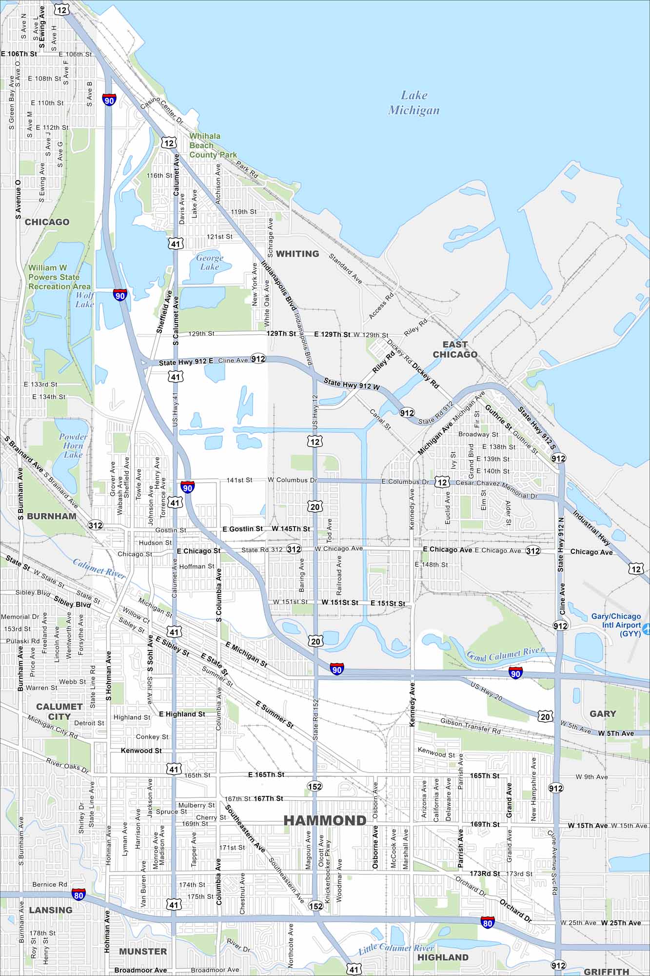
Hammond lies in northwest Indiana along Lake Michigan’s southern edge. You’ll see the lakefront, rail lines, and industry laid out on our map.
Indiana State Maps
Study about Indiana with our map collection


Map Information
On the Map
Interstates/Highways: I-80, I-90, US Hwy 12, US Hwy 20, US Hwy 41, State Rte 152, State Rte 312, State Rte 912 Major Roads: Indianapolis Blvd, Calumet Ave, Sheffield Ave, Columbia Ave, Hohman Ave, Sibley St, Michigan St, Chicago Ave, 165th St, 169th St, 173rd St, 175th St, Kennedy Ave, Cline Ave, Gostlin St, Columbus Dr, Summer St, Highland St, Kenwood St, Orchard Dr Airports: Lakes and Reservoirs: Lake Michigan, George Lake, Wolf Lake, Powder Horn Lake Major Rivers: Grand Calumet River, Little Calumet River Parks and Preserves: Whihala Beach County Park, William W Powers State Recreation Area Nearby Communities: Chicago, Whiting, East Chicago, Gary, Highland, Munster, Lansing, Burnham, Calumet CityIndiana City Maps
Here are our maps of Indianapolis and Indiana cities


