Map of Houma, Louisiana
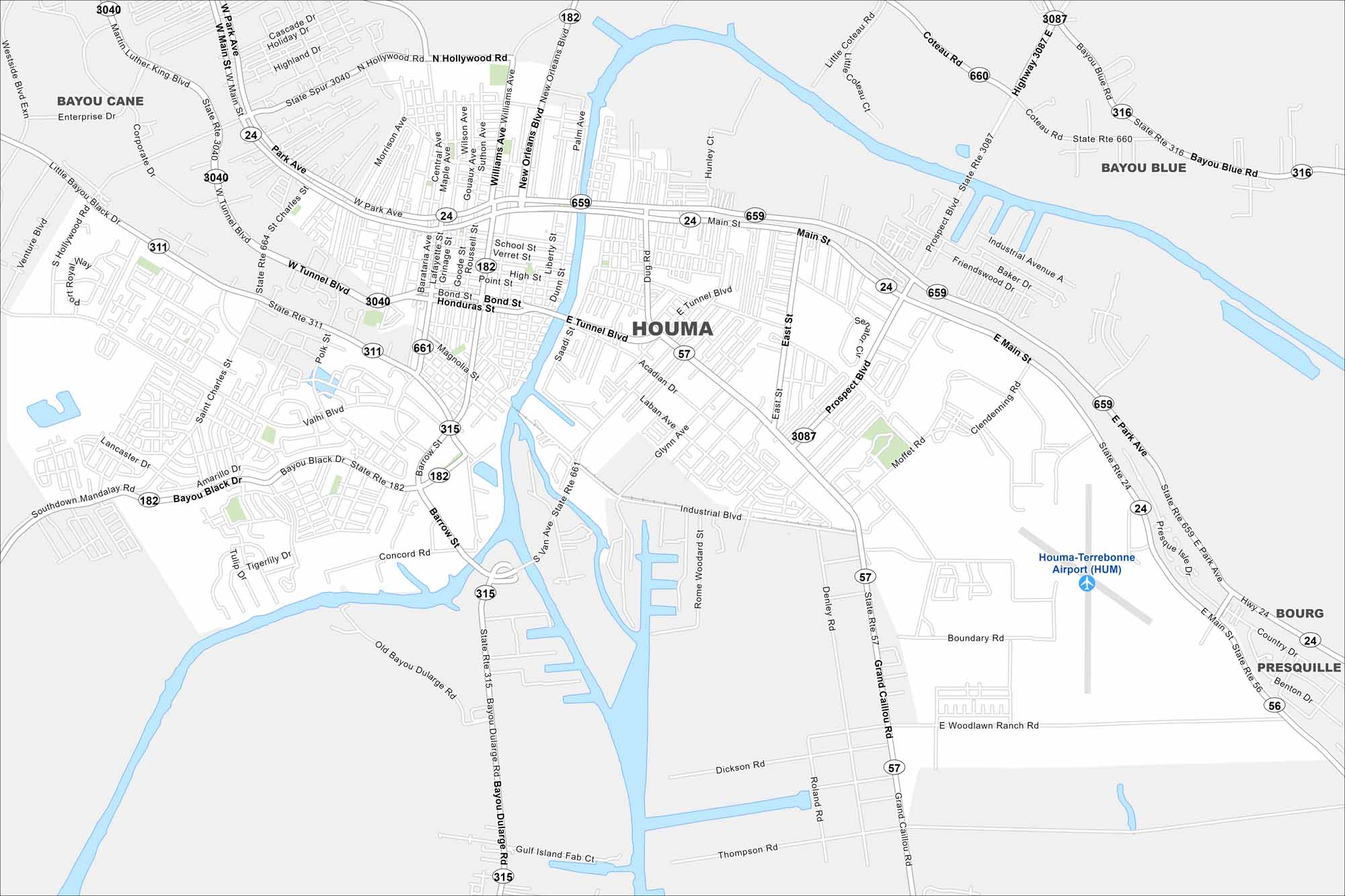
Check out our map of Houma deep in bayou country. Waterways and canals flow through the map. The Gulf lies just a short drive south.
Louisiana State Maps
Here are maps showcasing the state of Louisiana


Map Information
On the Map
Interstates/Highways: US Hwy 90, State Rte 24, State Rte 56, State Rte 57, State Rte 182, State Rte 311, State Rte 315, State Rte 316, State Rte 659, State Rte 660, State Rte 661, State Rte 3040, State Rte 3087 Major Roads: Main St, Grand Caillou Rd, Westside Blvd, Tunnel Blvd, Barrow St, Bayou Dularge Rd, Prospect Blvd, Hollywood Rd, Corporate Dr, Enterprise Dr, Valhi Blvd, Savanne Rd, Industrial Blvd, Boundary Rd, Woodlawn Ranch Rd, Thompson Rd, Dickson Rd, Southdown Mandalay Rd, Bayou Black Dr, Park Ave Airports: Houma-Terrebonne Airport (HUM) Nearby Communities: Bayou Cane, Bayou Blue, Bourg, PresquilleCity Maps of Louisiana
Explore New Orleans and Louisiana’s urban centers with our city maps