Map of Jeffersonville, Indiana
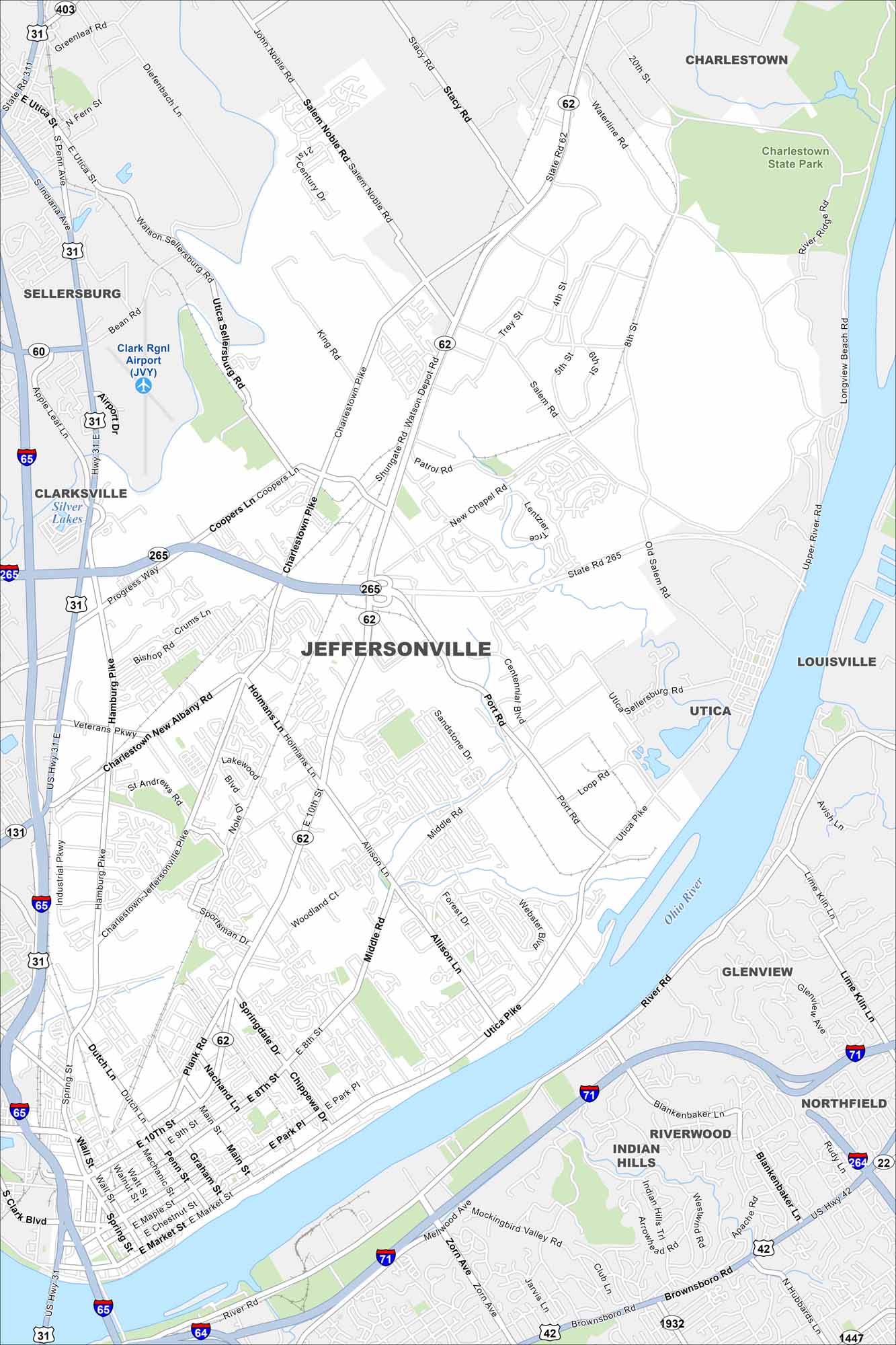
Jeffersonville sits right across the Ohio River from Louisville. Our map shows bridges linking the two cities. Neighborhoods spread along the river’s edge.
Indiana State Maps
Study about Indiana with our map collection


Map Information
On the Map
Interstates/Highways: I-65, I-264, I-265, US Hwy 31, US Hwy 31 E, US Hwy 42, State Rte 62, State Rte 131, State Rte 265, State Rte 403 Major Roads: 10th St, Market St, Utica Pike, Holmans Ln, Allison Ln, Charlestown New Albany Rd, Veterans Pkwy, Hamburg Pike, Charlestown Pike, Salem Noble Rd, Middle Rd, Port Rd, River Rd, Main St, Spring St, Zorn Ave, Brownsboro Rd, Upper River Rd, 8th St, Eastern Blvd Airports: Clark Rgnl Airport (JVY) Lakes and Reservoirs: Silver Lakes Major Rivers: Ohio River Parks and Preserves: Charlestown State Park Nearby Communities: Louisville, Clarksville, Sellersburg, Charlestown, Utica, Oak Park, Northfield, Riverwood, Indian HillsIndiana City Maps
Here are our maps of Indianapolis and Indiana cities


