Map of Kenner, Louisiana
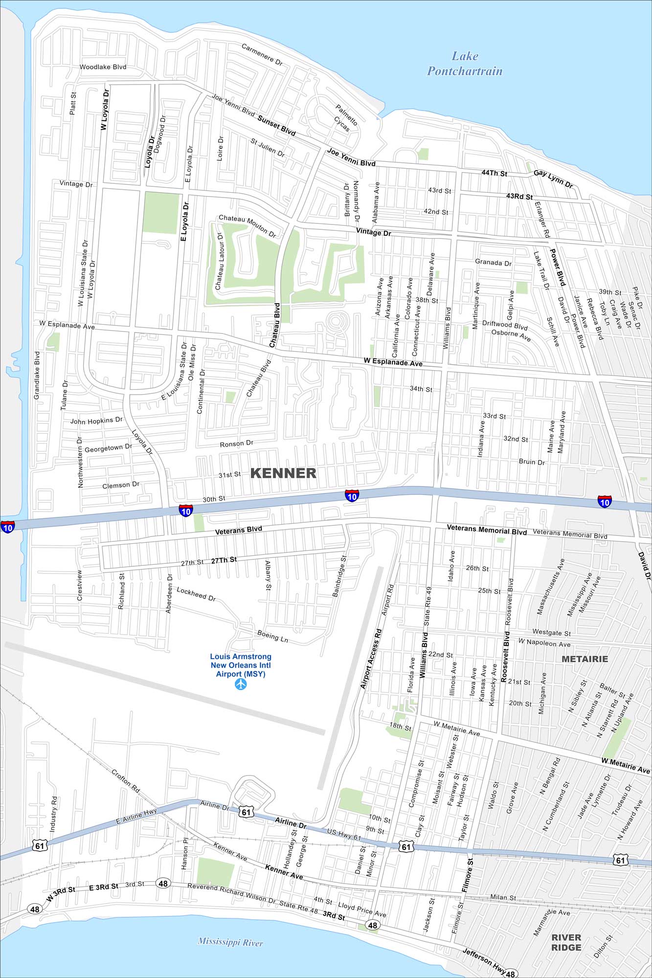
Kenner borders the Mississippi River to the south and Lake Pontchartrain to the north. This map shows Louis Armstrong Airport dominating its center.
Louisiana State Maps
Here are maps showcasing the state of Louisiana


Map Information
On the Map
Interstates/Highways: I-10, US Hwy 61, State Rte 48, State Rte 49 Major Roads: Williams Blvd, Veterans Memorial Blvd, Airline Dr, West Esplanade Ave, Vintage Dr, Chateau Blvd, Joe Yenni Blvd, Loyola Dr, Power Blvd, David Dr, Roosevelt Blvd, Kenner Ave, Jefferson Hwy, 31st St, Sunset Blvd, Palmetto Blvd, Maine Ave, Idaho Ave, Maryland Ave, Florida Ave Airports: Louis Armstrong New Orleans Intl Airport (MSY) Lakes and Reservoirs: Lake Pontchartrain Major Rivers: Mississippi River Nearby Communities: Metairie, River RidgeCity Maps of Louisiana
Explore New Orleans and Louisiana’s urban centers with our city maps


