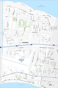
Map of Lafayette, Louisiana
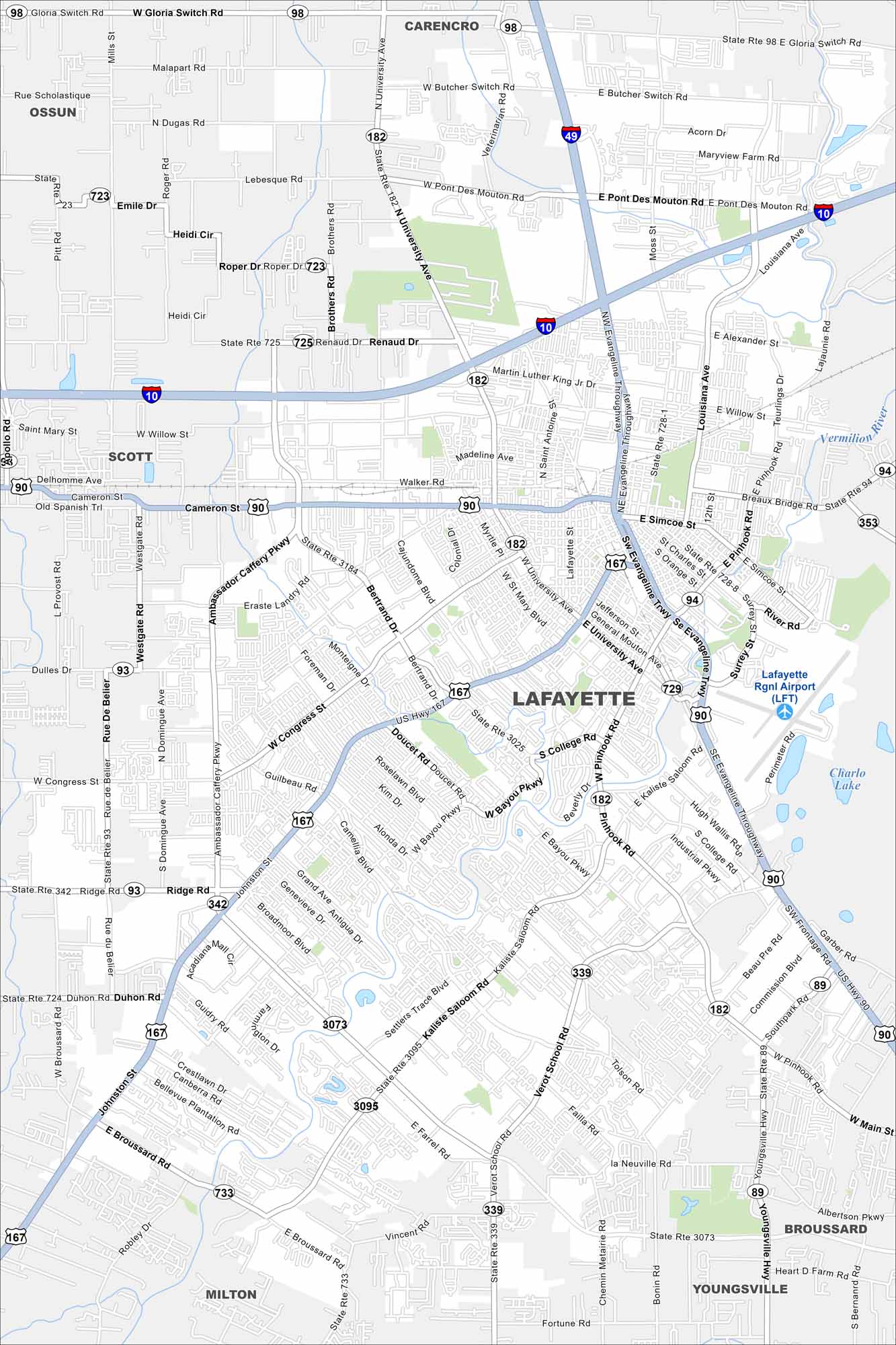
See Lafayette along the Vermilion River. Cajun culture and historic neighborhoods pop out on the map. Interstates connect the city to Baton Rouge.
Louisiana State Maps
Here are maps showcasing the state of Louisiana


Map Information
On the Map
Interstates/Highways: I-10, I-49, US Hwy 90, US Hwy 167, State Rte 89, State Rte 93, State Rte 94, State Rte 98, State Rte 182, State Rte 339, State Rte 342, State Rte 353, State Rte 723, State Rte 725, State Rte 728, State Rte 729, State Rte 3073, State Rte 3095, State Rte 3184 Major Roads: Ambassador Caffery Pkwy, Johnston St, Kaliste Saloom Rd, Evangeline Thruway, Pinhook Rd, University Ave, Congress St, Verot School Rd, Camellia Blvd, Ridge Rd, Broussard Rd, College Rd, E Broussard Rd, W Willow St, Cameron St, Erasmus Landry Rd, Bertrand Dr, Southpark Rd, Youngsville Hwy, Bonin Rd Airports: Lafayette Rgnl Airport (LFT) Lakes and Reservoirs: Charlo Lake Major Rivers: Vermilion River Nearby Communities: Carencro, Scott, Milton, Youngsville, Broussard, OssunCity Maps of Louisiana
Explore New Orleans and Louisiana’s urban centers with our city maps